Collection: U.S. State Maps
Looking for a state or a period not shown?
Email philaprint@philaprintshop.com or
phone the shop at 610.808.6165 with your requests.
-
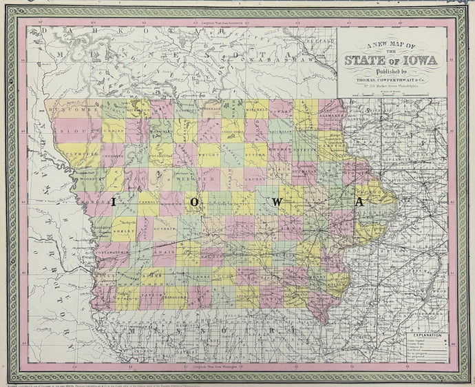
Thomas, Cowperthwait & Co. "A New Map of the State of Iowa"
![]()
- Regular price
- $185
- Sale price
- $185
- Regular price
-
- Unit price
- per
Sold -
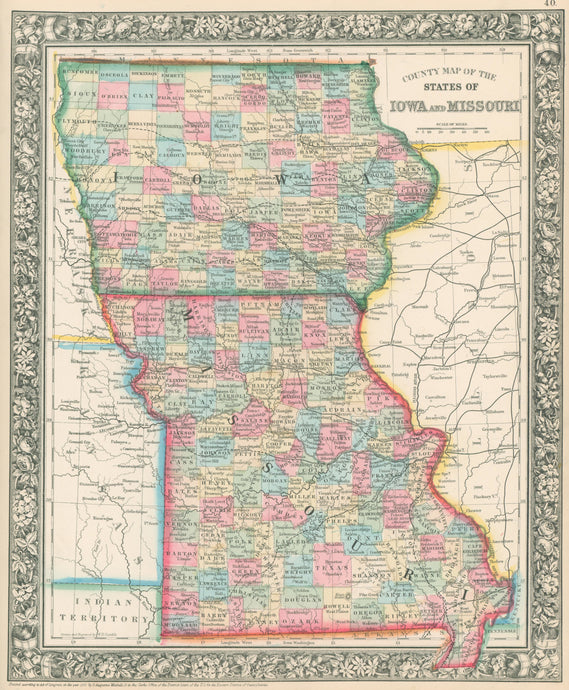
Mitchell, S. Augustus “County Map of the the States of Iowa and Missouri”
![]()
- Regular price
- $125
- Sale price
- $125
- Regular price
-
- Unit price
- per
Sold -
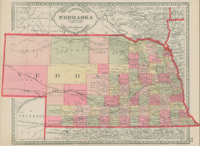
Tunison, Henry "Tunison's Nebraska"
![]()
- Regular price
- $50
- Sale price
- $50
- Regular price
-
- Unit price
- per
Sold -
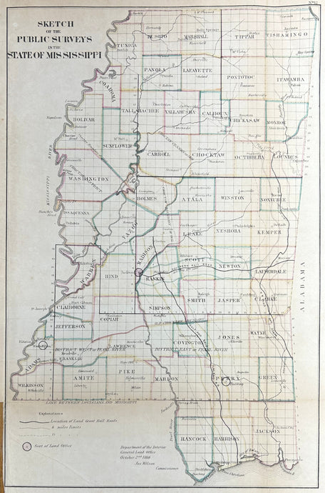
General Land Office "Sketch of the Public Surveys in the State of Mississippi"
![]()
- Regular price
- $350
- Sale price
- $350
- Regular price
-
- Unit price
- per
Sold -
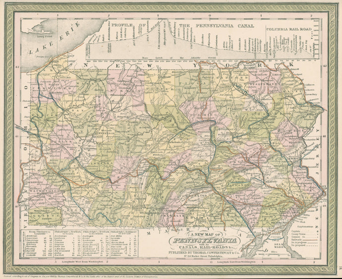
Thomas, Cowperthwait "A New Map of Pennsylvania with its Canals, Rail-roads &c."
![]()
- Regular price
- $225
- Sale price
- $225
- Regular price
-
- Unit price
- per
Sold -
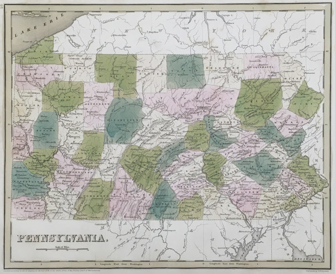
Bradford, Thomas G. “Pennsylvania”
![]()
- Regular price
- $250
- Sale price
- $250
- Regular price
-
- Unit price
- per
Sold -
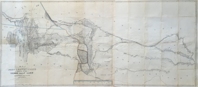
Gunnison, John Williams & Preuss, Charles “Map of a Reconnoissance between Fort Leavenworth and the Missouri River, and the Great Salt Lake in the Territory of Utah, made in 1849 and 1850"
![]()
- Regular price
- $475
- Sale price
- $475
- Regular price
-
- Unit price
- per
Sold -
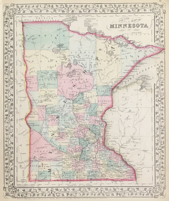
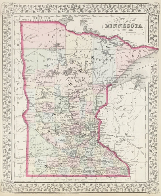
Mitchell, S. Augustus Jr. “County Map of Minnesota” 1867
![]()
- Regular price
- $80
- Sale price
- $80
- Regular price
-
- Unit price
- per
Sold -
Gamble, W.H. "County Map of Minnesota"
![]()
- Regular price
- $75
- Sale price
- $75
- Regular price
-
- Unit price
- per
Sold -
Asher & Adams "Asher & Adams' Minnesota"
![]()

- Regular price
- $75
- Sale price
- $75
- Regular price
-
- Unit price
- per
Sold -
Colton, G.W. & C.B. "Minnesota"
![]()

- Regular price
- $175
- Sale price
- $175
- Regular price
-
- Unit price
- per
Sold -
Johnson, A.J. "Johnson's Minnesota"
![]()

- Regular price
- $65
- Sale price
- $65
- Regular price
-
- Unit price
- per
Sold -
Rand, McNally "Map of Dakota – Southern Portion"
![]()

- Regular price
- $150
- Sale price
- $150
- Regular price
-
- Unit price
- per
Sold -
Rand, McNally "Map of Dakota – Northern Portion"
![]()

- Regular price
- $150
- Sale price
- $150
- Regular price
-
- Unit price
- per
Sold -
Colton, J.H. "Dakota" [Wisconsin on verso]
![]()

- Regular price
- $175
- Sale price
- $175
- Regular price
-
- Unit price
- per
Sold -
Mitchell, S. Augustus “County Map of Kansas, Nebraska, Colorado, Dakota, Wyoming, Montana”
![]()

- Regular price
- $250
- Sale price
- $250
- Regular price
-
- Unit price
- per
Sold -
Johnson, A.J. "Johnson's Georgia and Alabama" 1860
![]()

- Regular price
- $175
- Sale price
- $175
- Regular price
-
- Unit price
- per
Sold -
Johnson, A.J. "Johnson's Georgia and Alabama" 1862
![]()

- Regular price
- $175
- Sale price
- $175
- Regular price
-
- Unit price
- per
Sold -
Mitchell, S. Augustus “County Map of Georgia, and Alabama” 1867+
![]()

- Regular price
- $145
- Sale price
- $145
- Regular price
-
- Unit price
- per
Sold -
Mitchell, S. Augustus “County Map of Georgia, and Alabama” 1860
![]()

- Regular price
- $155
- Sale price
- $155
- Regular price
-
- Unit price
- per
Sold -
Mitchell, S. Augustus “County Map of the States of Georgia and Alabama” 1880
![]()

- Regular price
- $150
- Sale price
- $150
- Regular price
-
- Unit price
- per
Sold -
Mitchell, S. Augustus “County Map of the States of Georgia and Alabama”
![]()

- Regular price
- $150
- Sale price
- $150
- Regular price
-
- Unit price
- per
Sold


