


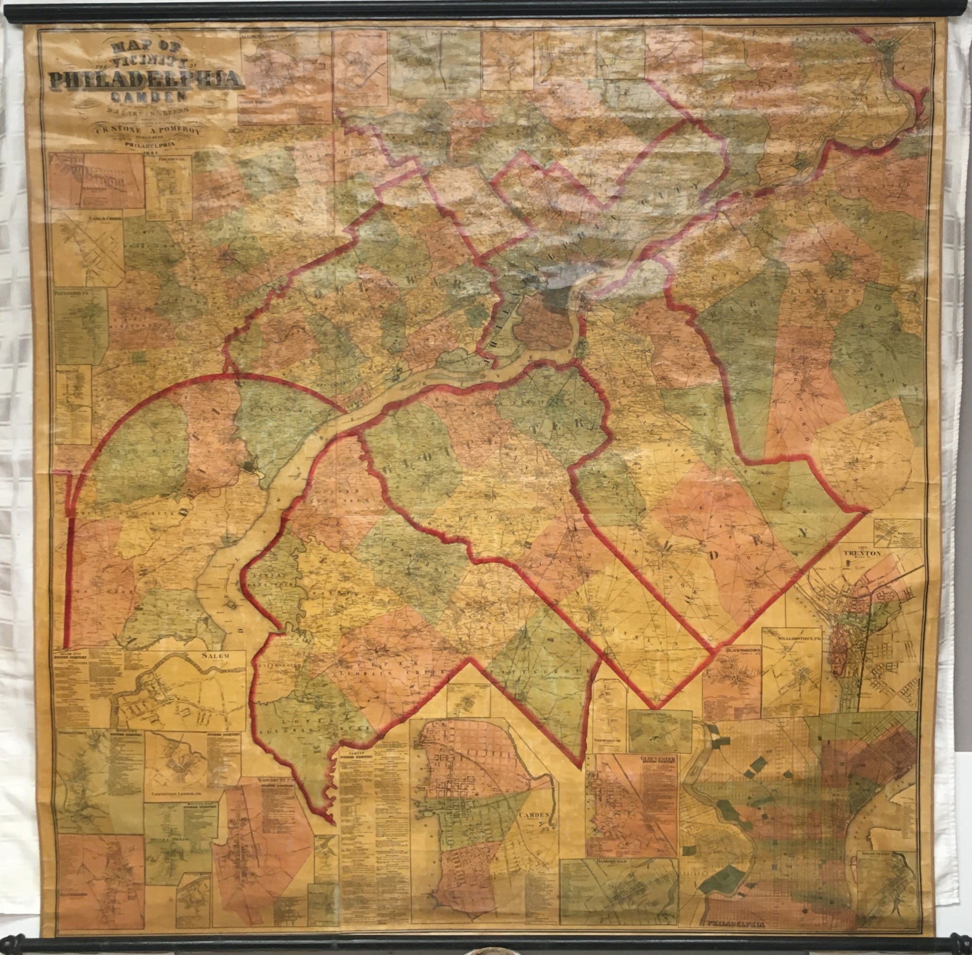
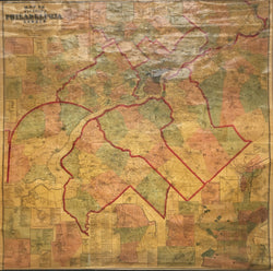
D.J. Lake & S.N. Beers. “Map of the Vicinity of Philadelphia and Camden.”
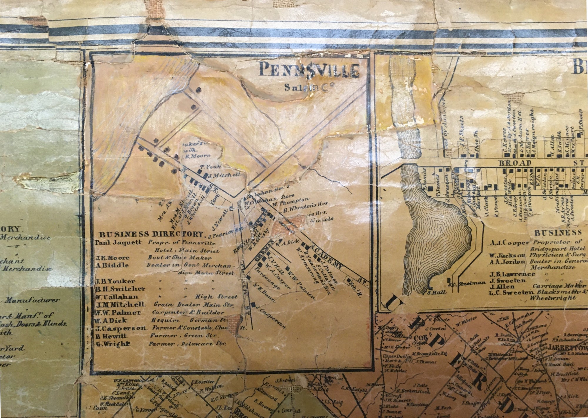
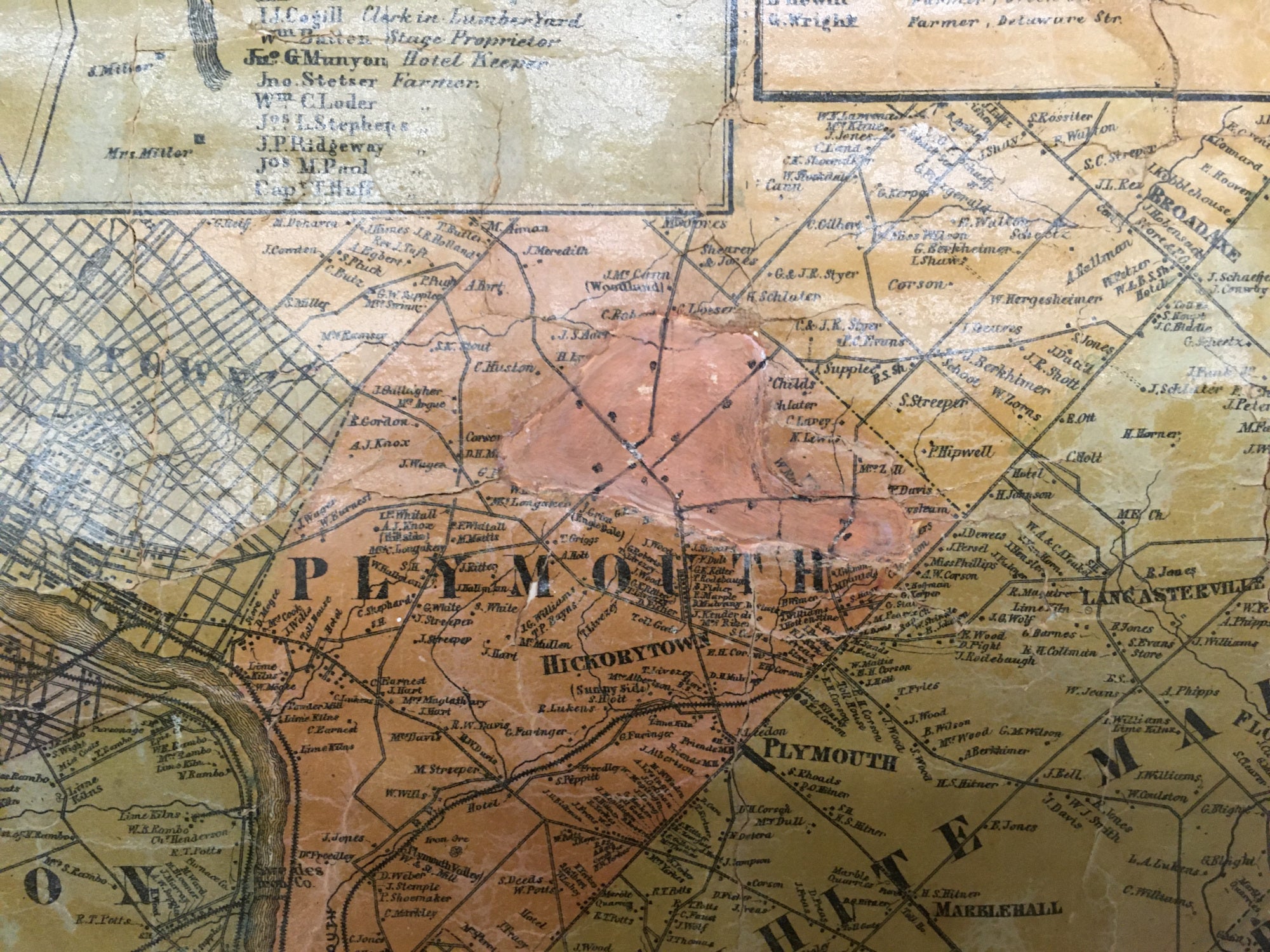
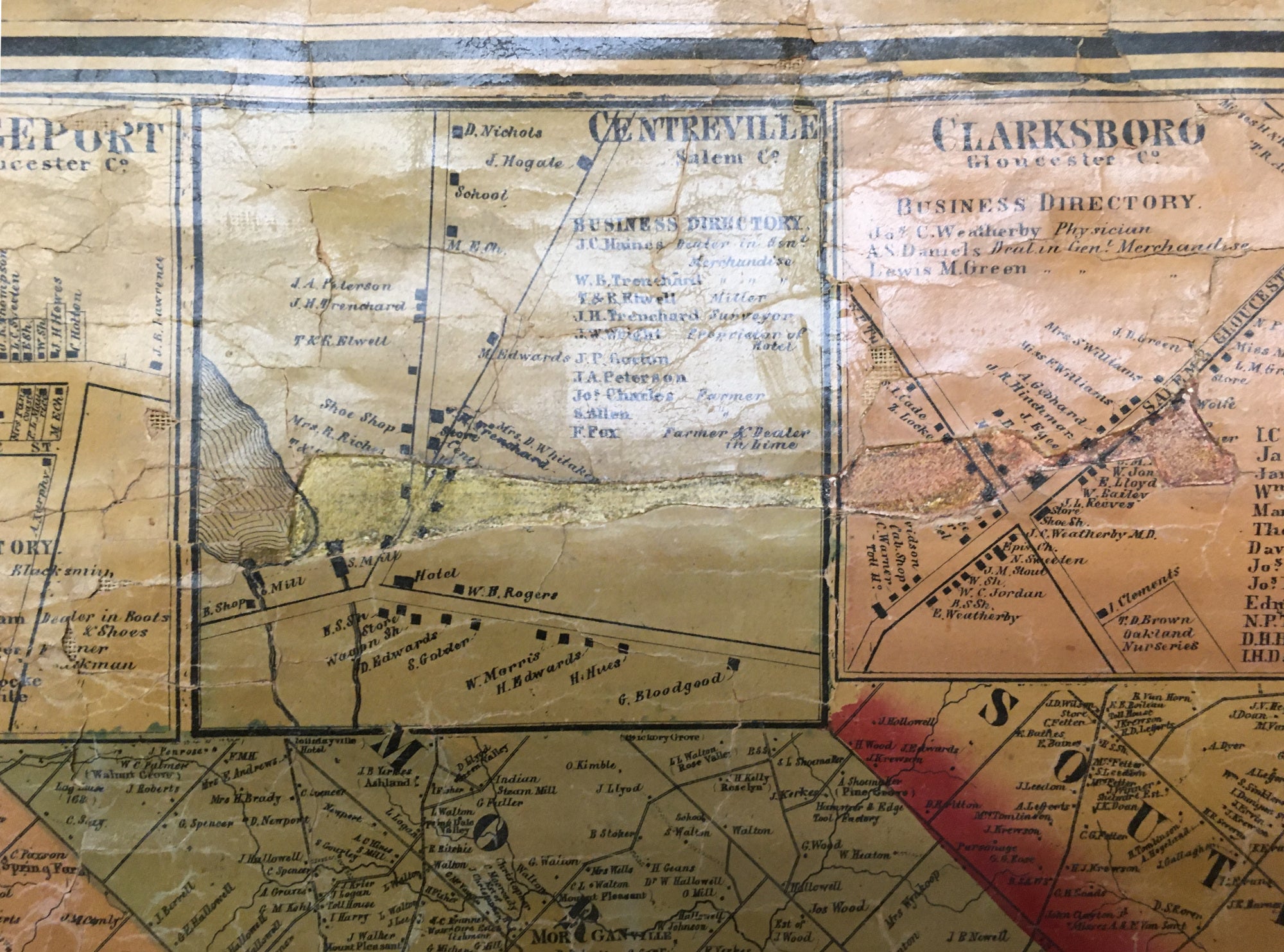
Philadelphia: C.K. Stone & A. Pomeroy, 1861. Separately issued wall map, mounted on canvas and varnished as originally issued. 68 x 68 (rollers). Lithograph. Original hand color. Light browning in map due to aging of varnish with numerous small cracking of map surface in top portion of map all as to be expected for wall maps of this period. Any small loose areas of printed map surface re-adhered to canvas backing. Archival linen tape on verso at top of map in order to repair and/or reinforce various areas of old canvas backing. Some loss of printed map surface in the inset maps at top (Pennsville, Bridgeport, Centerville, Clarksburg and Plymouth Township-see photos) filled and in-painted in facsimile as best as possible. In general, map is very clean and bright. Reflections of light in photographs due to old varnish. Original rollers attached.
Area shown. Philadelphia, and Southern New Jersey; with parts of the western suburbs. Including: all of Philadelphia County, all of Delaware County, southern Chester, southern Montgomery and Bucks Counties, northern portion of the state of Delaware, all of Camden County, all Salem County, all of Gloucester County and western Burlington County.
Inset maps: Philadelphia, Camden, Trenton, Burlington, Glassboro, Woodstown, Salem, Mullica Hill, Haddonfield, Gloucester, Blackwoodtown, Williamstown, Stockton Fislerville, Long-A-Coming, Pennington, Allowaystown, Sharptown, Paulsboro…
This large, separately issued map of the area of Philadelphia, parts of the western suburbs, and southern New Jersey is in surprisingly good condition. The focus of this map is on Philadelphia and southern New Jersey. As a piece of Philadelphia history, the map stands as an early example of the fully incorporated city, with boundaries extending to its final state. Detail throughout the map is quite amazing, showing the names of specific landowners throughout the large land area as well as roads and landmarks. Also, there are various inset maps of towns in New Jersey which are depicted in great detail. Most of the inset maps include a business directory of the town shown. A fascinating and impressive separately-issued map for those with interest in the greater Philadelphia and southern New Jersey areas.
Other Philadelphia and vicinity wall maps:
Supplee West Philadelphia 1847
 %20%0A%20%0Ahttps://philaprintshop.com/products/lake-d-j-s-n-beers-map-of-the-vicinity-of-philadelphia-and-camden %20%0A%20%0ALake,%20D.J.%20%26%20S.N.%20Beers%20%20%E2%80%9CMap%20of%20the%20Vicinity%20of%20Philadelphia%20and%20Camden%E2%80%9D %20%0A%20%0A//philaprintshop.com/cdn/shop/products/philawallmap1861c_1024x1024.jpg?v=1669824012 %20%0A%20%0AAntique Prints, Maps, Drawings, Paintings and Rare Books! %20%0A%20%0AThe Philadelphia Print Shop %20%0A106 E. Lancaster Avenue, Lower Level %20%0AWayne, PA 19087 %20%0A%20%0APhilaPrintShop.com %20%0A@PhiladelphiaPrintShop %20%0A 610 (808) 6165)