


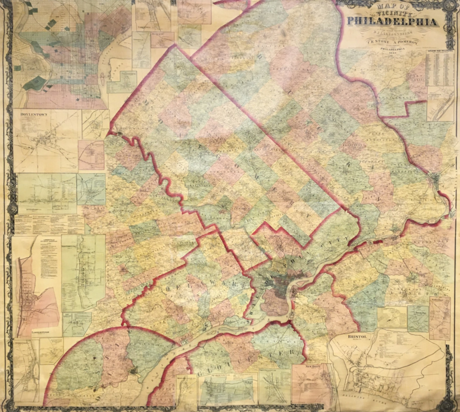
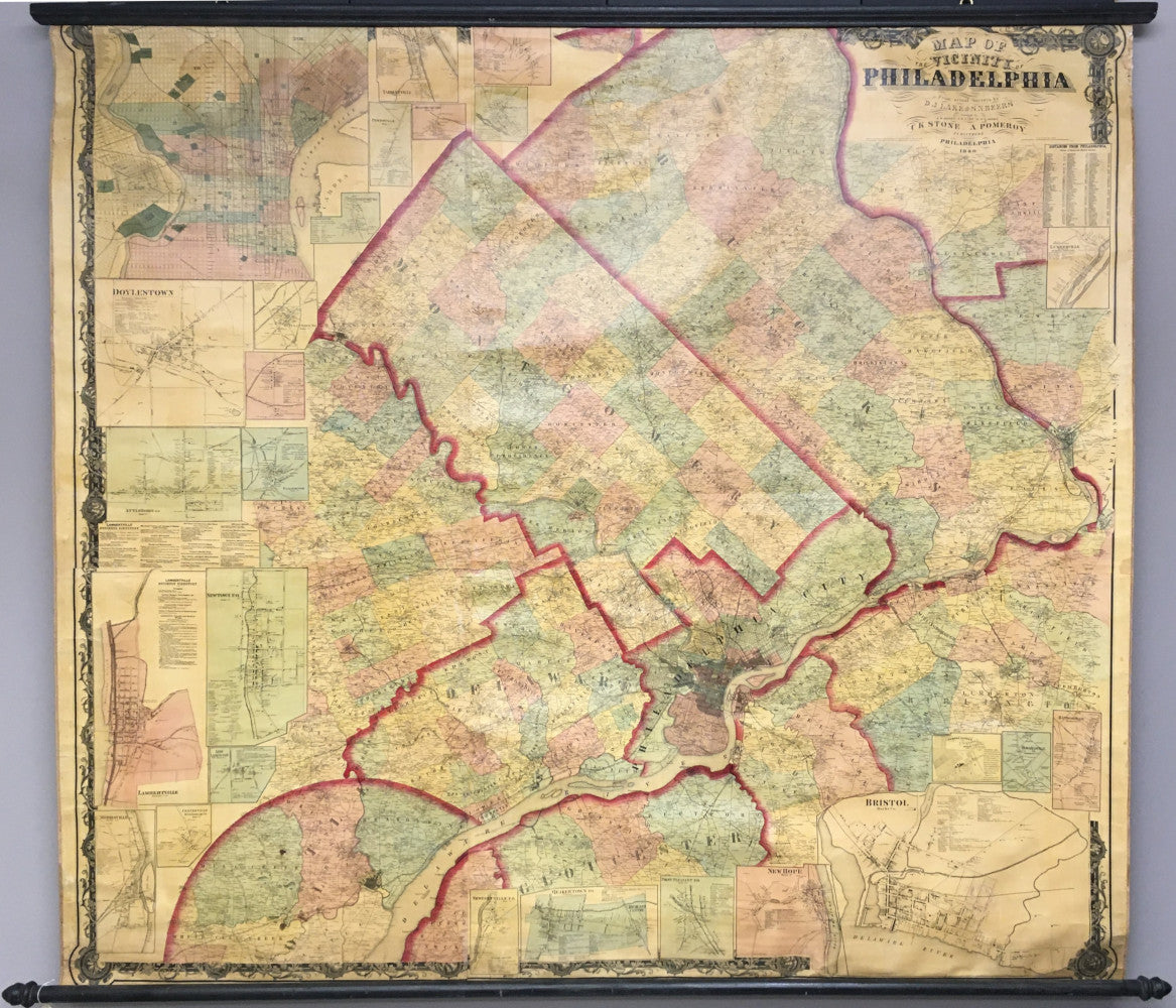
C.K. Stone & A. Pomeroy. “Map of the Vicinity of Philadelphia.”
Philadelphia: C.K. Stone & A. Pomeroy, 1860. Separately issued wall map, mounted on original linen backing, original hand colored and varnished. 65 x 63. Lithograph. Small tears at top repaired with acid free linen tape along with reinforcing of linen backing at top. A few small areas at top filled and in-painted. Light water stain in map of Philadelphia. Some fraying at map edges at top. Varnished has oxidized and the map surface has acquired a light brown patina, all as to be expected, but the map is clean and bright. With original rollers. Otherwise, map is in very good condition for such a large wall map.
Area shown: Philadelphia and western suburbs; with parts of southern New Jersey. Including: Philadelphia County, Delaware County, eastern Chester County, Montgomery and Bucks Counties, northern part of state of Delaware, part of Burlington County, part of Gloucester County and part of Trenton.
Inset maps: Philadelphia, Norristown, Conshohocken, Barren Hill, Jenkintown, Plymouth, Hatborough, Springmill, Skippackville, Pottstown…
This large, separately issued map of Philadelphia, the western suburbs and parts of southern New Jersey is in surprisingly good condition. As a piece of Philadelphia history, the map stands as an early example of the fully incorporated city, with boundaries extending to its final state. Detail throughout the map is quite amazing, showing the names of specific landowners throughout the large land area as well as roads and landmarks. Also, there are various inset maps of towns in the area which are depicted in great detail. A fascinating and impressive separately-issued map for those with interest in the greater Philadelphia area.
Other Philadelphia and vicinity wall maps:
Supplee West Philadelphia 1847

 %20%0A%20%0Ahttps://philaprintshop.com/products/stone-c-k-a-pomeroy-map-of-the-vicinity-of-philadelphia %20%0A%20%0AStone,%20C.K.%20%26%20A.%20Pomeroy%20%20%E2%80%9CMap%20of%20the%20Vicinity%20of%20Philadelphia%E2%80%9D %20%0A%20%0A//philaprintshop.com/cdn/shop/products/ScreenShot2021-07-22at3.43.43PM_1024x1024.png?v=1626990289 %20%0A%20%0AAntique Prints, Maps, Drawings, Paintings and Rare Books! %20%0A%20%0AThe Philadelphia Print Shop %20%0A106 E. Lancaster Avenue, Lower Level %20%0AWayne, PA 19087 %20%0A%20%0APhilaPrintShop.com %20%0A@PhiladelphiaPrintShop %20%0A 610 (808) 6165)