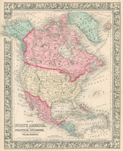
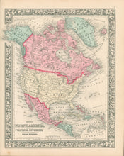
W. Williams. "Map of North America. Showing its Political Divisions, and Recent Discoveries in the Polar Regions."
Philadelphia: S. Augustus Mitchell Jr., 1860. 13 1/2 x 11. Lithograph. Original hand color. Decorative floral border. Very good condition.
S. Augustus Mitchell Jr., of Philadelphia, was one of the largest map publishers of the middle of the nineteenth century. The firm was founded by his father, who from around the middle of the nineteenth century issued atlases and maps of all parts of the world in all formats. The Mitchell atlases contained up-to-date maps which were as attractive as they were accurate. With its bold hand-color, decorative borders, and interesting information from this interesting period of American history, this is a fine example of the Mitchell firm's output. Of particular note is the indication of different national control in Alaska, Greenland, and Canada, as well as information on Capt. McClure's explorations in the polar regions.


