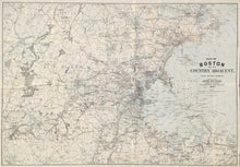
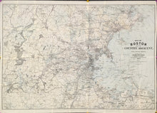
George H. Walker. "Map of Boston and the Country Adjacent. From Actual Surveys."
Boston: Damrell & Upham, 1892. 24 x 34 1/2. Cerograph. Original hand color. A few short separations at folds. Very good condition. With publisher's cloth case which is also in very good condition.
A map of Boston and the surroundings region from the late nineteenth century. The city had grown dramatically during the nineteenth century. Arriving to staff busy factories, immigrant families from all over Europe settled in places like the largely Italian North End or the predominantly Irish Mission Hill. Many began to move out into the surrounding region, shown on this map from Framingham to Cohasset in the south, and from Concord to Salem in the north. This folding map was intended to be used by those traveling in and about Boston, thus showing copious detail of every town and village, ponds and lakes, hills and swamps, roads and railroads, post offices and stations, and much besides. Concentric circles show the distance from the center of Boston. A super map of Boston from over a century ago.


