Adding product to your cart
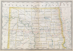
Rand, McNally. “Map of Dakota – Northern Portion.”
Chicago: Rand, McNally, 1881-1882. 12 ¾ x 18 ½. Lithograph. Original hand color.
A handsome map from a Rand. McNally atlas. This is a nice example of the firm's output, showing Northern Dakota Territory.
Hey!
Take a look at this unique item from The Philadelphia Print Shop :)
https://philaprintshop.com/products/rand-mcnally-map-of-dakota-northern-portion
Rand, McNally "Map of Dakota – Northern Portion"

Antique Prints, Maps, Drawings, Paintings and Rare Books!
The Philadelphia Print Shop
106 E. Lancaster Avenue, Lower Level
Wayne, PA 19087
PhilaPrintShop.com
@PhiladelphiaPrintShop
610.808.6165
Use left/right arrows to navigate the slideshow or swipe left/right if using a mobile device