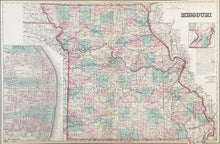
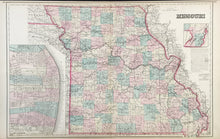
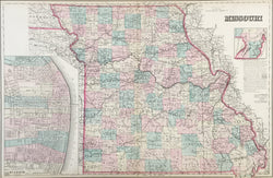
O.W. Gray. "Missouri."
Philadelphia: O.W. Gray, 1876. 16 3/4 x 25 1/2. Lithograph. Original hand color. Very good condition.
A map showing Missouri in the Centennial year. It was published by the Philadelphia firm of O.W. Gray which began its publishing around mid-century and issued regional and U.S. atlases up to the 1880s, first as O.W. Gray and then O.W. Gray & Son. This map is typical of their work, presenting the latest information available with clear and precise detail. Missouri was well settled by this date and the many counties and towns are shown precisely. Of particular interest are the myriad railroad lines criss-crossing the state. The Missouri "boot" is shown in an inset in the top right and a nice map of St. Louis in an inset in the lower left.


