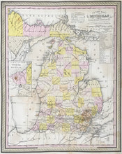
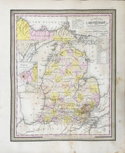
S.Augustus Mitchell. “Michigan.”
From A New Universal Atlas. Philadelphia: S.A. Mitchell Sr., [1846-1849]. 11 1/4 x 14 1/2. Lithographic transfer from engraved copper plate. Original hand color. Faded original hand color with scattered staining in map and margins. Fair condition and sold as is.
A crisp, detailed map by the leading American cartographic publisher of the period, Samuel Augustus Mitchell Sr. For much of the mid-nineteenth century, the Mitchell firm dominated American cartography in output and influence. S.A. Mitchell Jr.’s maps of the 1860s are probably the best known issues of the firm, but his father’s earlier efforts are excellent maps derived from H.S. Tanner’s atlas of the 1830s. This map is a good example of this work. Topographical information, including rivers, roads, canals, towns etc. is profuse and clearly shown, and the counties are shaded with contrasting pastel colors. A fine early American cartographic document of this state.


