


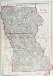
S. Augustus Mitchell, Jr. “Iowa and Missouri.”
From Mitchell’s New General Atlas. Philadelphia: Wm. M. Bradley & Bro., 1887. 16 x 22. Lithograph. Original hand color. Very good condition.
A precisely detailed map from the Philadelphia publishing firm of William M. Bradley & Bro. Bradley took over the publication of Mitchell’s New General Atlas in the early 1880s. This Iowa map is a fine example of nineteenth century American map making. It shows the state in impressive detail, with emphasis on rivers, towns, and the myriad railroad lines criss-crossing the state. Counties are delineated with attractive, light pastel colors.
 %20%0A%20%0Ahttps://philaprintshop.com/products/mitchell-s-augustus-jr-iowa-and-missouri %20%0A%20%0AMitchell%20,%20S.%20Augustus%20Jr.%20%20%E2%80%9CIowa%20and%20Missouri%E2%80%9D %20%0A%20%0A//philaprintshop.com/cdn/shop/files/bradleyia1887thmb_1024x1024.jpg?v=1707331985 %20%0A%20%0AAntique Prints, Maps, Drawings, Paintings and Rare Books! %20%0A%20%0AThe Philadelphia Print Shop %20%0A106 E. Lancaster Avenue, Lower Level %20%0AWayne, PA 19087 %20%0A%20%0APhilaPrintShop.com %20%0A@PhiladelphiaPrintShop %20%0A 610 (808) 6165)