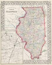
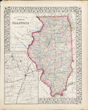
S. Augustus Mitchell, Jr. "County Map of the State of Illinois."
Philadelphia: S. Augustus Mitchell, Jr., 1871. 13 3/4 x 10 3/4. Lithograph. With decorative grape vine border. Original hand color. Very good condition. With inset, "Vicinity of Springfield."
For most of the middle part of the nineteenth century, the firm founded by S. Augustus Mitchell dominated American cartography in output and influence. This fine map is from his son's New General Atlas. Illinois is depicted with its counties brightly colored and topographical features detailed. Included are towns, rivers, roads and rail lines. In the lower left corner is a good plan of the state capital, Springfield. Besides its geographic interest, the map is very attractive, with its striking hand color and decorative border.


