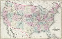
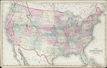
“Map of the United States and Territories.”
Philadelphia: S.A. Mitchell, Jr. 1877. 16 x 26 ½ (neat lines). Lithograph. Original hand color. Narrow margins with center fold as originally issued. Minor chipping in margin corners. Else, very good condition.
A slightly larger map issued by Mitchell without a decorative border where all western territories are shown with their present day borders with the exception of the Dakota and Indian Territories. In all versions of this map only a portion of the Bahama Islands is shown depending on how the paper was trimmed prior to being bound into the atlas.


