

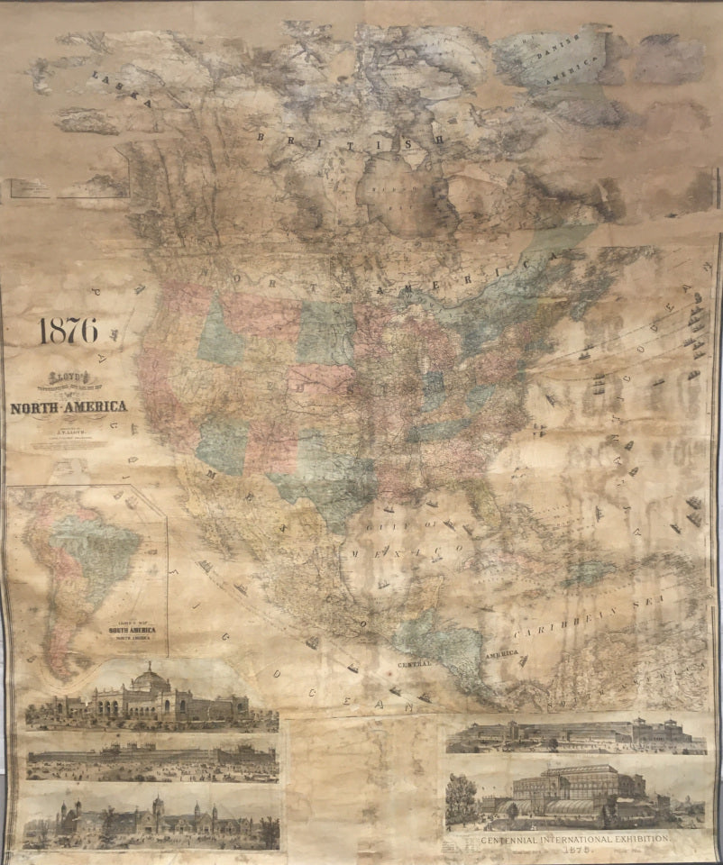

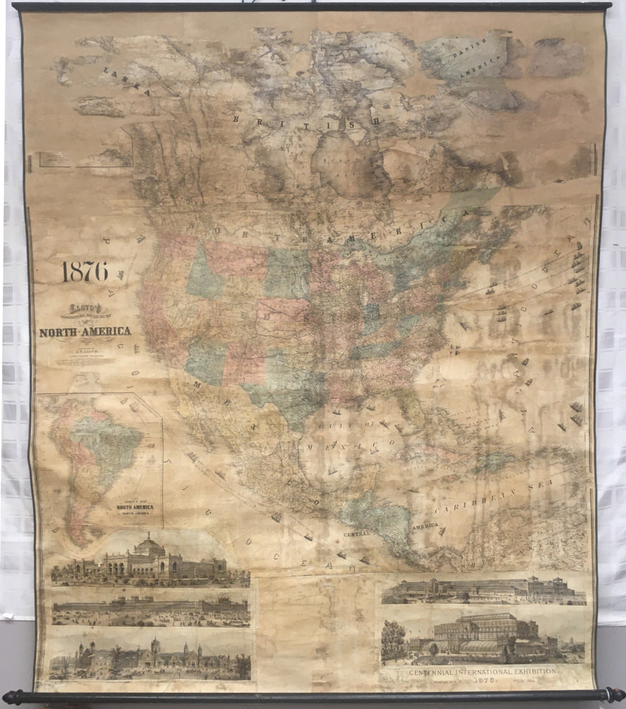
J.T. Lloyd. "Lloyd's Topographical and Railway Map of North America."
New York: J.T. Lloyd, 1876. "Philadelphia: E. Lloyd, 1876." Lithograph (hand coloring to the state of the union and countries of South and Central America). 69 x 57 (sheet). A wall map with original molding and spindle. Conserved with new linen backing and new fringe ribbons. Much age browning and staining. Missing surface is toward the top areas in Canada and Alaska.
Inset map of South America. Below the map area are depictions of the five major buildings of the Centennial Exposition in Philadelphia.
References: Not in: Phillips, Maps in the Library of Congress; British Museum Catalogue of Maps; or Tooley's Dictionary of Mapmakers.
 %20%0A%20%0Ahttps://philaprintshop.com/products/lloyd-j-t-lloyds-topographical-and-railway-map-of-north-america %20%0A%20%0ALloyd,%20J.T.%20%20%22Lloyd's%20Topographical%20and%20Railway%20Map%20of%20North%20America%22 %20%0A%20%0A//philaprintshop.com/cdn/shop/products/lloydnamerica1876c_1024x1024.jpg?v=1649185087 %20%0A%20%0AAntique Prints, Maps, Drawings, Paintings and Rare Books! %20%0A%20%0AThe Philadelphia Print Shop %20%0A106 E. Lancaster Avenue, Lower Level %20%0AWayne, PA 19087 %20%0A%20%0APhilaPrintShop.com %20%0A@PhiladelphiaPrintShop %20%0A 610 (808) 6165)