


"Johnson's North America."
New York: Johnson & Ward, 1863. 22 1/4 x 17 1/4. Lithograph. Original hand color. Wear at center fold, into decorative border at left; scattered spots and foxing. Else good condition.
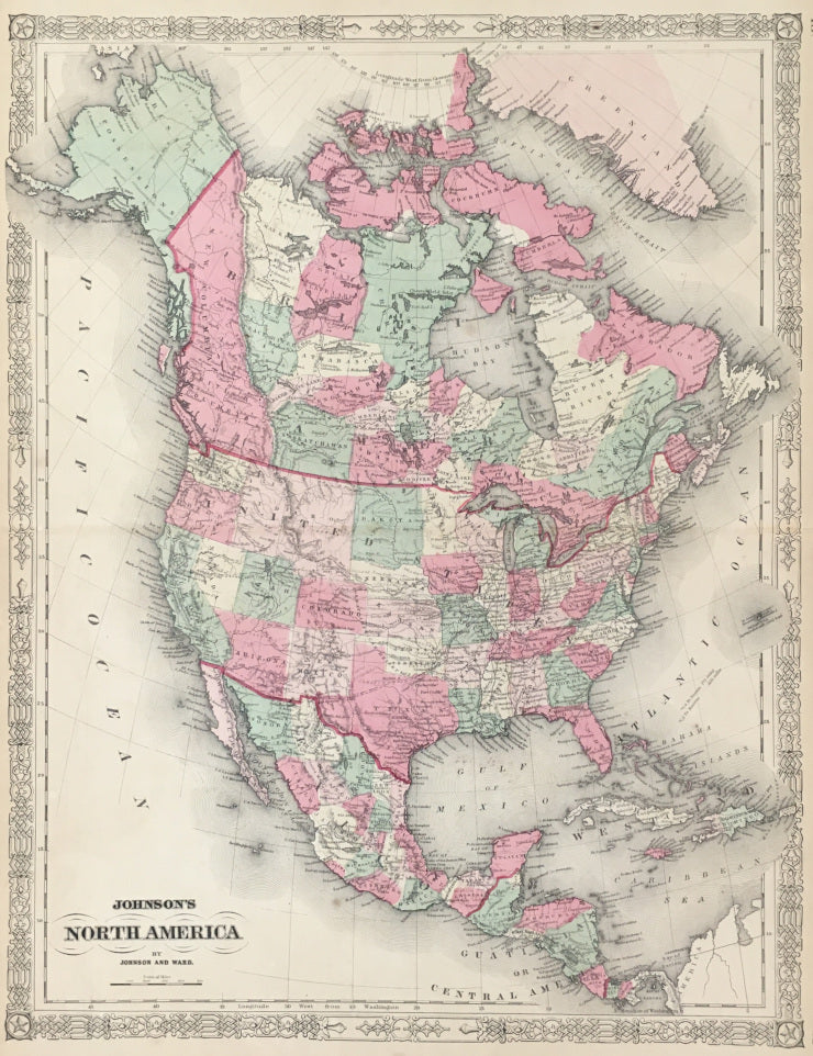
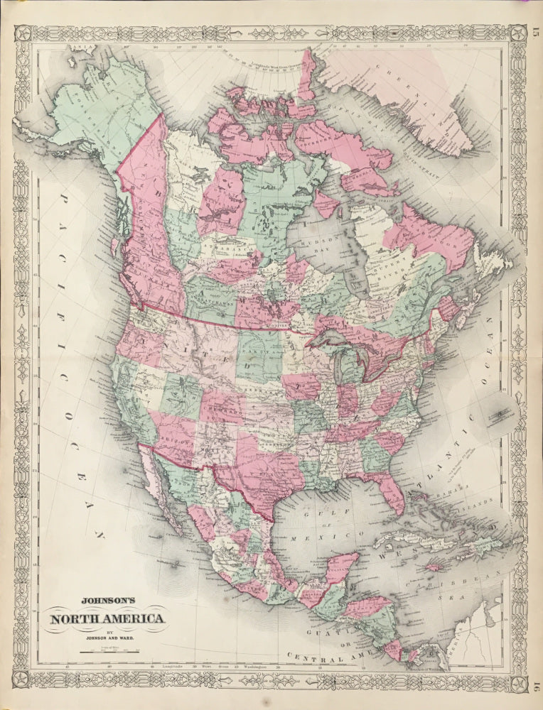
The western territories have interesting shapes, especially the large Idaho Territory, covering the modern states of Idaho, Montana and Wyoming. Also shown is the Pony Express Route.
A map of North America at an interesting period in its history. In the north, Alaska is still shown as "Russian Possessions" and what would, beginning in 1867, become Canada is still shown as "British America." In the south, Chiriqui and Veragua are shown as independent of Columbia, which at that time had control over Panama. In the United States, this map is interesting in showing the situation in the American West during the middle of the Civil War, including numerous new and proposed territories. The Arizona Territory is shown in its current position, although it includes the southern tip of what is now Nevada. Also of note, the Pony Express Mail Route is indicated crossing the continent. A nice map of the continent in the midst of the American Civil War.
 %20%0A%20%0Ahttps://philaprintshop.com/products/johnsons-north-america %20%0A%20%0A%22Johnson's%20North%20America%22%201863 %20%0A%20%0A//philaprintshop.com/cdn/shop/products/johnson1863namericac_1024x1024.jpg?v=1651683002 %20%0A%20%0AAntique Prints, Maps, Drawings, Paintings and Rare Books! %20%0A%20%0AThe Philadelphia Print Shop %20%0A106 E. Lancaster Avenue, Lower Level %20%0AWayne, PA 19087 %20%0A%20%0APhilaPrintShop.com %20%0A@PhiladelphiaPrintShop %20%0A 610 (808) 6165)