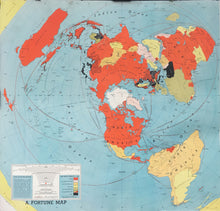
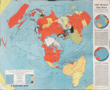
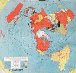
Richard Edes Harrison (1902-94). “One World One War. A Map Showing the line-up and the strategic stakes in this first global war.”
Chicago: Time Inc. March, 1942. Second edition. Supplement from Fortune Magazine. 21 ½ x 26 ¼. Off-set color lithograph. Repaired tears into key bottom left corner. Some wear and minor stains along map edges. A few soft vertical folds with scattered crinkling of paper in map. Good condition.
A very colorful and detailed map issued just a few months after Pearl Harbor. This map is drawn on the north polar projection and was published as a supplement for Fortune Magazine. This map describes and illustrates the tremendous complexities the United States had in waging war in Europe and the Pacific. Bottom left corner is a key which indicates by color the warring powers of the Allies, the Axis and the Neutral countries along with the allied supply routes. This map was found in many American homes during the war.


