
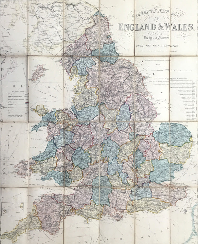
James Gilbert. "Gilbert's New Map of England & Wales, drawn from the best authorities."
London: Collins, 1849. Separately issued, folding map: dissected into 24 sections and mounted on linen. 32 x 25 3/4. Steel engraving. Original hand color. Slightly browned, but very good condition. Folding into original cloth case. Case rubbed.
A very detailed transportation map of England as the Industrial Revolution went into high gear. Roads, railroads, and steamship lines are shown in abundance. An unusual feature is a "Comparative Chart of the Navigation of the Principal Rivers" which shows the length to which one can pilot a boat.

 %20%0A%20%0Ahttps://philaprintshop.com/products/gilbert-james-gilberts-new-map-of-england-wales-drawn-from-the-best-authorities %20%0A%20%0AGilbert,%20James%20%22Gilbert's%20New%20Map%20of%20England%20%26%20Wales,%20drawn%20from%20the%20best%20authorities%22 %20%0A%20%0A//philaprintshop.com/cdn/shop/products/gilbertenglandfold_1024x1024.jpg?v=1614249435 %20%0A%20%0AAntique Prints, Maps, Drawings, Paintings and Rare Books! %20%0A%20%0AThe Philadelphia Print Shop %20%0A106 E. Lancaster Avenue, Lower Level %20%0AWayne, PA 19087 %20%0A%20%0APhilaPrintShop.com %20%0A@PhiladelphiaPrintShop %20%0A 610 (808) 6165)