

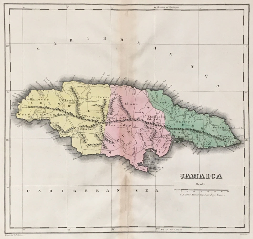

J. Finlayson. “Jamaica.”
Philadelphia: H.C. Carey & I. Lea, 1827. 15 x 14 1/2 (map); 16 3/4 x 20 1/2 (full sheet). Engraving by P. E. Hamm. Full original hand color. Light vertical browning along center fold as is usually found in this atlas. Else, very good condition.
In 1822, Henry Charles Carey and Isaac Lea published their A Complete Historical, Chronological, and Geographical American Atlas. This volume was based on Emmanuel Las Cases’ Atlas Historique of 1803, with updated maps and text modified by Carey, a political economist. He considered himself an American foil to John Stuart Mill and the London economists who were proclaimers of “the gloomy science” influenced by Ricardo and Malthus. Instead of preaching overpopulation and degeneration of the human species, Carey illustrated the nations of the western hemisphere through maps that showed an expanding region with ample promise of developing into lands of great new opportunity and growth.
The sheets from this atlas, which cover North America, Central America, South America and the West Indies, are comprised of an engraved map surrounded by text documenting the history, climate, population and so forth of the area depicted.

 %20%0A%20%0Ahttps://philaprintshop.com/products/finlayson-j-jamaica %20%0A%20%0AFinlayson,%20J.%20%22Jamaica%22 %20%0A%20%0A//philaprintshop.com/cdn/shop/products/careylea-jamaicac_1024x1024.jpg?v=1677793121 %20%0A%20%0AAntique Prints, Maps, Drawings, Paintings and Rare Books! %20%0A%20%0AThe Philadelphia Print Shop %20%0A106 E. Lancaster Avenue, Lower Level %20%0AWayne, PA 19087 %20%0A%20%0APhilaPrintShop.com %20%0A@PhiladelphiaPrintShop %20%0A 610 (808) 6165)