

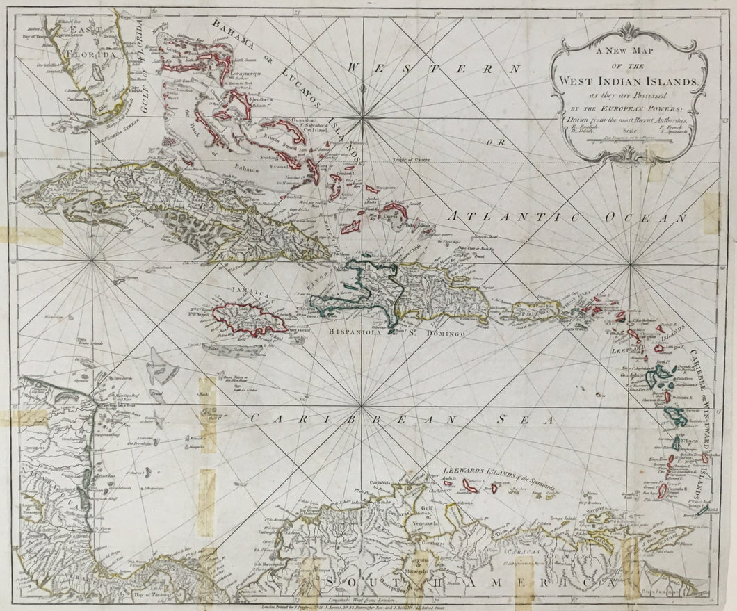

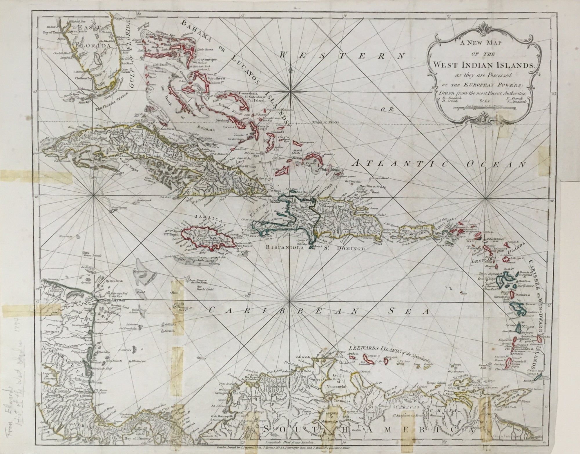
Bryan Edwards (1743-1800). “New Map of the West Indian Islands as they are Possessed by the European Powers.”
London: Stockdale, 1794. 18 ¾ x 22 ¼ (neatlines) plus margins. Original outline hand color. Fine impression. Old stains from old adhesive tape. Repaired tear right hand side just into cartouche. Professionally conserved. Fine condition.
An attractive and very detailed map depicting from western Cuba and Nicaragua, to the Bahamas, the Leeward and Windward Islands and the north coast of South America. Many small islands are designated with letters following names with English as “E”, Dutch as “D”, French as “F” and Spanish as “S.” The map appeared in the first edition of Bryan Edwards’ History, Civil and Commercial of the British Colonies in the West Indies. Subsequent editions were in 1801, 1807 and 1818. A very detailed map in the British tradition of Faden and Jefferys.
 %20%0A%20%0Ahttps://philaprintshop.com/products/edwards-bryan-new-map-of-the-west-indian-islands-as-they-are-possessed-by-the-european-powers %20%0A%20%0AEdwards,%20Bryan%20%22New%20Map%20of%20the%20West%20Indian%20Islands%20as%20they%20are%20Possessed%20by%20the%20European%20Powers%22 %20%0A%20%0A//philaprintshop.com/cdn/shop/products/edwards-westindiesc_1024x1024.jpg?v=1677792462 %20%0A%20%0AAntique Prints, Maps, Drawings, Paintings and Rare Books! %20%0A%20%0AThe Philadelphia Print Shop %20%0A106 E. Lancaster Avenue, Lower Level %20%0AWayne, PA 19087 %20%0A%20%0APhilaPrintShop.com %20%0A@PhiladelphiaPrintShop %20%0A 610 (808) 6165)