

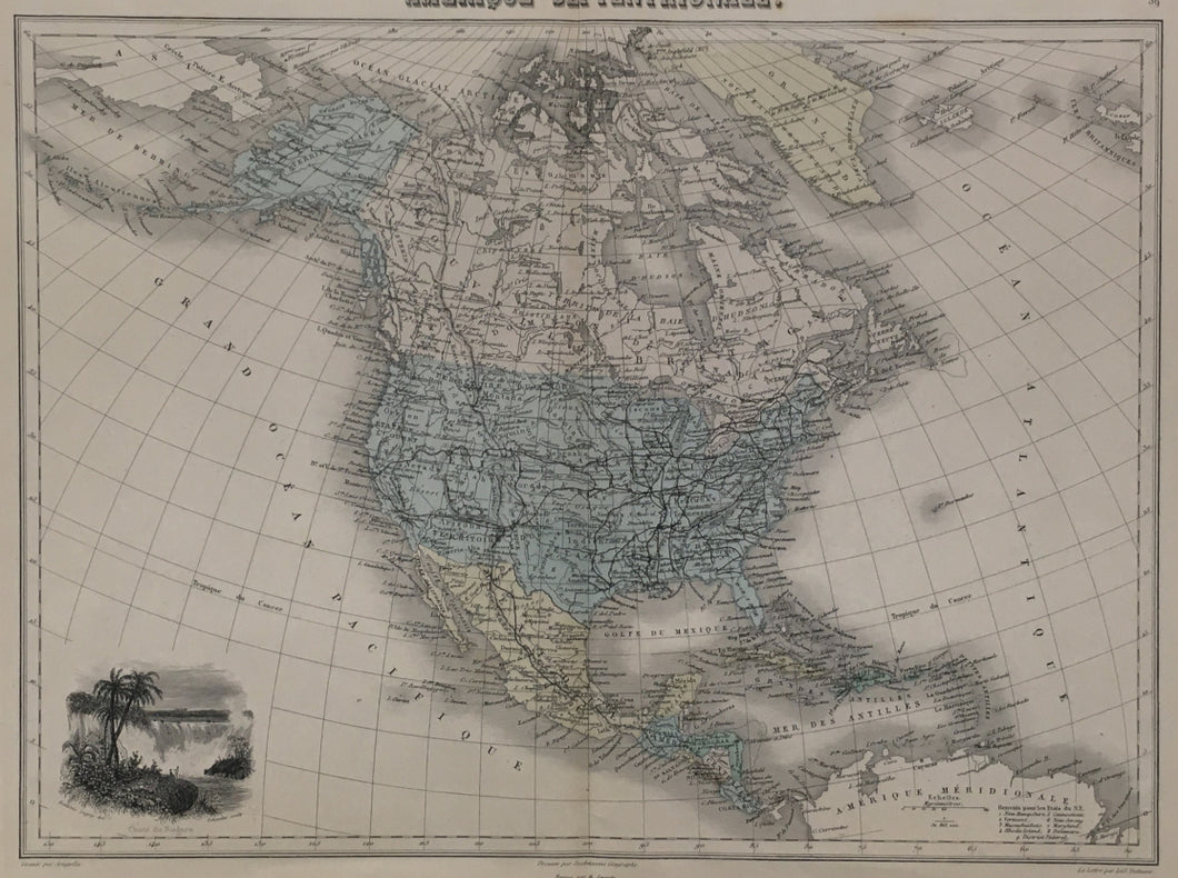


L.E. Desbuissons. "Amérique Septentrionale." From Géographie Universelle.
Paris: J. Migeon, 1874. 11 x 14 3/4 (neatlines) plus full margins. With inset "Chute du Niagara." Drawn by Frederic Legrip and engraved by Schoeder. Map engraved by L.A. Sengteller. Original hand color. Very good condition. Ref.: Lane, Impressions of Niagara, 427.
Louis Edouard Desbuissons (b. 1827) was a prolific mapmaker who worked in Paris for many decades in the Ministère des Affaires Etrangères. This map, emphasizing the railroads of North and Central America, was published by Migeon in his Géographie Universelle. The inset view of Niagara Falls is interesting for its depiction of palm trees in upstate New York as Europeans had inaccurately shown it a hundred years previously. Niagara was a popular tourist site, accessible by railroad from British America as well as the United States, thus the connection of this map and its lovely view.
 %20%0A%20%0Ahttps://philaprintshop.com/products/desbuissons-l-e-amerique-septentrionale-from-geographie-universelle %20%0A%20%0ADesbuissons,%20L.E.%20%22Am%C3%A9rique%20Septentrionale.%22%20From%20%22G%C3%A9ographie%20Universelle%22 %20%0A%20%0A//philaprintshop.com/cdn/shop/products/desbuissonsnamericac_1024x1024.jpg?v=1651684288 %20%0A%20%0AAntique Prints, Maps, Drawings, Paintings and Rare Books! %20%0A%20%0AThe Philadelphia Print Shop %20%0A106 E. Lancaster Avenue, Lower Level %20%0AWayne, PA 19087 %20%0A%20%0APhilaPrintShop.com %20%0A@PhiladelphiaPrintShop %20%0A 610 (808) 6165)