
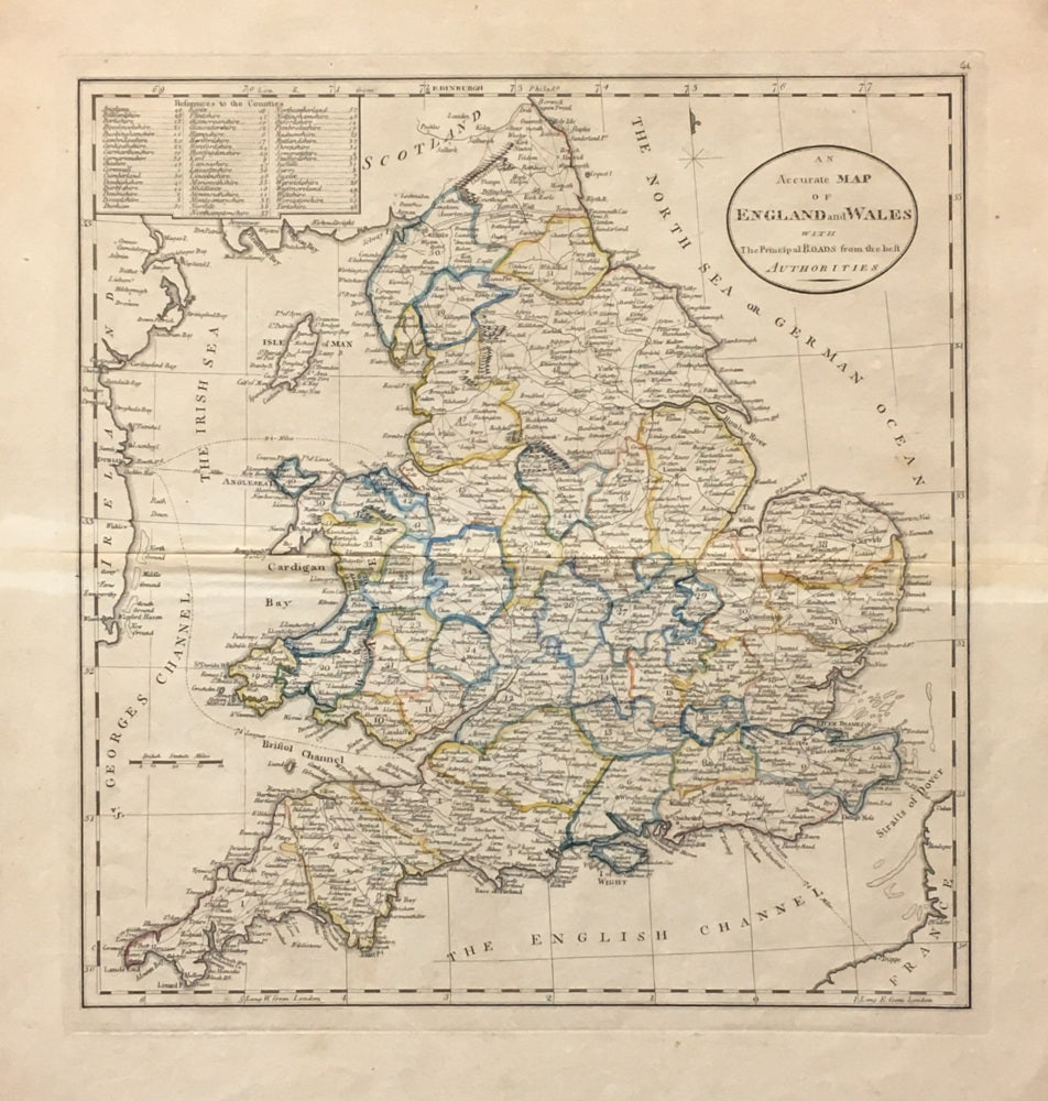
Mathew Carey. "An Accurate Map of England and Wales with The Principal Roads from the best Authorities".
Philadelphia: Carey, 1818. Folio. Engraving. Stain along centerfold from binding hinge. Spots in margins away from image. Else, very good condition. Wheat & Brun: 769.
The most influential name in American cartography at the end of the eighteenth century was Mathew Carey (1760-1839). Carey was the first major American publisher of maps and atlases, and his Atlas of 1795 is one of the landmarks of early American cartography because it contained some of the first printed maps of many states. The 1790s marked the beginning of the new republic under a new constitution, and patriotic sentiments filled the hearts and minds of men and their publications. In England, William Guthrie's geographies were disparaging to the former colonies, so Carey wrote new text and produced his own maps for an "improved" edition that merely recognized while not compensating Guthrie. As a youth Carey had been expelled from Ireland for printing seditious literature, so he escaped to Paris where he worked for Benjamin Franklin until the cessation of hostilities. He then went to Philadelphia, worked for Franklin briefly and later opened his own printing shop. Eventually Mathew Carey became one of the great citizens of Philadelphia and founder of the present-day firm of Lea & Febiger, which until recently was located on Washington Square.

 %20%0A%20%0Ahttps://philaprintshop.com/products/carey-mathew-an-accurate-map-of-england-and-wales-with-the-principal-roads-from-the-best-authorities %20%0A%20%0ACarey,%20Mathew%20%22An%20Accurate%20Map%20of%20England%20and%20Wales%20with%20The%20Principal%20Roads%20from%20the%20best%20Authorities%22 %20%0A%20%0A//philaprintshop.com/cdn/shop/products/careyeng1818_1024x1024.jpg?v=1613349095 %20%0A%20%0AAntique Prints, Maps, Drawings, Paintings and Rare Books! %20%0A%20%0AThe Philadelphia Print Shop %20%0A106 E. Lancaster Avenue, Lower Level %20%0AWayne, PA 19087 %20%0A%20%0APhilaPrintShop.com %20%0A@PhiladelphiaPrintShop %20%0A 610 (808) 6165)