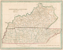
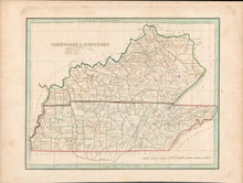
Thomas G. Bradford. “Tennessee & Kentucky.”
Boston: William D. Ticknor, 1835. From A Comprehensive Atlas. Geographical, Historical & Commercial. 7 3/4 x 10. Engraving. Original outline color. Full margins. Some typical, light spotting. First issue. Overall, very good condition.
A small map of Tennessee and Kentucky published in Boston in 1835 showing the states in the third decade of the nineteenth century. Information shown includes rivers, towns, and some topography. Throughout the early period of the century, Kentucky continually added counties, as the population expanded and developed around the state. This map is very up-to-date in showing this political development, with each county indicated and named.


