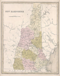
Thomas G. Bradford. "New Hampshire."
Boston: T. G. Bradford, 1838. 14 1/8 x 11 3/8. Engraving by G. W. Boynton. Original hand color. Some minor discoloring from oxidation. Otherwise, very good condition.
A finely engraved map issued by Thomas G. Bradford, a Boston map publisher. The map shows New Hampshire in the third decade of the nineteenth century, depicting the terrain of the state with considerable detail, including rivers, towns, counties, and some sense of the Presidential Range of the White Mountains. The maps by Bradford are fine examples of the developing American cartographic industry and are among the scarcest of state maps.

