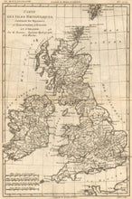
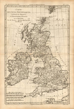
Rigobert Bonne. "Carte des Isles Britanniques contenant les Royaumes D'Angleterre, D'Ecosse et D'Irlande." From Bonne's Atlas de toutes les parties connues du Globe Terrestre.
Paris, 1780. 12 3/4 x 8 1/2. Engraving by André. Very good condition.
Rigobert Bonne was the Royal Hydrographer of France, so his primary interest was in marine charts. However, with his Royal connections and access to the cartographic documents in Paris, Bonne was able to compile maps containing some of the most up-to-date information of his time. This map of Great Britain is a good example of his work. The counties, cities, rivers, and other information along the coast are clearly presented. A good picture of the country near the end of the eighteenth century.


