


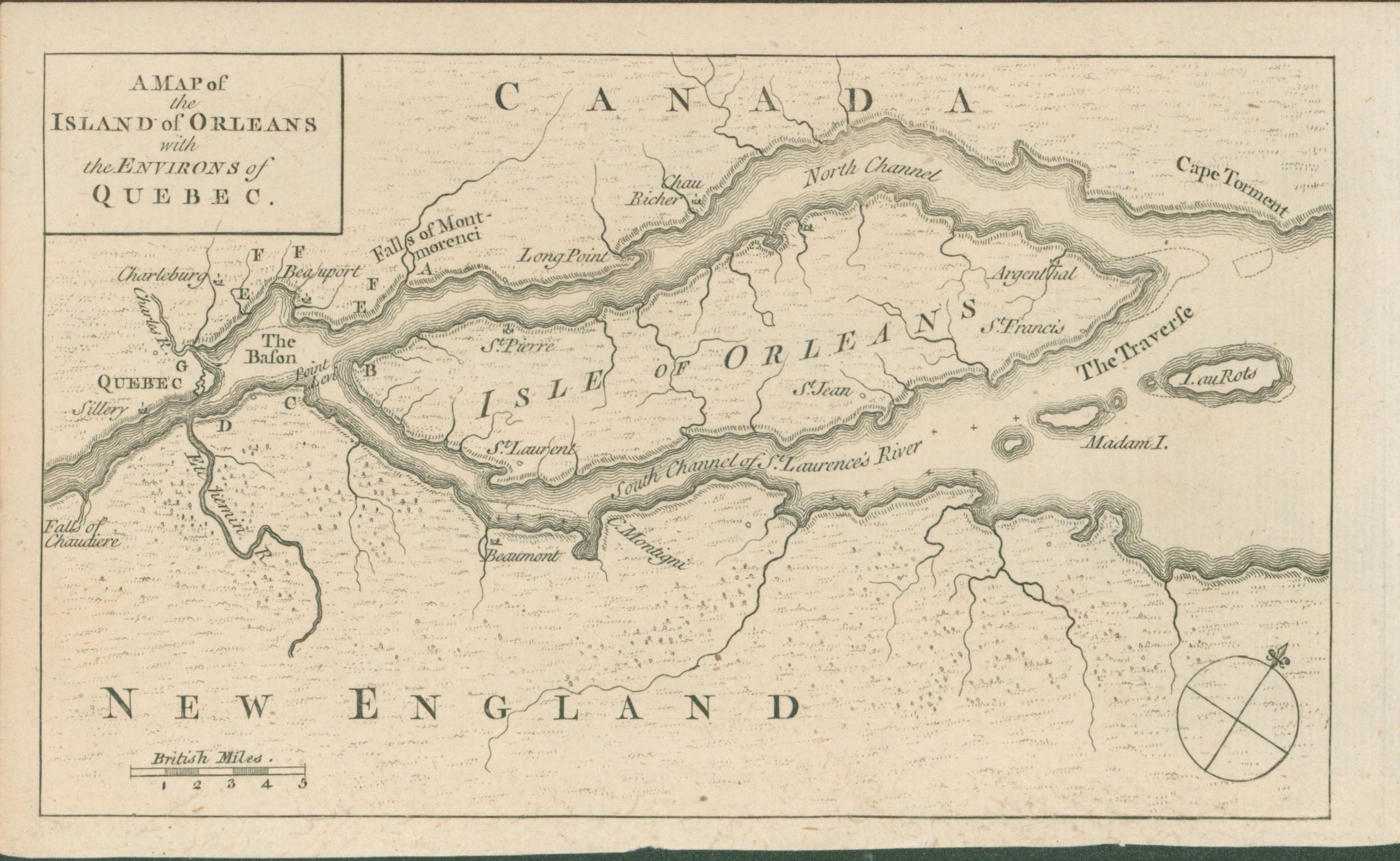
Unattributed. “A Map of the Island of Orleans with the Environs of Quebec.” From Gentlemen’s Magazine.
4 1/4 x 7 1/4. Engraving. Very good condition.
Beginning in 1731, monthly news magazines made their appearance in Britain. These magazines, with such names as Gentleman’s Magazine and London Magazine, contained poetry, prose, and articles on events, fashions, personalities, and other items of the day that might be of interest to the English gentleman. One of their most popular, and historically important, features was the inclusion of prints and maps to accompany their articles. This map of the environs of Quebec is a very nice example of one such map, issued in Gentleman’s Magazine, October 1759. This city was the strongest fortress in Canada, the lynch-pin of French power in North America. The British knew that if they were able to capture Quebec, the rest of the country would soon fall into their dominion, so they lay siege to Quebec from June 27th until September 18th, when the French surrendered their garrison in the city. This was the turning point of the war, with an eventual British victory all but certain. This map, issued just after that major victory, would have been of great interest to the British public.
 %20%0A%20%0Ahttps://philaprintshop.com/products/anonymous-a-map-of-the-island-of-orleans-with-the-environs-of-quebec %20%0A%20%0AUnattributed%20%22A%20Map%20of%20the%20Island%20of%20Orleans%20with%20the%20Environs%20of%20Quebec%E2%80%9D %20%0A%20%0A//philaprintshop.com/cdn/shop/products/ScreenShot2021-05-03at12.55.23AM_1024x1024.png?v=1620024961 %20%0A%20%0AAntique Prints, Maps, Drawings, Paintings and Rare Books! %20%0A%20%0AThe Philadelphia Print Shop %20%0A106 E. Lancaster Avenue, Lower Level %20%0AWayne, PA 19087 %20%0A%20%0APhilaPrintShop.com %20%0A@PhiladelphiaPrintShop %20%0A 610 (808) 6165)