

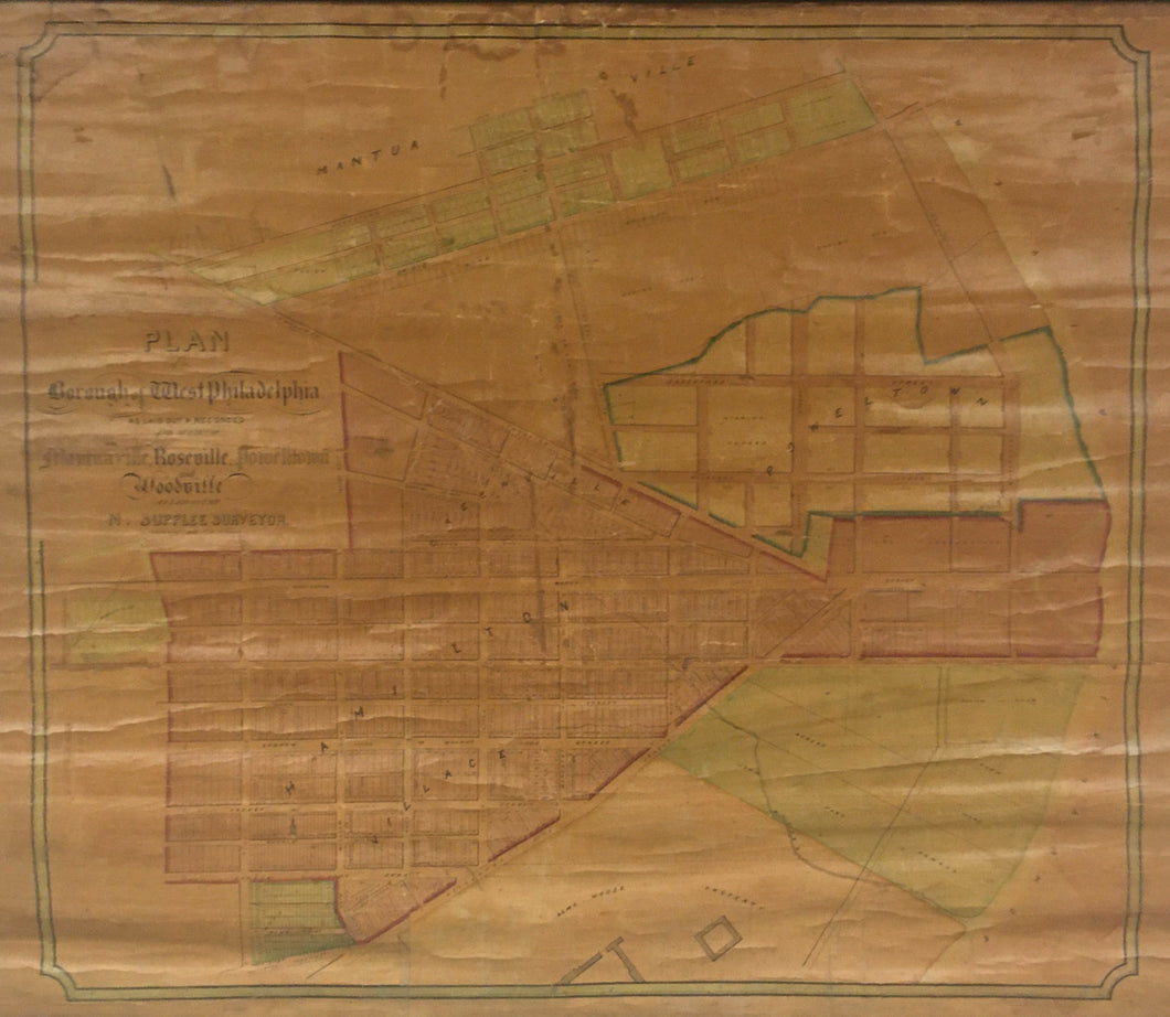
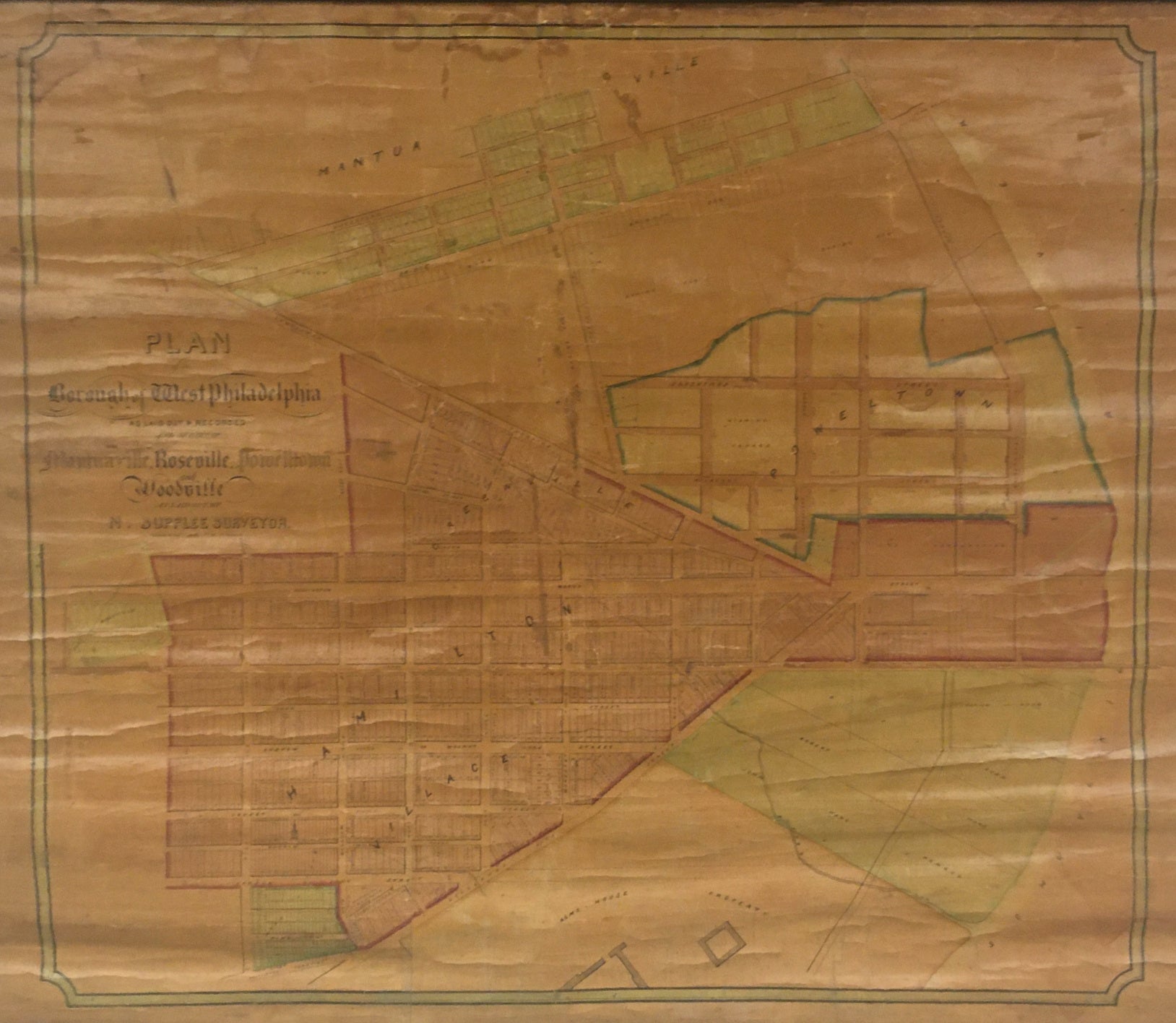
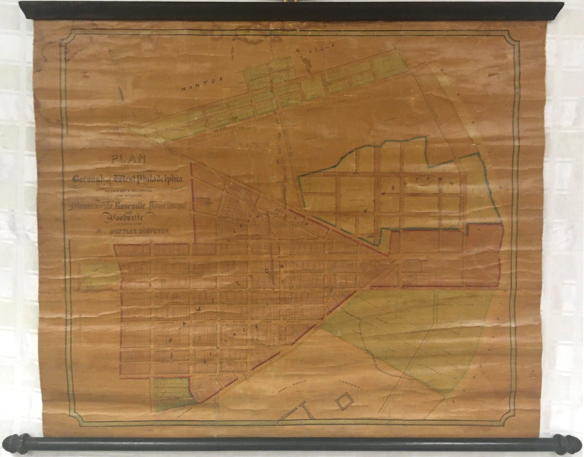
N. Supplee. “Map of the Borough of West Philadelphia as Laid Out and Recorded and of Part of Mantua, Rossville, Powelton and Woodsville.”
Philadelphia: Lloyd P. Smith, [1847]. 26 1/4 x 30 1/2 (neatlines). Lithograph. Original hand color. Map mounted to linen backing and varnished as originally issued. Browning in map due to oxidation of varnish as to be expected. Map was in three sections and was re-assembled and stabilized using acid free linen tape. Heavy use of acid free linen tape to repair, reinforce and flatten horizontal tears, folds and cracking. Water stains in top, right and left hand margins. A few small areas of map in-painted. Old bottom roller and top rail. Unrecorded. Very scarce wall map. Sold as is. A/A
This map focuses on the area of the intersection of Lancaster Avenue, Woodlands (now Woodland Walk) and Market Streets in West Philadelphia. In the 1840s development began to expand into West Philadelphia and with the help of the horse drawn omnibus service which helped shuttle people into downtown Philadelphia. As the various towns of Hamiltonville, Mantua, and Powelton in West Philadelphia grew they decide to band together to create the borough of West Philadelphia in 1844 in order to provide various services for the population who lived there. The borough only lasted 11 years before being incorporated into the city proper under the Consolidation Act of 1854. This map shows where Drexel University is now located and part of the University of Pennsylvania. To the south is the Alms House or Old Blockley where the Children’s Hospital of Philadelphia now stands.
This map could not be located in any collection, but we did find an 1847 advertisement for the map in the American Booksellers.
This map cannot be rolled and must be displayed and shipped flat.
Other Philadelphia and vicinity wall maps:
 %20%0A%20%0Ahttps://philaprintshop.com/products/supplee-n-map-of-the-borough-of-west-philadelphia-as-laid-out-and-recorded-and-of-part-of-mantua-rossville-powelton-and-woodsville %20%0A%20%0ASupplee,%20N.%20%20%E2%80%9CMap%20of%20the%20Borough%20of%20West%20Philadelphia%20as%20Laid%20Out%20and%20Recorded%20and%20of%20Part%20of%20Mantua,%20Rossville,%20Powelton%20and%20Woodsville%22 %20%0A%20%0A//philaprintshop.com/cdn/shop/products/westphilawallmap1847c_1024x1024.jpg?v=1658345669 %20%0A%20%0AAntique Prints, Maps, Drawings, Paintings and Rare Books! %20%0A%20%0AThe Philadelphia Print Shop %20%0A106 E. Lancaster Avenue, Lower Level %20%0AWayne, PA 19087 %20%0A%20%0APhilaPrintShop.com %20%0A@PhiladelphiaPrintShop %20%0A 610 (808) 6165)