

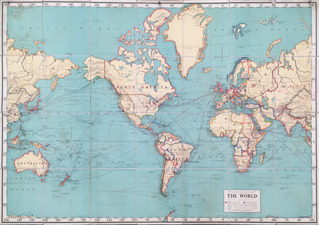

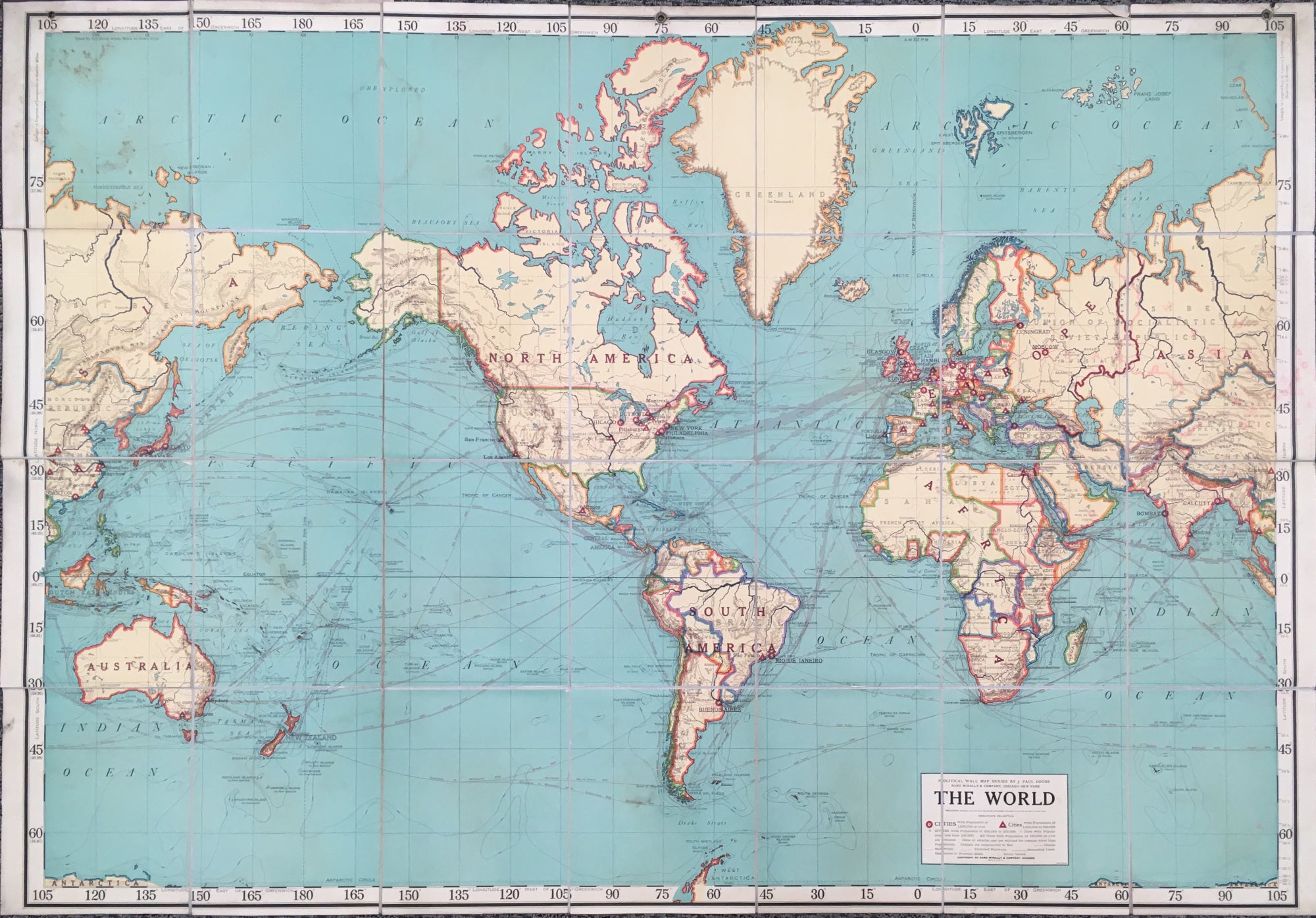
J. Paul Goode. "The World: Political Wall Map Series." Sixth edition.
Chicago & New York: Rand, McNally & Co., c. 1920. 45 x 64. Dissected into 28 sections and laid down on fabric folding into brown cloth covers. Three grommets at top. Some staining; else, good condition.
Prior to the First World War Rand McNally published a series of eighteen wall maps, half "Physical" and half "Political." The American Geographical Society's Geographical Review called them "the first modern geographical wall maps of American manufacture."
This world map is from the political series and shows the world after the war and the Versailles Conference. For example, there are Pacific Islands that had been Germany's but were now under a Japanese Mandate, while Palestine is shown as a British Mandate and Syria a French one.
John Paul Goode (1862-1932) was professor of geography at the University of Chicago. Interestingly, although he had labored to create a variation to what he termed "evil Mercator," this map is on Mercator's projection.
 %20%0A%20%0Ahttps://philaprintshop.com/products/goode-j-paul-the-world-political-wall-map-series %20%0A%20%0AGoode,%20J.%20Paul%20%22The%20World:%20Political%20Wall%20Map%20Series%22 %20%0A%20%0A//philaprintshop.com/cdn/shop/products/rand1920worldfoldc_1024x1024.jpg?v=1657826193 %20%0A%20%0AAntique Prints, Maps, Drawings, Paintings and Rare Books! %20%0A%20%0AThe Philadelphia Print Shop %20%0A106 E. Lancaster Avenue, Lower Level %20%0AWayne, PA 19087 %20%0A%20%0APhilaPrintShop.com %20%0A@PhiladelphiaPrintShop %20%0A 610 (808) 6165)