

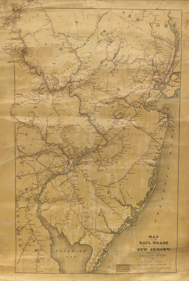


J.A. Anderson. "Map of the Rail Roads of New Jersey, and parts of Adjoining States. 1870."
New Jersey: J.A. Anderson, 1869. Lithograph by James McGuigan. 21 1/2 x 16 (full sheet). Original light varnish rubbed. Backed on original linen. Puncture in top margin filled and in-painted. Some wear and minor chipping at map edges as to be expected. Tacked to the original antique top moulding and bottom spindle. Full margins. A lovely small wall map in its original format. Ref.: Phillips, MAPS, p. 491.
This fascinating, separately issued map focuses almost exclusively on the railroads of New Jersey by naming and drawing the lines with the names of stations with distances between these stations expressed in "miles and tenths." No wagon roads are designated and only major waterways are drawn. All of New Jersey is shown with large areas of northern Delaware, Eastern Pennsylvania and New York along the Hudson River. At the bottom margin and to the left of the title area is a small merchant's label reading "Sheble, Smith & Co. / Successors to R. L. Barnes, / Map Publishers, 27 S. 6th. Sth., [sic.] Phila." Measuring a petite 1" x 1 1/2".

 %20%0A%20%0Ahttps://philaprintshop.com/products/anderson-j-a-map-of-the-rail-roads-of-new-jersey-and-parts-of-adjoining-states-1870 %20%0A%20%0AAnderson,%20J.A.%20%22Map%20of%20the%20Rail%20Roads%20of%20New%20Jersey,%20and%20parts%20of%20Adjoining%20States.%201870%22 %20%0A%20%0A//philaprintshop.com/cdn/shop/products/njrailroadwallmapc_1024x1024.jpg?v=1645727601 %20%0A%20%0AAntique Prints, Maps, Drawings, Paintings and Rare Books! %20%0A%20%0AThe Philadelphia Print Shop %20%0A106 E. Lancaster Avenue, Lower Level %20%0AWayne, PA 19087 %20%0A%20%0APhilaPrintShop.com %20%0A@PhiladelphiaPrintShop %20%0A 610 (808) 6165)