


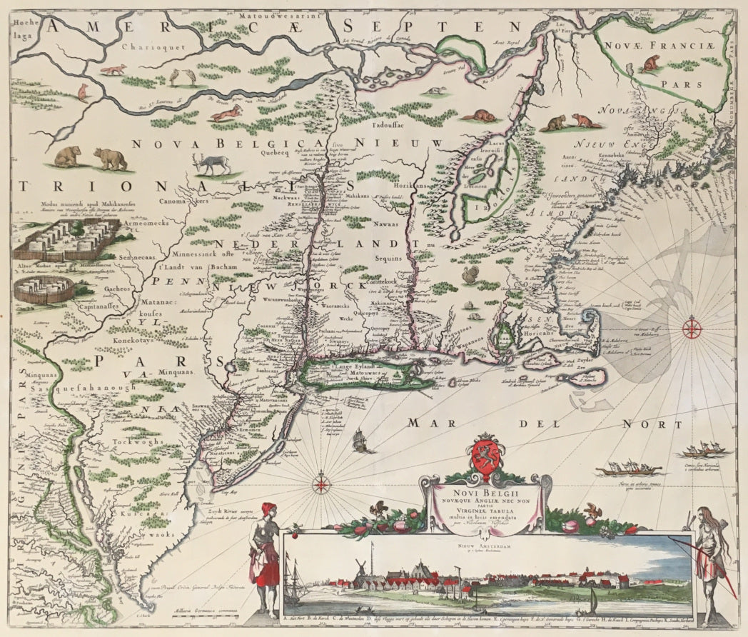
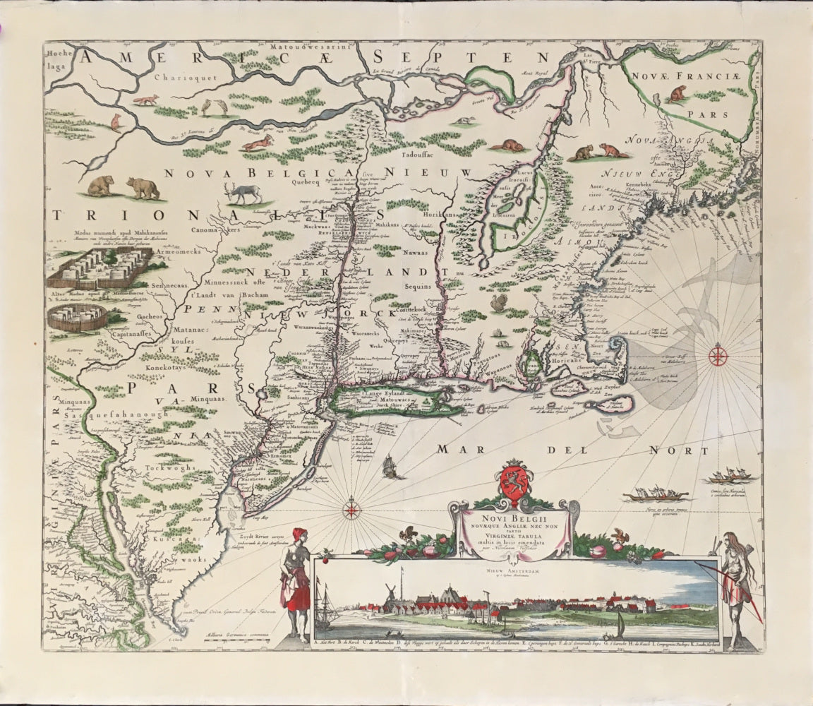
Nicholaus Visscher. “Novi Belgii Novaeque Angliae Nec Non Partis Virginiae Tabula multis in lotis emendata per Nicolaum Visscher.”
Amsterdam: N. Visscher II, [1655]-1684. Fourth state. 18 1/8 x 21 1/2. Engraving. Hand color. Full margins. Professionally conserved. Excellent condition. Tony Campbell, The Jansson-Visscher Maps of New England, #6. A/A
A gorgeous example of one of the most decorative and desirable maps of north-eastern United States. This map, drawn by Nicholaus Visscher the elder around 1655, is based upon Jan Jansson’s map of New England first issued around 1651. The map was intended to detail the situation of the Dutch and England settlements between the Chesapeake Bay and what is today Maine. The coastline, though quite inaccurate, is based on information gathered in Amsterdam from English, Dutch, and Swedish sources (the Swedes had control of the Delaware until around the time this map was issued). Inland the cartographic rendering is based on somewhat accurate conjectures of river courses and Indian settlements. What distinguishes the Visscher from the earlier Jansson map is the former’s inclusion of a view of “Nieuw Amsterdam op t Eylant Manhattans.” This is the third known engraved view of New York City, and it inspired the economic rise of this Dutch trading town as the center of their New World colony.

 %20%0A%20%0Ahttps://philaprintshop.com/products/visscher-nicholaus-novi-belgii-novaeque-angliae-nec-non-partis-virginiae-tabula-multis-in-lotis-emendata-per-nicolaum-visscher %20%0A%20%0AVisscher,%20Nicholaus%20%20%E2%80%9CNovi%20Belgii%20Novaeque%20Angliae%20Nec%20Non%20Partis%20Virginiae%20Tabula%20multis%20in%20lotis%20emendata%20per%20Nicolaum%20Visscher%22 %20%0A%20%0A//philaprintshop.com/cdn/shop/products/visschernewenglandc_1024x1024.jpg?v=1656002558 %20%0A%20%0AAntique Prints, Maps, Drawings, Paintings and Rare Books! %20%0A%20%0AThe Philadelphia Print Shop %20%0A106 E. Lancaster Avenue, Lower Level %20%0AWayne, PA 19087 %20%0A%20%0APhilaPrintShop.com %20%0A@PhiladelphiaPrintShop %20%0A 610 (808) 6165)