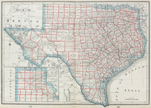
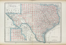
Unattributed. "Texas."
Ca. 1890. 11 3/4 x 17. Cerograph. Original color. Time toned at margin edges, with short archivally repaired tears, none affecting image. Else, very good condition.
A detailed map of Texas. The map is filled with useful and up-to-date political and cultural information, and details on roads, towns, railroads, and so forth. This map is typical of the Cram output and it shows railroads, forts, springs, and much else precisely and clearly. On the reverse of this atlas map are smaller maps of Arkansas and the Indian Territory (Oklahoma).


