

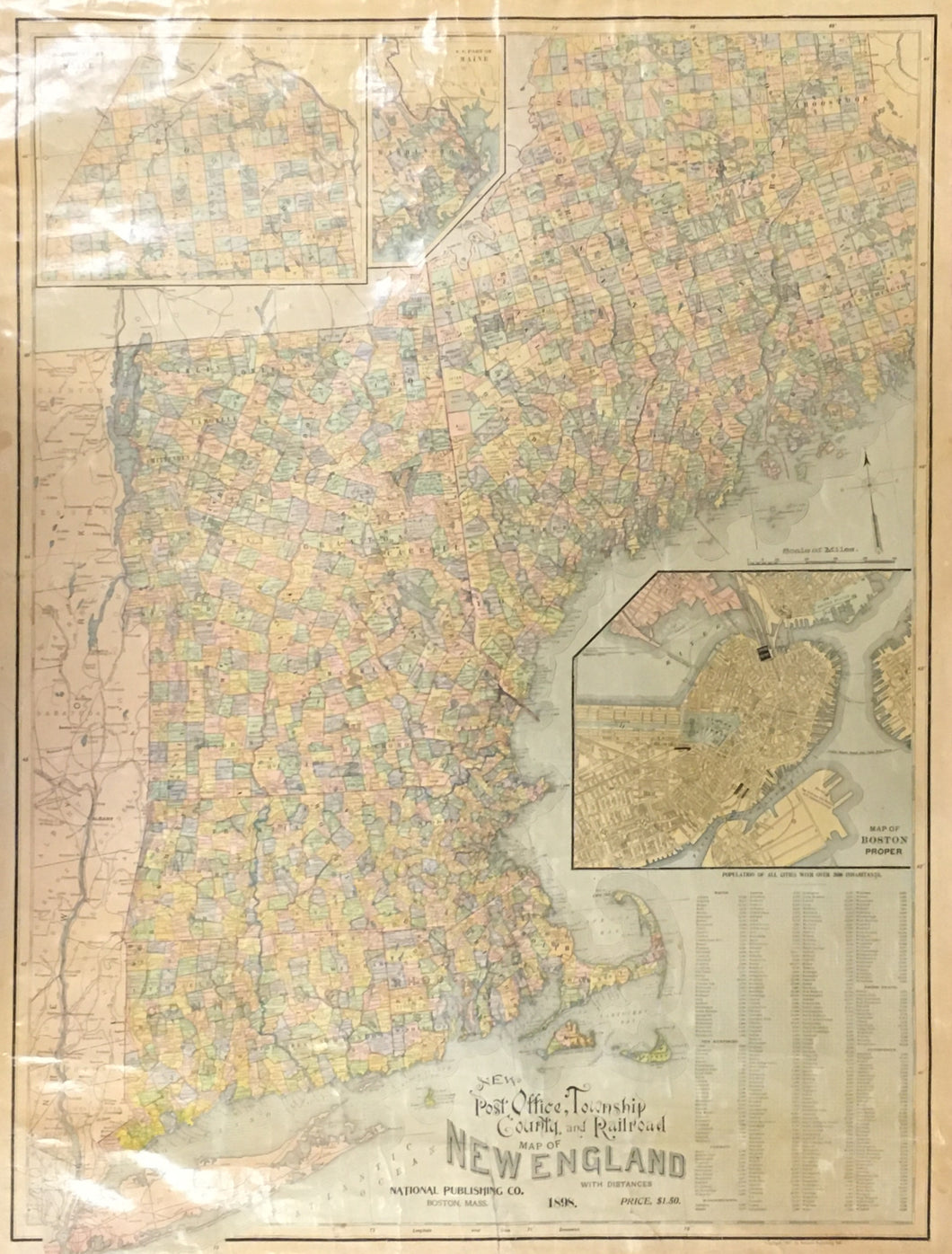

National Publishing Co. “New Post Office, Township, County and Railroad Map of New England with Distances.”
Boston: National Publishing Co., 1898. 37 x 29 ½ (map with rollers). Color cerograph. Varnished as originally issued. [Reflections in photo due to old varnish]. Several long vertical tears into map repaired with archival linen tape. Several areas of margins filled with old matching paper. Else, good condition. With original rollers. Map cannot be rolled. Else, good condition. A/A
An attractive and informative wall map of New England at the end of the 19th century. There are three inset maps: Boston, northern and southeast parts of Maine. To the right is a list of cities with population over 2,000 inhabitants.

 %20%0A%20%0Ahttps://philaprintshop.com/products/national-publishing-co-new-post-office-township-county-and-railroad-map-of-new-england-with-distances %20%0A%20%0ANational%20Publishing%20Co.%20%20%E2%80%9CNew%20Post%20Office,%20Township,%20County%20and%20Railroad%20Map%20of%20New%20England%20with%20Distances%22 %20%0A%20%0A//philaprintshop.com/cdn/shop/products/nationalpublishnewenglandwallmapc_1024x1024.jpg?v=1663348743 %20%0A%20%0AAntique Prints, Maps, Drawings, Paintings and Rare Books! %20%0A%20%0AThe Philadelphia Print Shop %20%0A106 E. Lancaster Avenue, Lower Level %20%0AWayne, PA 19087 %20%0A%20%0APhilaPrintShop.com %20%0A@PhiladelphiaPrintShop %20%0A 610 (808) 6165)