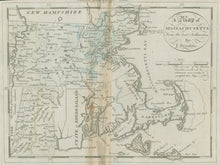
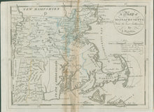
J. Denison. “A Map of Massachusetts from the best Authorities.” From Jedidiah Morse’s The American Universal Geography.
Boston: Thomas & Andrews, 1796. 7 1/2 x 9 3/4. Engraving by Samuel Hill. Hand color. Repairs and small areas of paper loss filled in center of map. Vertical browning in center of map. Else, fair condition. Wheat & Brun: 218.
An excellent late eighteenth century map of Massachusetts. This map was from Jedidiah Morse’s Geography, one of the first American publications of its kind. Morse, the father of Samuel F.B. Morse, established himself in the 1780s as one of the leading producers of American maps. Hill, the engraver, is one of the early names in American engraving, especially during the Federalist Period. The map is of interest because of its early detail, including towns, counties, lakes, streams and other topographical information. The eastern counties are almost blank because, as the map explains, “the surveys . . . could not be completed seasonably.”


