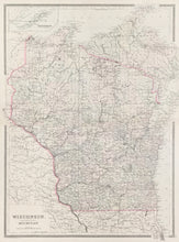
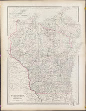
William Bradley. "Wisconsin, Showing North Western portion of Michigan." With inset of "Isle Royale (Part of Michigan)." From Bradley's Atlas of the World for Commercial and Library Reference.
Philadelphia: Wm. M. Bradley & Bro., 1885. 22 x 17 1/2. Map extends past borders on all sides. Lithograph. Original hand color.
A precisely detailed map from the Philadelphia publishing firm of William M. Bradley & Bro. While Philadelphia was no longer the main center of cartographic publishing in North America by the late nineteenth century, many fine maps were still produced there, as is evidenced by this map. It shows the state with impressive detail, with emphasis on rivers, towns, and the myriad railroad lines crisscrossing the state.


