


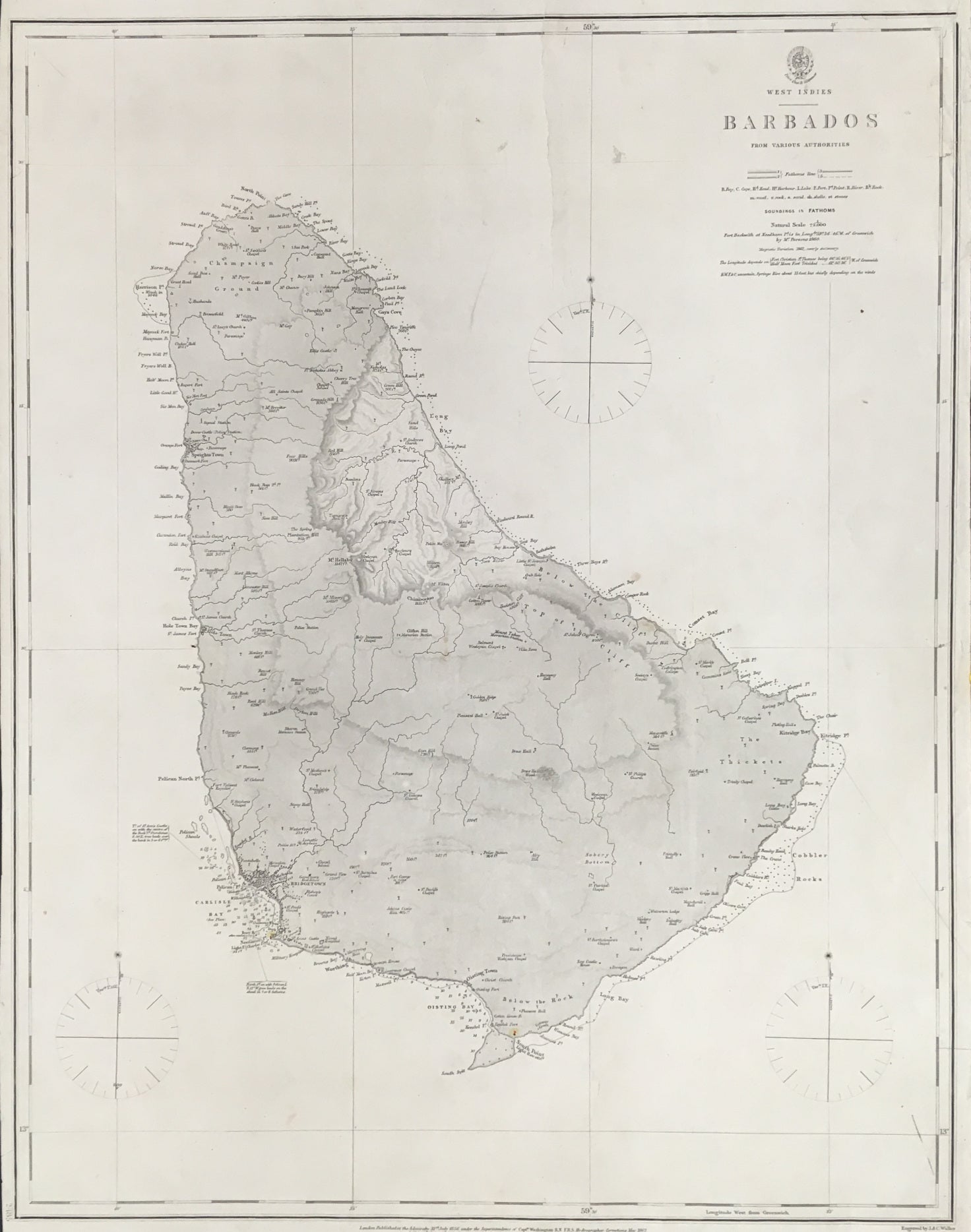
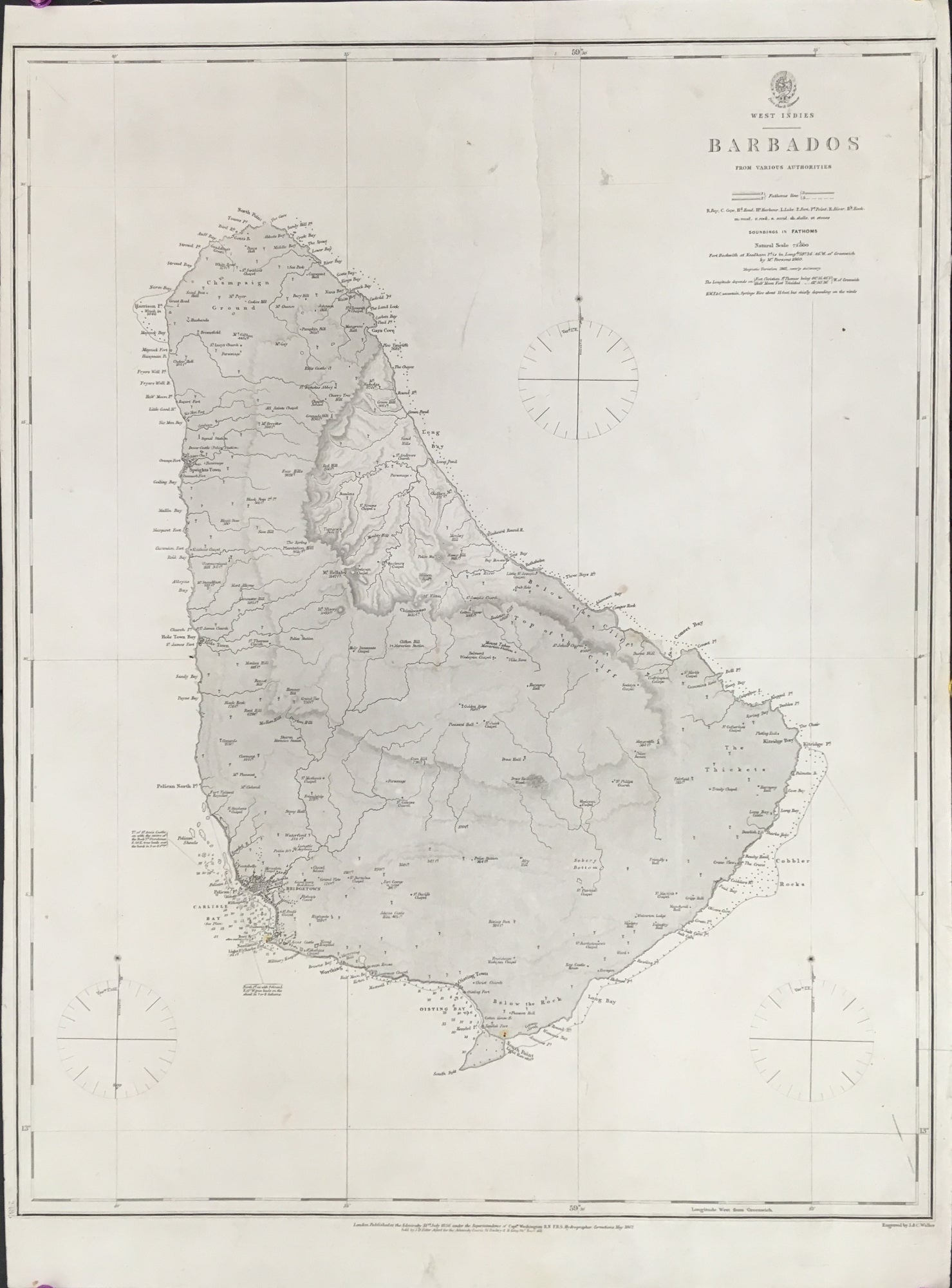
"Barbados From Various Authorities."
London: Admiralty, 31 July 1856, corrected to May 1862. 24 1/4 x 19. Engraving by J.& C. Walker. Very good condition.
A British Admiralty map of Barbados. The Admiralty's charts were some of the best in the world and this depiction of Barbados is a good example of the quality of their output. The coastline is precisely delineated, with soundings given in the accessible southwest area and indications of shoals around much of the rest of the coast. The interior, with hatching for topography and indications of rivers, is filled with interesting information of buildings etc. As good a map as one could expect from this period.

 %20%0A%20%0Ahttps://philaprintshop.com/products/british-admiralty-barbados-from-various-authorities %20%0A%20%0ABritish%20Admiralty%20%22Barbados%20From%20Various%20Authorities%22 %20%0A%20%0A//philaprintshop.com/cdn/shop/products/barbadosadmiraltyc_1024x1024.jpg?v=1677788069 %20%0A%20%0AAntique Prints, Maps, Drawings, Paintings and Rare Books! %20%0A%20%0AThe Philadelphia Print Shop %20%0A106 E. Lancaster Avenue, Lower Level %20%0AWayne, PA 19087 %20%0A%20%0APhilaPrintShop.com %20%0A@PhiladelphiaPrintShop %20%0A 610 (808) 6165)