


"Those Splendid Wall Maps That Fold"
American Geographical Institute. The New World Series of School Maps.
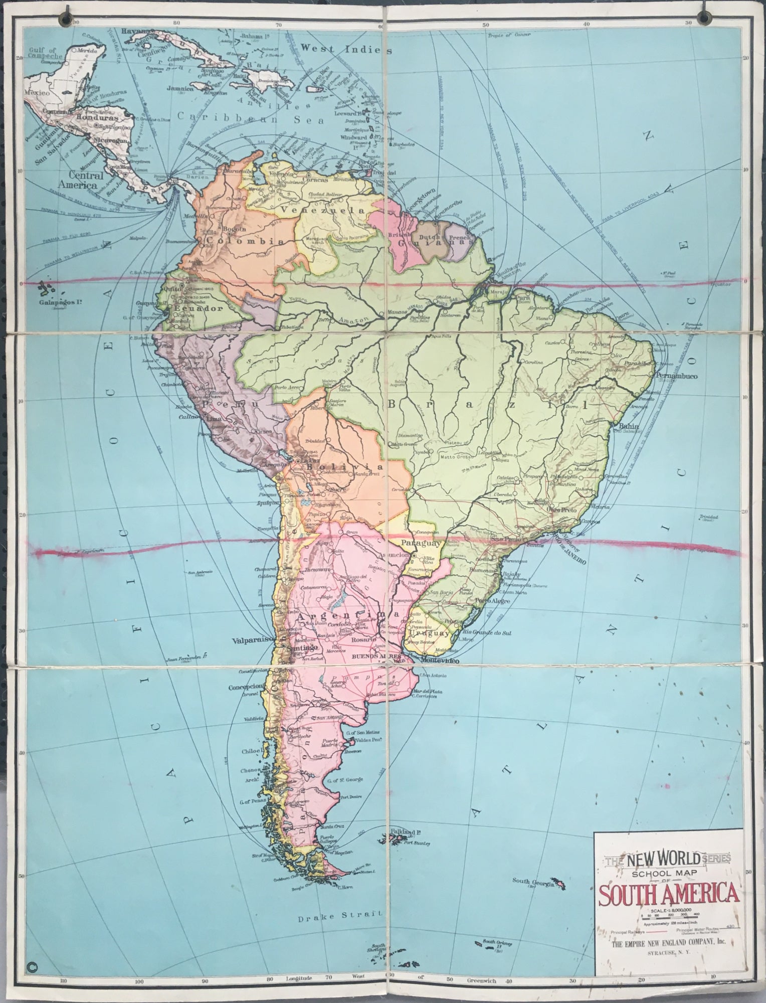
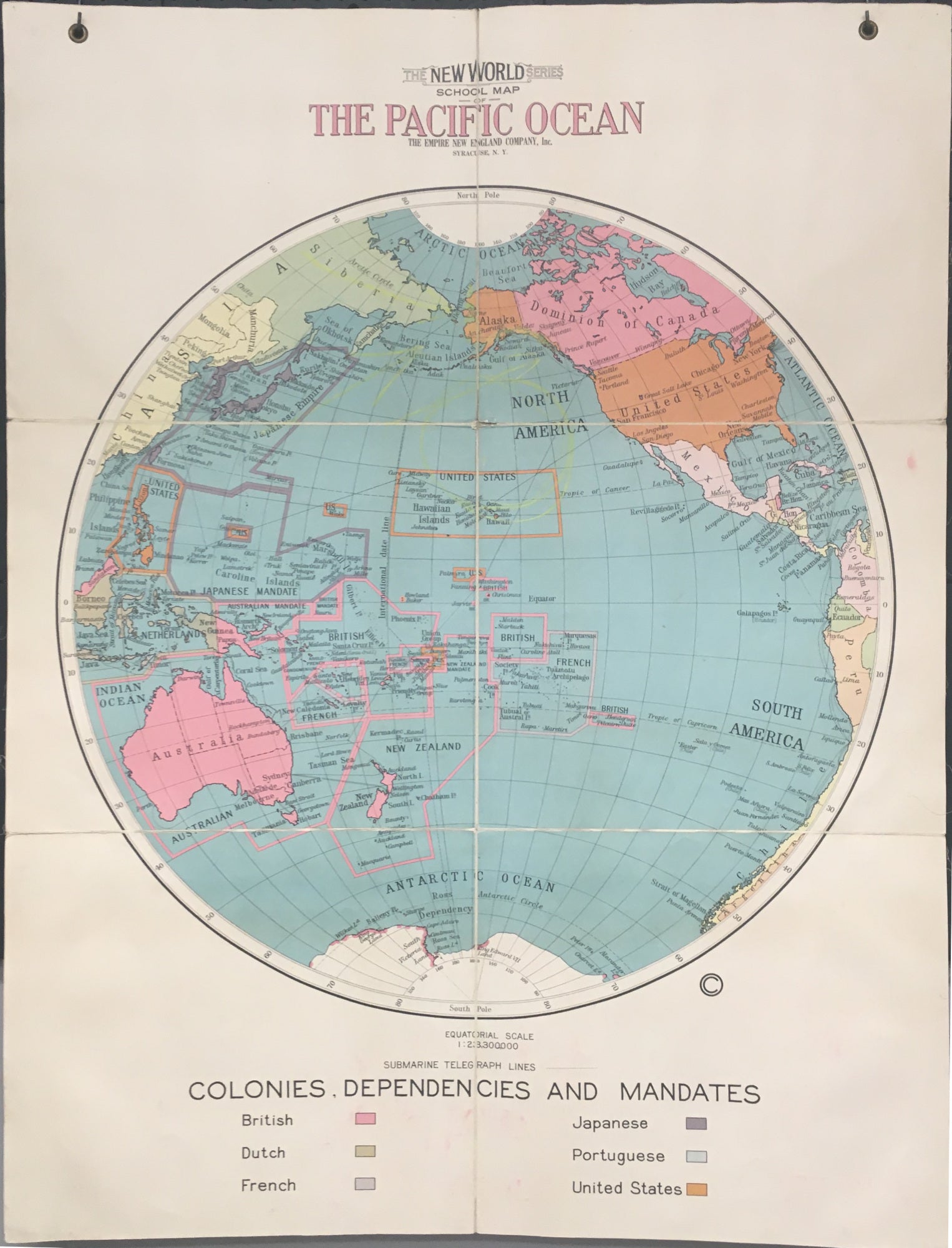
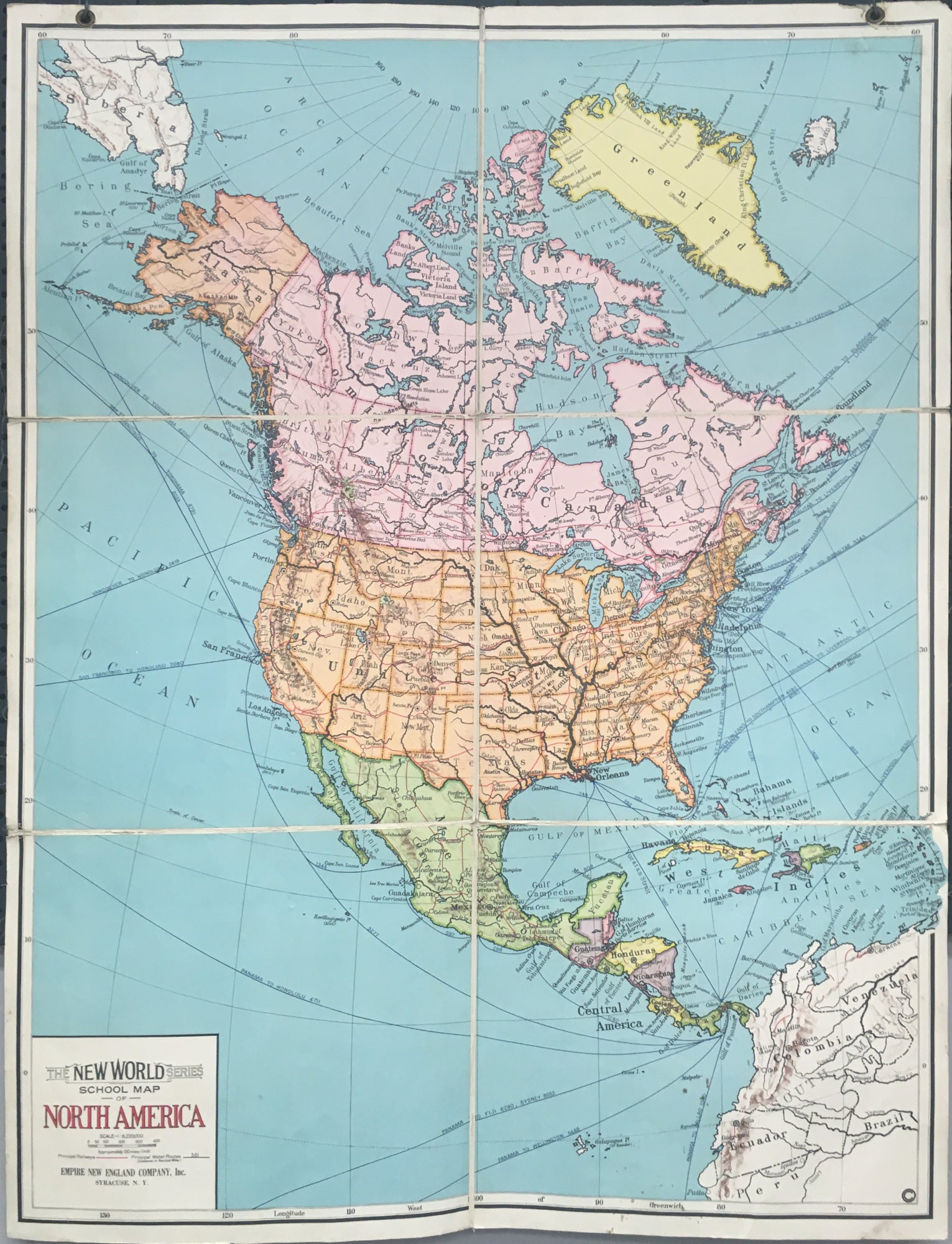
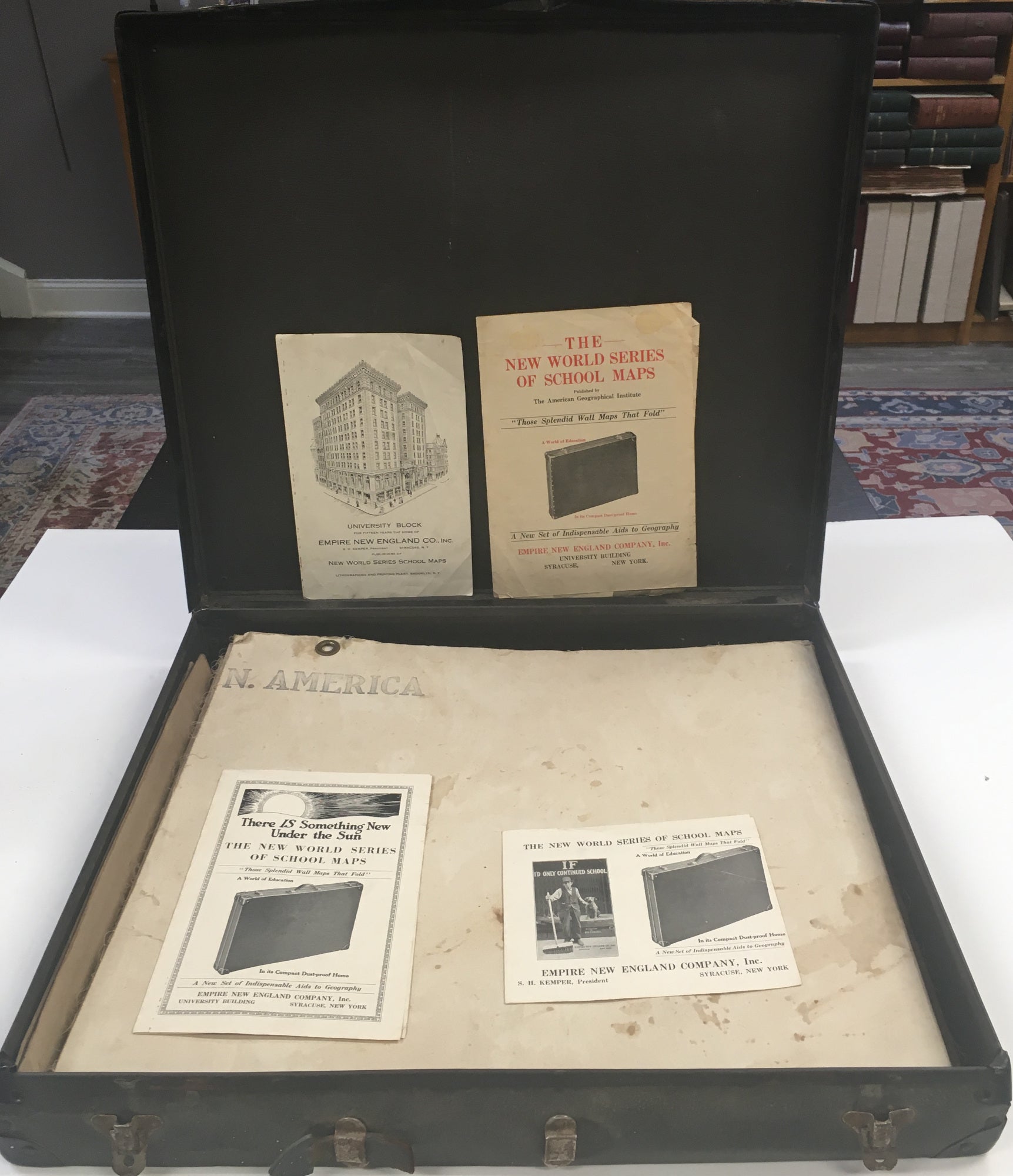
Syracuse: Empire New England Company, Inc., 1925. Six maps, dissected and backed on linen. Each map ca. 40 x 52. Folded into original case and with promotional material from the Empire New England Company. All maps with some chipping and wear. Overall very good, except for South America, which has some color lines and stains, but still good condition.
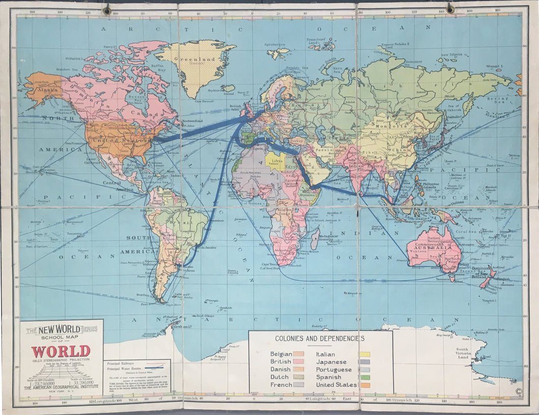
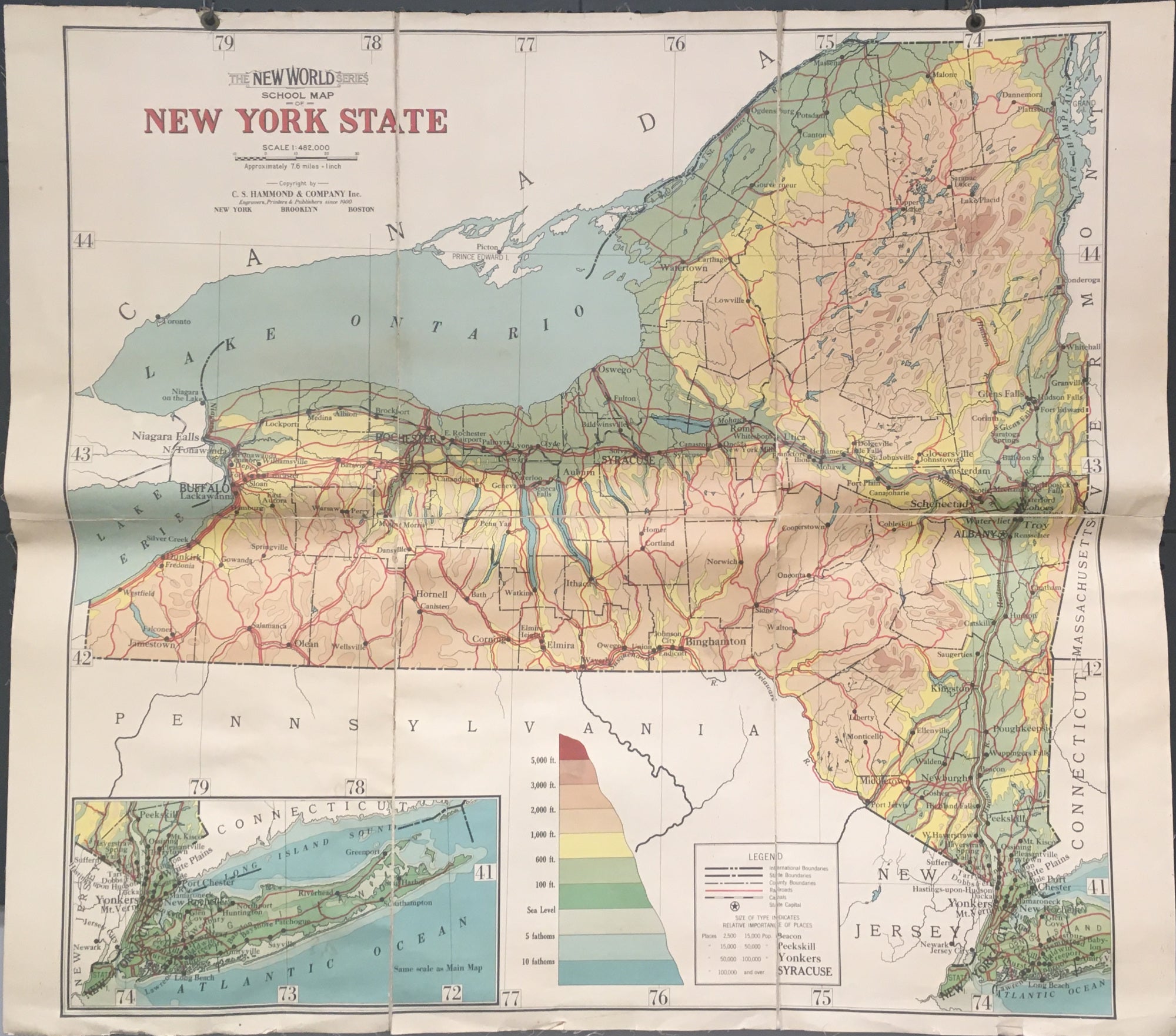
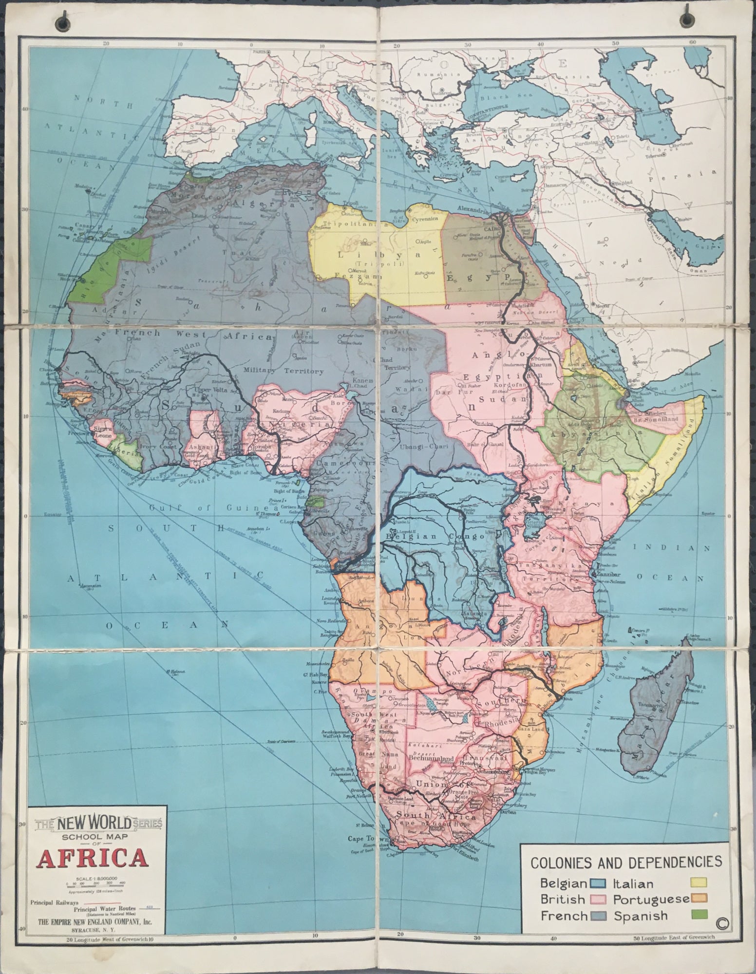
A wonder set of six school maps with the original case in which they were issued. The maps represent 1) The World, 2) North America, 3) South American, 4) Africa, 5) Pacific Ocean, and 6) New York State. As stated in one of the promotional flyers included, the world went through many changes during World War I, "There has never been a greater need for new wall maps for school use than at the present time. The changes wrought by the World War have been so extensive that old maps present a world totally different from the world of to-day." Another flyer lists the changes reflected in the maps, "A New World - A Changed World Re-Mapped In This Fine Series." One of the flyers calls for a different group of maps, but probably these cases were put together differently for different regions, so that this case includes unmentioned maps the Pacific Ocean and New York, but lack some of the others. The maps have boldly presented information, focusing on economic trade, political boundaries, and colonial dominion. A wonderful and unusual picture of the world just post WW I.

 %20%0A%20%0Ahttps://philaprintshop.com/products/american-geographical-institute-the-new-world-series-of-school-maps %20%0A%20%0AAmerican%20Geographical%20Institute%20%22The%20New%20World%20Series%20of%20School%20Maps%22 %20%0A%20%0A//philaprintshop.com/cdn/shop/products/splendidwall_1024x1024.jpg?v=1658521023 %20%0A%20%0AAntique Prints, Maps, Drawings, Paintings and Rare Books! %20%0A%20%0AThe Philadelphia Print Shop %20%0A106 E. Lancaster Avenue, Lower Level %20%0AWayne, PA 19087 %20%0A%20%0APhilaPrintShop.com %20%0A@PhiladelphiaPrintShop %20%0A 610 (808) 6165)