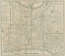
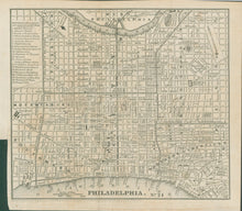
W. Williams. “Philadelphia.” From Appleton's Railroad and Steamboat Companion.
New York: W. Williams, 1848. Lithograph. With folds as originally issued. 7 x 7 ¾ (neat lines). Very good condition.
This map shows the city with the north oriented to the right. Philadelphia is shown from Kensington to Southwark and Moyamensing, and from the Delaware to just into West Philadelphia. The north-south streets west of Penn Square (City Hall) are identified (from east to west) as Schuylkill Eighth to Schuylkill Front; these streets were later re-named in numerical sequence, as we know them today, starting at Broad Street.


