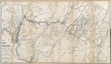
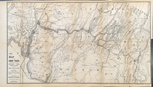
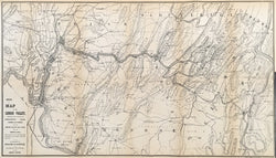
Unattributed. “Map of the Lehigh Valley Showing the Counties of Northampton, Lehigh, Carbon, and Luzerne. Also the Lehigh Valley Railroad and Lehigh Canal.” From History of the Lehigh Valley…
Easton, PA: Bixler & Corwin, 1860. 15 ½ x 27 (neat lines). Lithograph by P.S. Duval & Son on thin bank note paper. Full margins. With folds as originally issued. Several repaired tears in margins and along folds. Right hand portion of map, along far right hand fold, skillfully re-attached to map with archival tape. Two small chips in margins filled with old matching paper. Else, very good condition. A/A
A very detailed map of the Lehigh Valley showing the cities of Bethlehem, Allentown, Easton and the surrounding countryside just before the start of the Civil War. This map is oriented with north arrow pointing to the bottom right hand corner of the map with the most northern town of Wilkes-Barre shown in this area of the map. This map was included in a publication on the history of the valley that also included various small views. These views are also featured on our web site.
Views from History of the Lehigh Valley:
Catasauqua & Fogelsville R.R. Bridge
Lehigh Crane Iron Works, Catasauqua
Mt. Pisgah Plane at Mauch Chunk
Thomas Iron Works at Hockendauqua


