

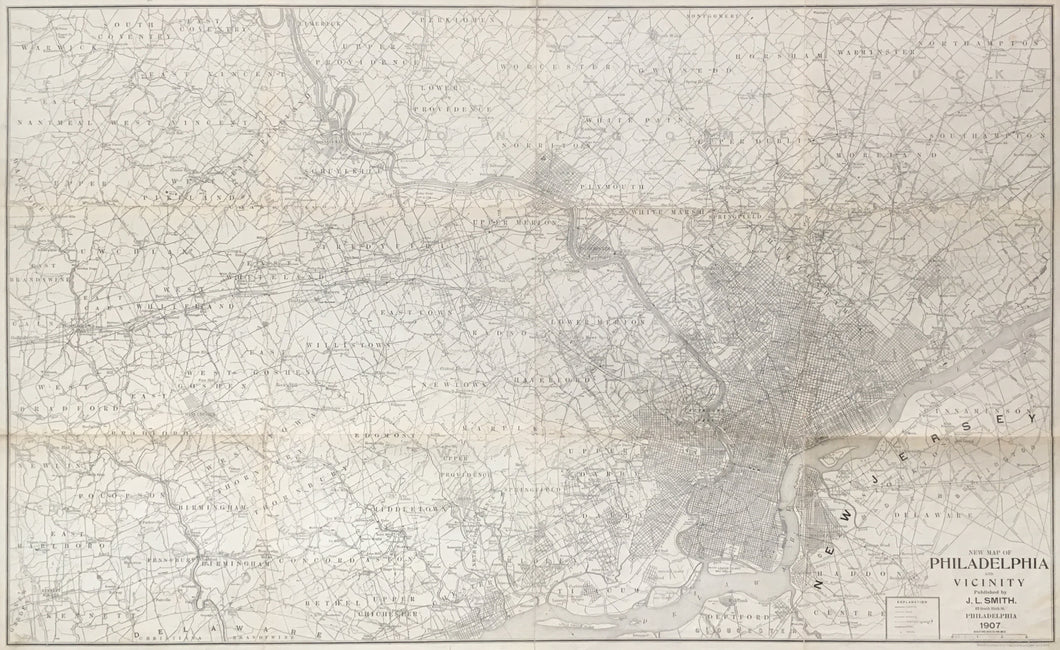
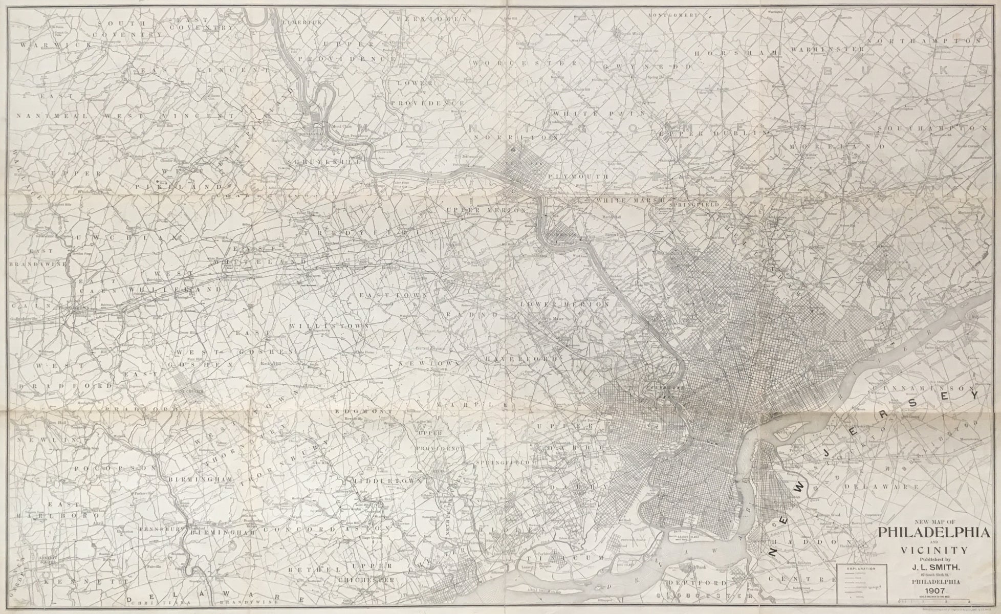
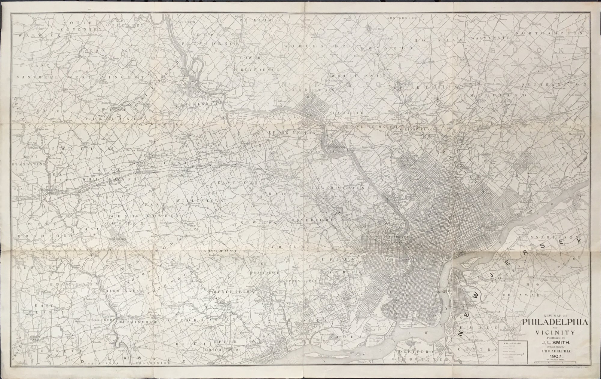
J.L. Smith (1846-1921). “New Map of Philadelphia and Vicinity.”
Philadelphia: J.L. Smith, 1907. Lithograph. 26 1/4 x 42 3/4 (neat lines) plus borders. Separately issued, folding map backed on linen. Some separations along folds repaired and/or reinforced with archival tape. Else, good condition.
A large folding map of Philadelphia and the regions to the north as far as Trappe and North Wales, to the east as far as Andalusia on the Delaware River, to the west just beyond Downingtown and Kennett Square, and to the south to the Delaware River and Deptford, New Jersey. Major streets and some buildings are shown in the city. Extensive information is given for the surrounding area, including roads, rivers, rail lines, mills, hotels, meeting houses, and myriad other geographic details. A useful historical map.
Map must be shipped flat.
 %20%0A%20%0Ahttps://philaprintshop.com/products/smith-j-l-new-map-of-philadelphia-and-vicinity-1907 %20%0A%20%0ASmith,%20J.L.%20%22New%20Map%20of%20Philadelphia%20and%20Vicinity%22%201907 %20%0A%20%0A//philaprintshop.com/cdn/shop/files/smithphilafolding1907c_1024x1024.jpg?v=1691591818 %20%0A%20%0AAntique Prints, Maps, Drawings, Paintings and Rare Books! %20%0A%20%0AThe Philadelphia Print Shop %20%0A106 E. Lancaster Avenue, Lower Level %20%0AWayne, PA 19087 %20%0A%20%0APhilaPrintShop.com %20%0A@PhiladelphiaPrintShop %20%0A 610 (808) 6165)