


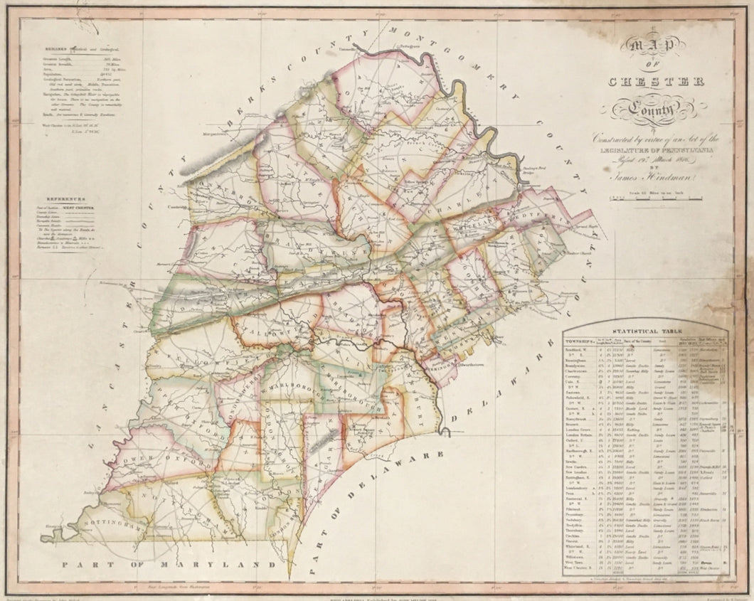

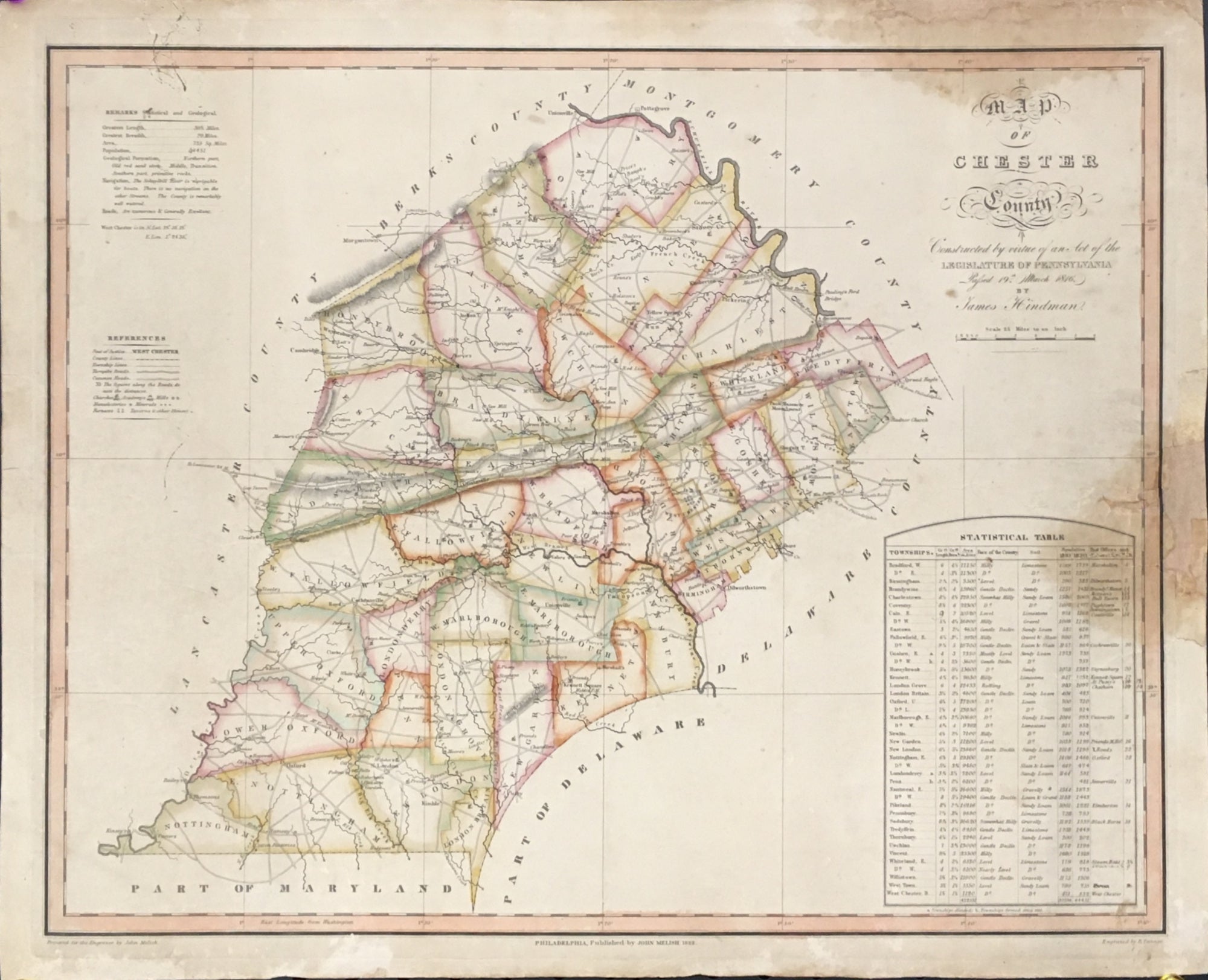
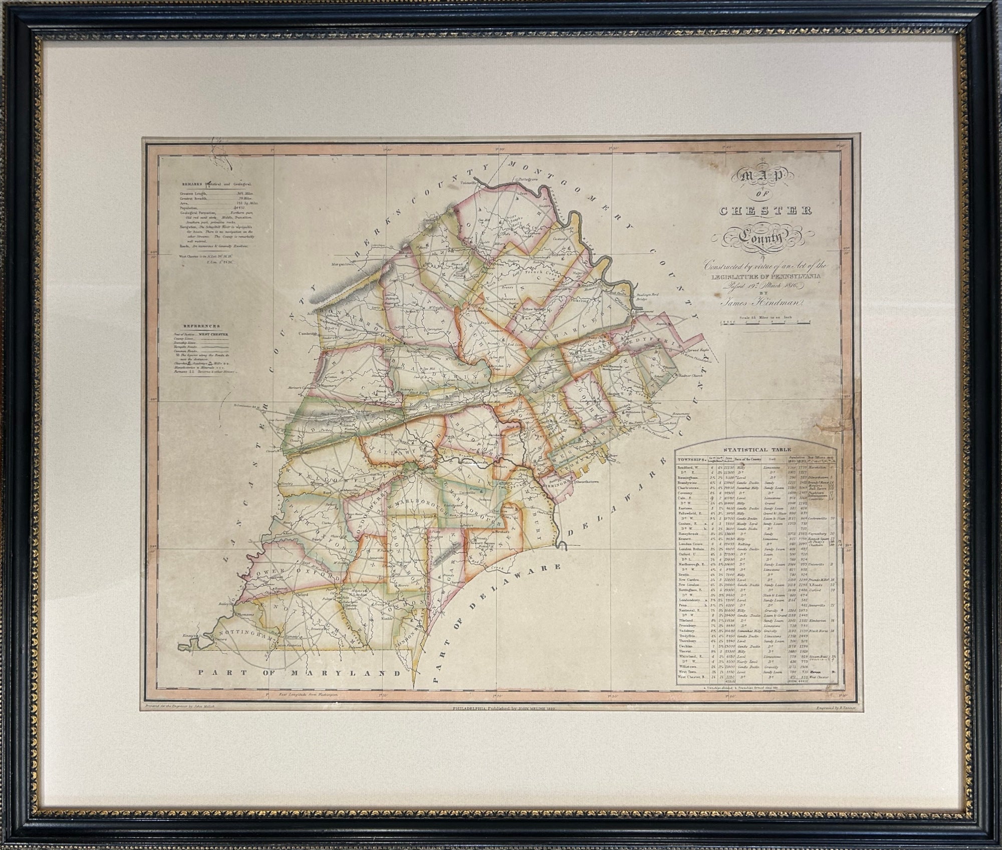
James Hindman. “Map of Chester County. Constructed by virtue of an Act of the Legislature of Pennsylvania by James Hindman.”
Philadelphia: John Melish, 1822. First edition. 17 ¼ x 21 ½ (neat lines). Engraving by Benjamin Tanner. Original hand color. Large margins. Old stain right hand side with small loss of paper filled and in-painted. Old stain at top just into title. Stray old ink marks top left hand side. Print has been professionally conserved and laid on an archival paper backing. Very scarce. Framed with UV filter glass.
An extremely scarce map of the first map of Chester County, PA, surveyed and drawn by John Hindman. In 1816, the Pennsylvania Legislature passed an act to publish an official map of the State and contracted John Melish to create this map. John Melish was perhaps the premier American cartographer from 1812 to 1822 and Melish was an early proponent of the production of official state maps, sponsored, directed and controlled by the state government. Individual maps of each Pennsylvania County were commissioned, and James Hindman was hired to survey Chester County. All the townships in the county are clearly delineated by contrasting outline hand color with all the major roads and places of note indicated. A statistical table to the right provides various county information.
Both maps, of the entire state and of Chester County, were issued in 1822. Melish died soon after publication, in December of that year. This first edition map is very scarce and it was noted in an 1881 book on the history of Chester County that this map at that time was rarely seen. Besides this one, we could only find three other examples of the map: The Beinecke Rare Book and Manuscript Library at Yale University, Chester County Archives, and the Pennsylvania State Archives. An even scarcer second edition of this map was issued in 1830 by Henry Tanner, the younger brother of Benjamin Tanner who engraved this map.

 %20%0A%20%0Ahttps://philaprintshop.com/products/hindman-james-map-of-chester-county-constructed-by-virtue-of-an-act-of-the-legislature-of-pennsylvania-by-james-hindman %20%0A%20%0AHindman,%20James%20%22Map%20of%20Chester%20County.%20Constructed%20by%20virtue%20of%20an%20Act%20of%20the%20Legislature%20of%20Pennsylvania%20by%20James%20Hindman%22 %20%0A%20%0A//philaprintshop.com/cdn/shop/products/melishchestercountyc_1024x1024.jpg?v=1674753838 %20%0A%20%0AAntique Prints, Maps, Drawings, Paintings and Rare Books! %20%0A%20%0AThe Philadelphia Print Shop %20%0A106 E. Lancaster Avenue, Lower Level %20%0AWayne, PA 19087 %20%0A%20%0APhilaPrintShop.com %20%0A@PhiladelphiaPrintShop %20%0A 610 (808) 6165)