

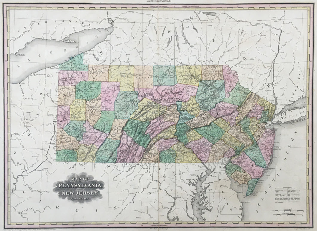
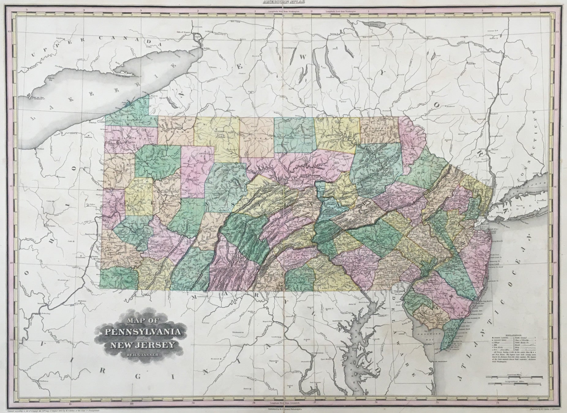
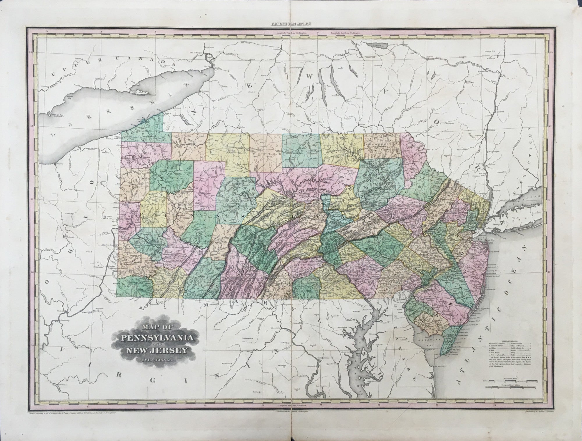
Henry S. Tanner. "Map of Pennsylvania and New Jersey."
From New American Atlas. Philadelphia: H.S. Tanner, 1823. 20 1/2 x 27. Engraving by "H.S. Tanner & Assistants." Full original color. Slight separation at centerfold. Acid-free mending tape along centerfold on verso. Both top margin corners slightly chipped. Three short repaired tears in margins. Else, good condition.
An impressive and important American map of Pennsylvania and New Jersey. From Tanner's seminal American Atlas, which was a monument in the early history of American cartography. Its format and size and detail made it probably the first American made atlas to equal the work of the best European firms. The atlas was well received and this established Tanner in his subsequent position as the leading American cartographic publisher. The state maps, all but two showing two states on a sheet, are wonderful historic documents of an important and dynamic period of American history. Tanner used Washington, D.C. as the prime meridian; as he explains in the introduction to the atlas, this was primarily because of a lack of an accepted European prime meridian. Each state is carefully mapped, using the most up-to-date information of physical features, towns, roads, trails, political boundaries, and other cultural details. This map of Pennsylvania and New Jersey is typical of the quality of the maps from the atlas.

 %20%0A%20%0Ahttps://philaprintshop.com/products/tanner-henry-s-map-of-pennsylvania-and-new-jersey %20%0A%20%0ATanner,%20Henry%20S.%20%20%22Map%20of%20Pennsylvania%20and%20New%20Jersey%22 %20%0A%20%0A//philaprintshop.com/cdn/shop/files/tannerpa23c_1024x1024.jpg?v=1711472152 %20%0A%20%0AAntique Prints, Maps, Drawings, Paintings and Rare Books! %20%0A%20%0AThe Philadelphia Print Shop %20%0A106 E. Lancaster Avenue, Lower Level %20%0AWayne, PA 19087 %20%0A%20%0APhilaPrintShop.com %20%0A@PhiladelphiaPrintShop %20%0A 610 (808) 6165)