

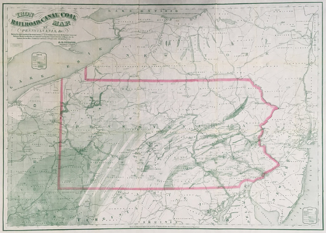
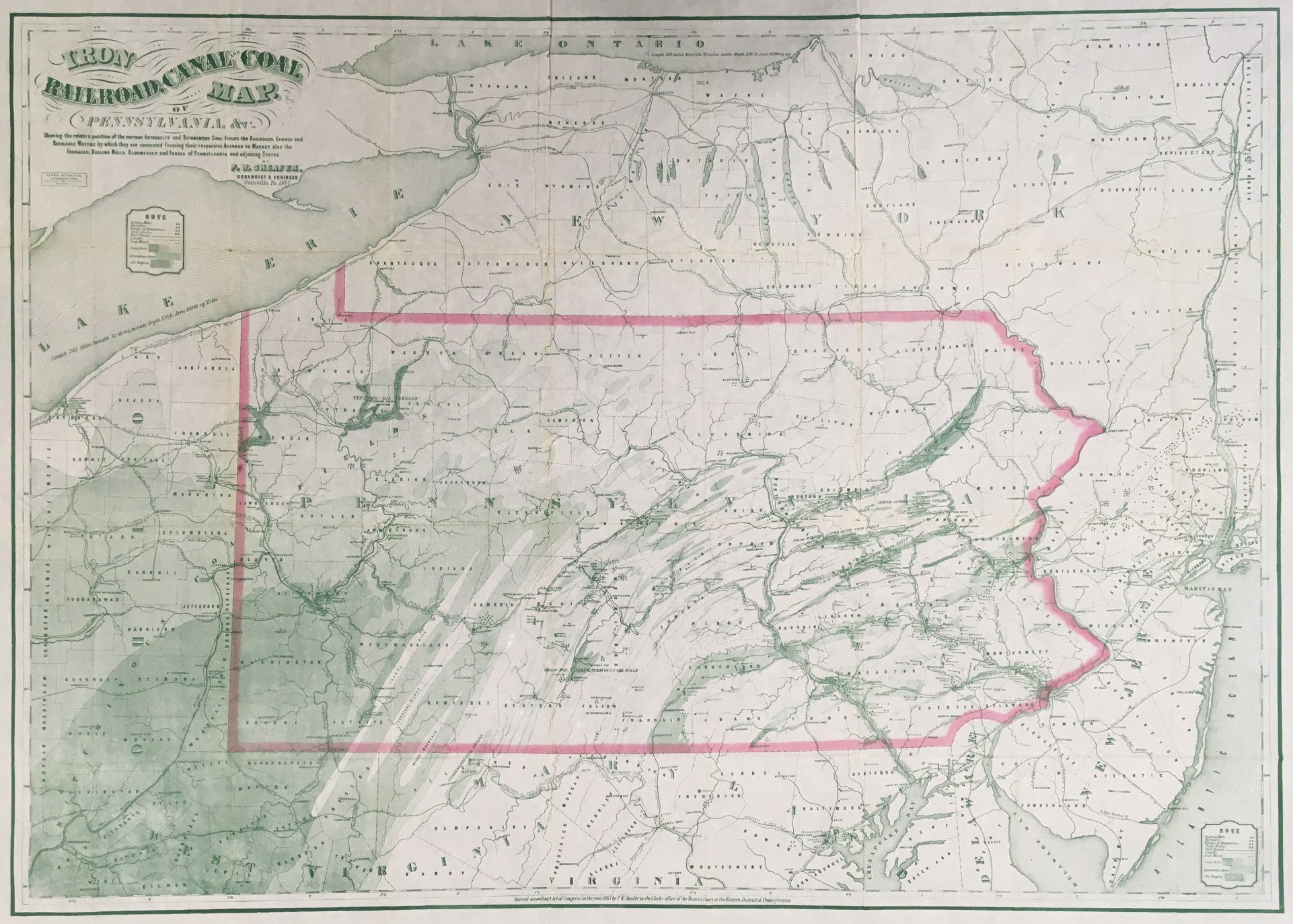
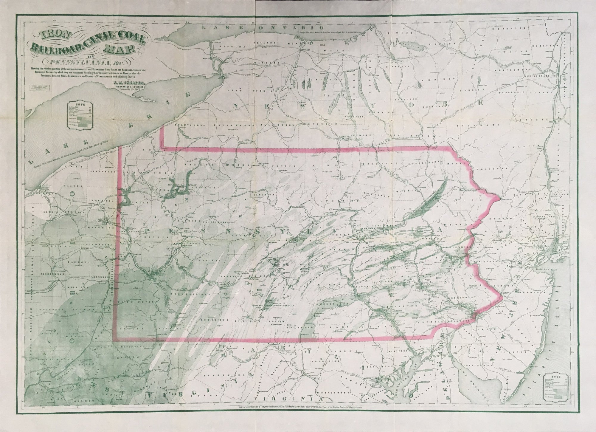
P.W. Sheafer. "Iron, Railroad, Canal and Coal Map of Pennsylvania &c. Showing the Relative Positions of Anthracite and Bituminous Coal Fields . . . the Railroads, Canals and Navigable Waterways . . . also the Furnaces, Rolling Mills, Bloomeries and Forges of Pennsylvania and Adjoining States."
Pottsville, PA: P. W. Sheafer, 1867. 32 1/2 x 44 (full sheet). Lithograph on bank note paper. Was once folded. Full margins. Some separation at folds, with tear into map right hand side, all repaired with acid-free mending tape. Else, very good condition.
Symbols are given throughout for: Rolling Mills, Furnaces, Forges, Bloomeries, Steel works, Railroads, Canals, Iron Mines, Coal Areas, Limestone Areas, and Oil Regions. The map also gives full information as described above for a circumference of approximately 100 additional miles around the borders of Pennsylvania. The amount of geological development shown on this map is remarkable considering the time immediately after the Civil War. A fine map.

 %20%0A%20%0Ahttps://philaprintshop.com/products/sheafer-p-w-iron-railroad-canal-and-coal-map-of-pennsylvania %20%0A%20%0ASheafer,%20P.W.%20%22Iron,%20Railroad,%20Canal%20and%20Coal%20Map%20of%20Pennsylvania...%22 %20%0A%20%0A//philaprintshop.com/cdn/shop/files/shaeferpa1867c_1024x1024.jpg?v=1711472357 %20%0A%20%0AAntique Prints, Maps, Drawings, Paintings and Rare Books! %20%0A%20%0AThe Philadelphia Print Shop %20%0A106 E. Lancaster Avenue, Lower Level %20%0AWayne, PA 19087 %20%0A%20%0APhilaPrintShop.com %20%0A@PhiladelphiaPrintShop %20%0A 610 (808) 6165)