


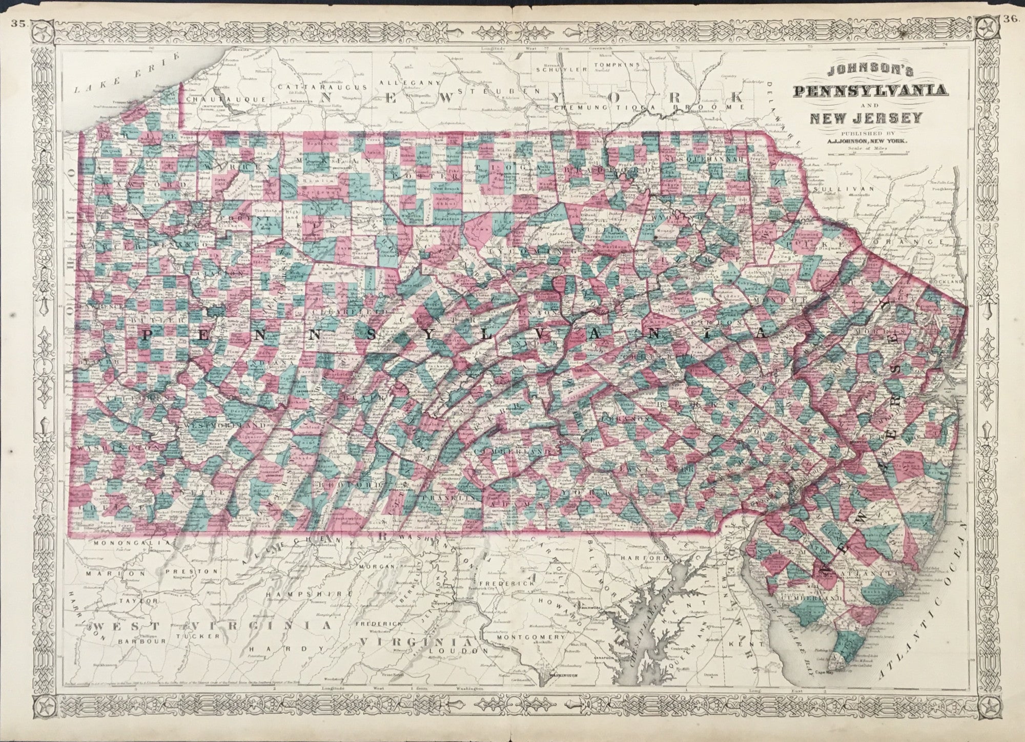
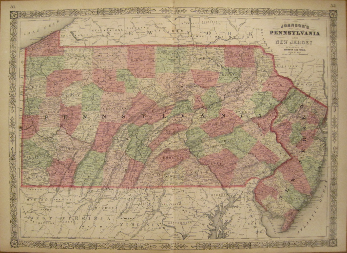
A. J. Johnson. "Johnson's Pennsylvania and New Jersey."
New York: A.J. Johnson, 1865. 17 x 23 1/2. Lithograph. Full original hand-color. Decorative border. A few scattered spots. Light chipping in top margin edge. Else, very good condition.
An attractive map of Pennsylvania from A.J. Johnson's mid-nineteenth century atlas of the world. Johnson, who published out of New York City, was one of the leading cartographic publishers in the latter half of the century, producing popular atlases, geographies and so on. This finely detailed map is an good example of Johnson's, and thus early American, cartography. Townships, towns, roads, rail lines, rivers and lakes are shown throughout. The clear presentation of cartographic information and the warm hand coloring make this an attractive as well as interesting historical document.
 %20%0A%20%0Ahttps://philaprintshop.com/products/johnson-a-j-johnsons-pennsylvania-and-new-jersey %20%0A%20%0AJohnson,%20A.%20J.%20%20%22Johnson's%20Pennsylvania%20and%20New%20Jersey%22 %20%0A%20%0A//philaprintshop.com/cdn/shop/files/johnsonpa1865c_1024x1024.jpg?v=1711470463 %20%0A%20%0AAntique Prints, Maps, Drawings, Paintings and Rare Books! %20%0A%20%0AThe Philadelphia Print Shop %20%0A106 E. Lancaster Avenue, Lower Level %20%0AWayne, PA 19087 %20%0A%20%0APhilaPrintShop.com %20%0A@PhiladelphiaPrintShop %20%0A 610 (808) 6165)