

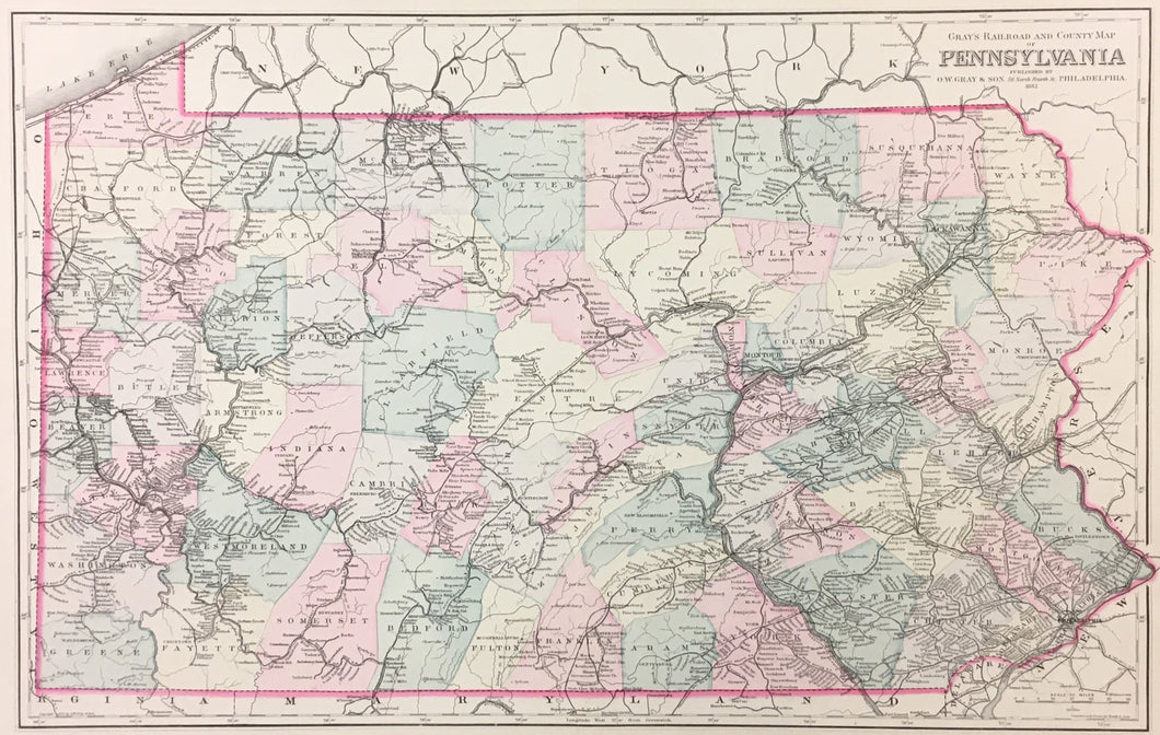
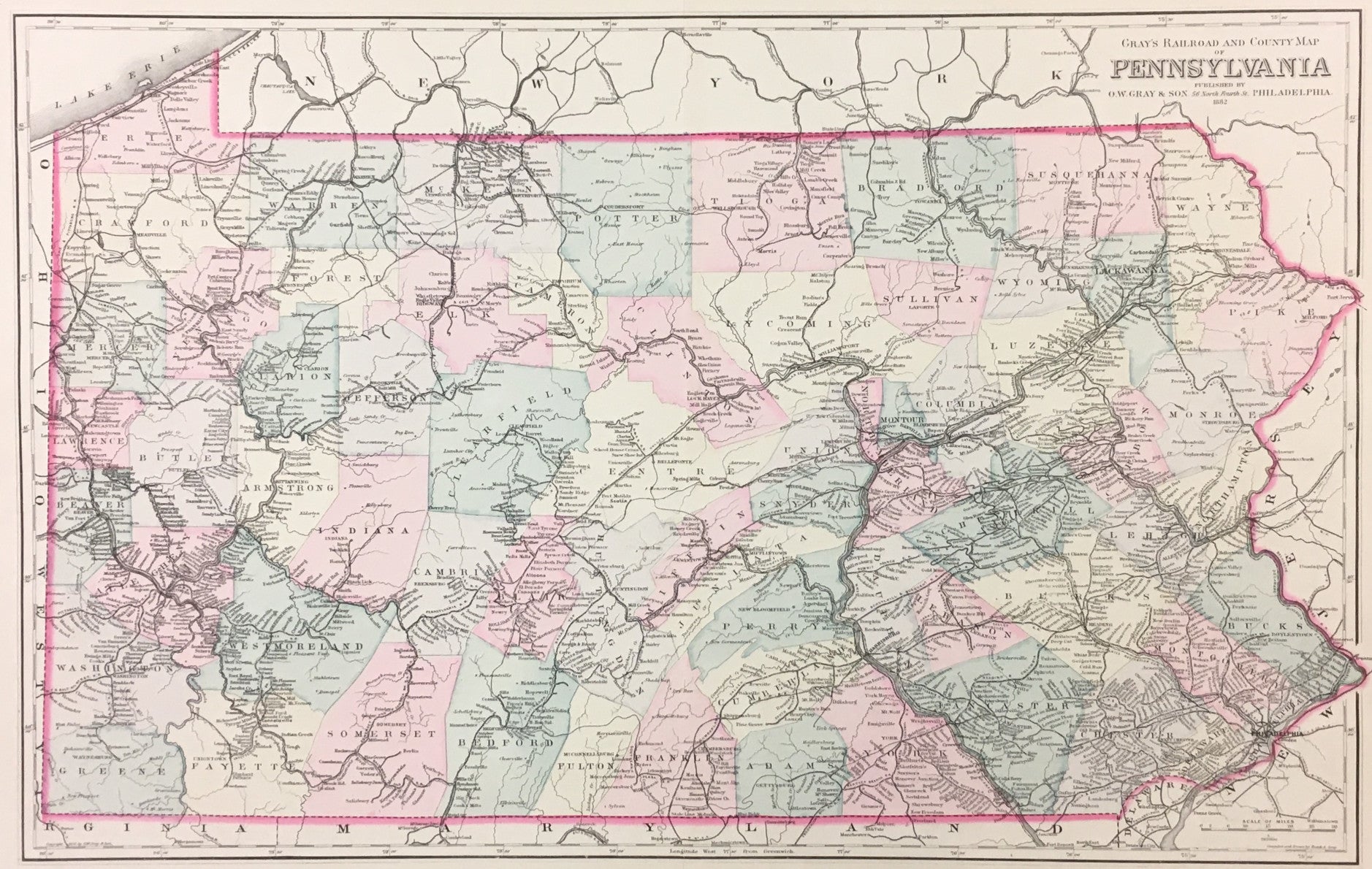
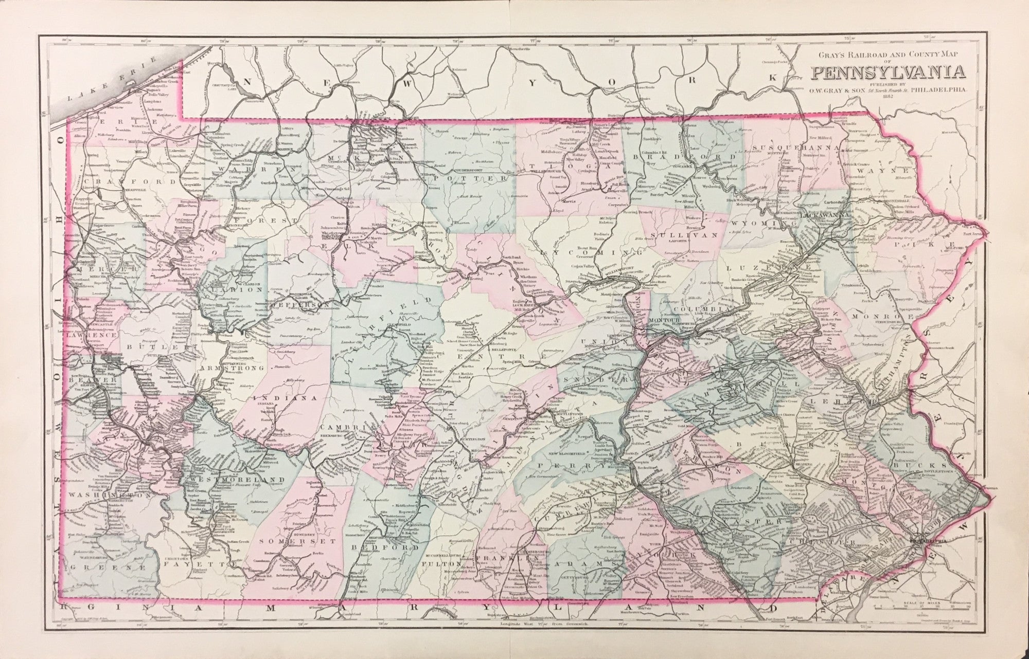
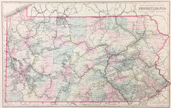
Frank A. Gray. "Gray's Railroad and County Map of Pennsylvania."
Philadelphia: O.W. Gray & Son, 1882. Lithograph. 15 1/4 x 24 3/4 (neat lines) plus full margins. Very good condition.
A fine map showing political boundaries plus railroads and the towns and cities they served in 1882, by which time Pennsylvania had expanded to its full and current 67 counties with the 1878 creation of Lackawanna County.
The firm of O.W. Gray and Son began its publishing around mid-century and produced regional and U.S. atlases up to the 1880s. This map is typical of their work, and its attractive presentation and interesting detail make it a nice example of late nineteenth century Philadelphia cartography
 %20%0A%20%0Ahttps://philaprintshop.com/products/gray-frank-a-grays-railroad-and-county-map-of-pennsylvania %20%0A%20%0AGray,%20Frank%20A.%20%20%22Gray's%20Railroad%20and%20County%20Map%20of%20Pennsylvania. %20%0A%20%0A//philaprintshop.com/cdn/shop/files/graypa1882c_1024x1024.jpg?v=1711486525 %20%0A%20%0AAntique Prints, Maps, Drawings, Paintings and Rare Books! %20%0A%20%0AThe Philadelphia Print Shop %20%0A106 E. Lancaster Avenue, Lower Level %20%0AWayne, PA 19087 %20%0A%20%0APhilaPrintShop.com %20%0A@PhiladelphiaPrintShop %20%0A 610 (808) 6165)