

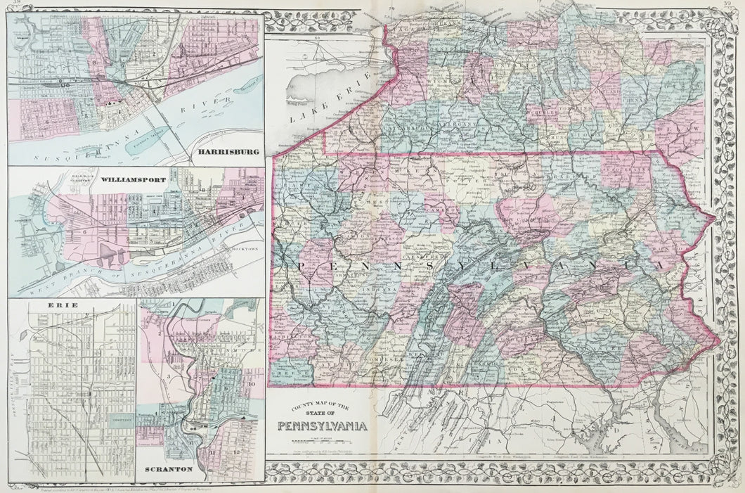
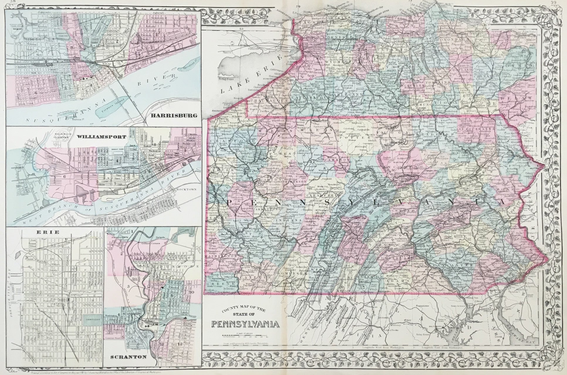
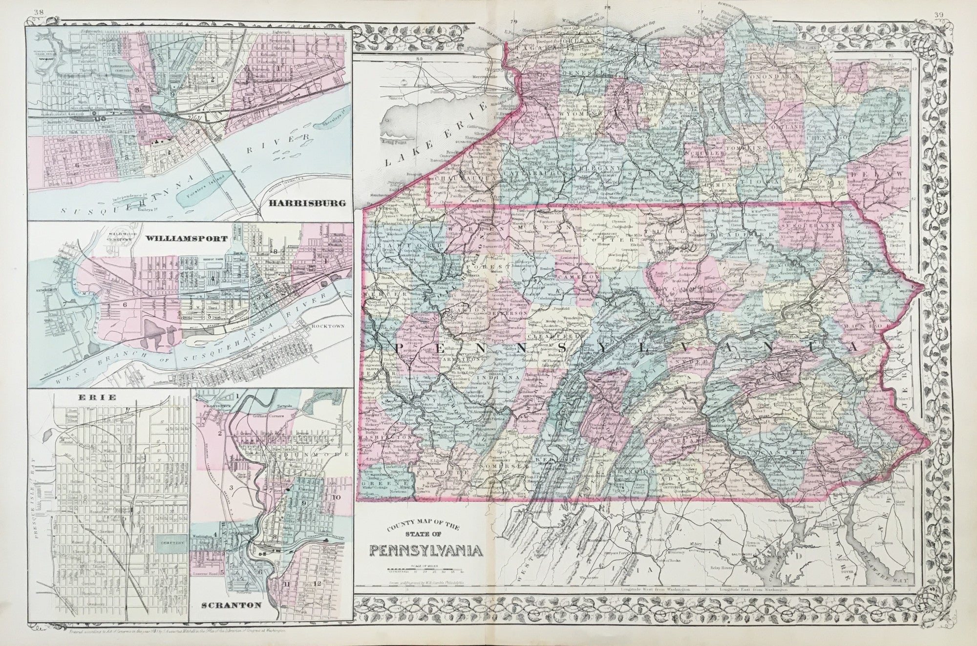
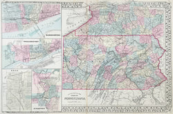
W.H Gamble. "County Map of the State of Pennsylvania.” With inset maps of Harrisburg, Williamsport, Erie and Scranton.
Philadelphia: S. Augustus Mitchell, Jr., 1881. 14 x 21 ¼. Lithograph. Original hand color. With decorative grape vine border. Light vertical stain along center fold. Else, very good condition. Very good condition.
For most of the middle part of the nineteenth century, the firm founded by S. Augustus Mitchell, Sr. dominated American cartography in output and influence. His son, S. Augustus Mitchell, Jr., continued the family business. A nice map of the state and of the four cities.
 %20%0A%20%0Ahttps://philaprintshop.com/products/gamble-w-h-county-map-of-the-state-of-pennsylvania-with-inset-maps-of-harrisburg-williamsport-erie-and-scranton %20%0A%20%0AGamble,%20W.H.%20%20%22County%20Map%20of%20the%20State%20of%20Pennsylvania%E2%80%9D%20%20With%20inset%20maps%20of%20Harrisburg,%20Williamsport,%20Erie%20and%20Scranton %20%0A%20%0A//philaprintshop.com/cdn/shop/files/mitchellpa1881c_1024x1024.jpg?v=1711486068 %20%0A%20%0AAntique Prints, Maps, Drawings, Paintings and Rare Books! %20%0A%20%0AThe Philadelphia Print Shop %20%0A106 E. Lancaster Avenue, Lower Level %20%0AWayne, PA 19087 %20%0A%20%0APhilaPrintShop.com %20%0A@PhiladelphiaPrintShop %20%0A 610 (808) 6165)