


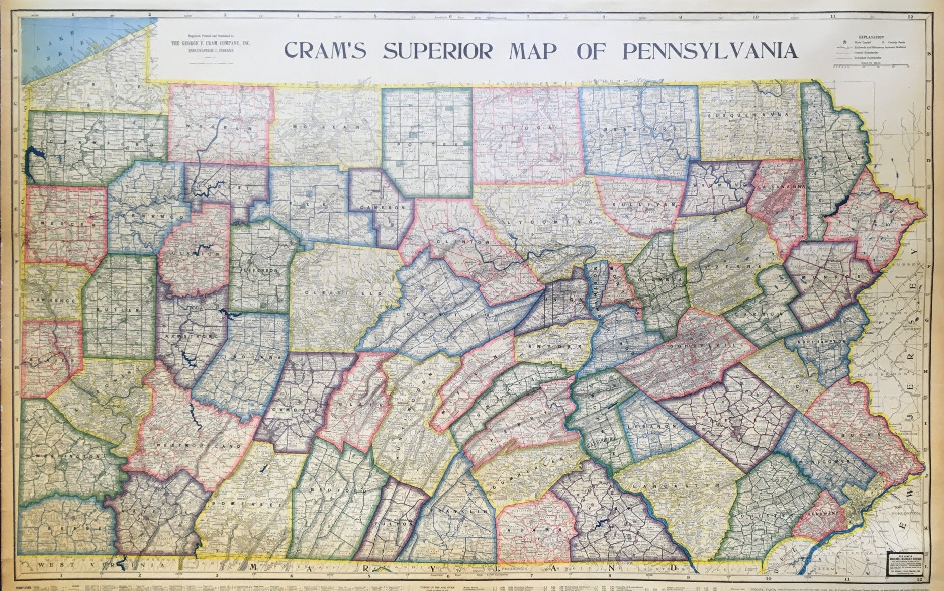
George F. Cram. "Cram's Superior Map of Pennsylvania."
Indianapolis: George F. Cram Company, Inc., 1941. 35 3/4 x 58. Full sheet: 47 x 60. Wax engraving, printed in very bright colors laid on original canvas backing. A few short tears at edges of margins repaired. Minor browning in right and left margins and in index below map; else, fine condition. With wooden rollers.
A very colorful and impressive map of Pennsylvania showing population centers and roads, along with two inset maps of the trunk highways and counties with populations by 1000s. Below the body of the map are several charts, from left: Populations by County, by town and a table of the populations of towns over 2500 from both the 1930 and 1940 censuses. Fascinating and colorful map of Pennsylvania just at the beginning of World War II.
The George Cram Company was an engraving and publishing firm from Chicago. In the mid-nineteenth century, the center of cartographic publishing was New York City, but in the 1880’s this began to shift towards Chicago with the advent of the Rand, McNally and Cram firms. These firms were noted for their efficient output of precise maps filled with useful and up-to-date political and cultural information, and details on roads, towns, railroads, and so forth

 %20%0A%20%0Ahttps://philaprintshop.com/products/cram-george-f-crams-superior-map-of-pennsylvania %20%0A%20%0ACram,%20George%20F.%20%20%22Cram's%20Superior%20Map%20of%20Pennsylvania%22 %20%0A%20%0A//philaprintshop.com/cdn/shop/files/crampawallmapc_1024x1024.jpg?v=1711479610 %20%0A%20%0AAntique Prints, Maps, Drawings, Paintings and Rare Books! %20%0A%20%0AThe Philadelphia Print Shop %20%0A106 E. Lancaster Avenue, Lower Level %20%0AWayne, PA 19087 %20%0A%20%0APhilaPrintShop.com %20%0A@PhiladelphiaPrintShop %20%0A 610 (808) 6165)