

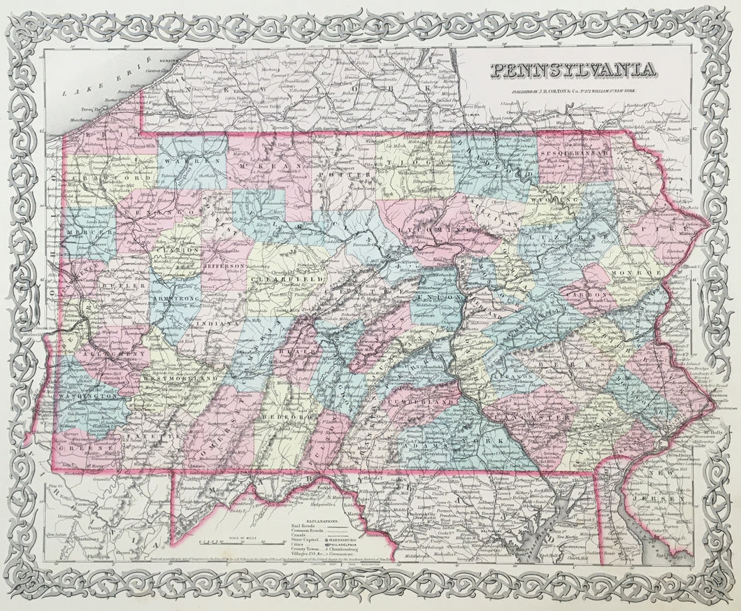

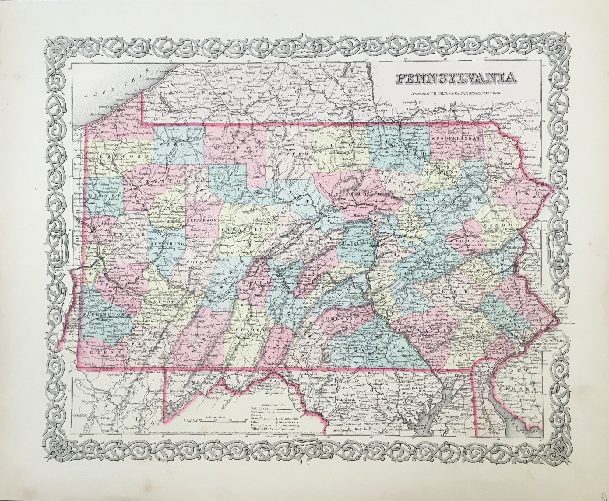
J.H. Colton. "Pennsylvania."
From Atlas of the World Illustrating Physical & Railroad Geography. New York: J.H. Colton, 1855. 12 5/8 x 15 5/8. Lithograph. Original hand color. Light spotting in margins with repaired tear in right hand margin. Else, very good condition.
One of the first of the great lithographic publishers, whose maps set a standard followed by such firms as A.J. Johnson and S.A. Mitchell, Jr., was J.H. Colton. This map of Pennsylvania, with its fine detail, is a strong example of the firm's successful work. The map presents the counties in contrasting pastel shades, and includes depictions of towns, rivers, marshes, and some topography. Of particular interest are the indications of the burgeoning transportation network in the state, with roads and railroads clearly shown. An attractive map as well as a worthwhile historical document.
 %20%0A%20%0Ahttps://philaprintshop.com/products/colton-j-h-pennsylvania %20%0A%20%0AColton,%20J.H.%20%20%20%22Pennsylvania. %20%0A%20%0A//philaprintshop.com/cdn/shop/files/coltonpa1855c_1024x1024.jpg?v=1711485556 %20%0A%20%0AAntique Prints, Maps, Drawings, Paintings and Rare Books! %20%0A%20%0AThe Philadelphia Print Shop %20%0A106 E. Lancaster Avenue, Lower Level %20%0AWayne, PA 19087 %20%0A%20%0APhilaPrintShop.com %20%0A@PhiladelphiaPrintShop %20%0A 610 (808) 6165)