


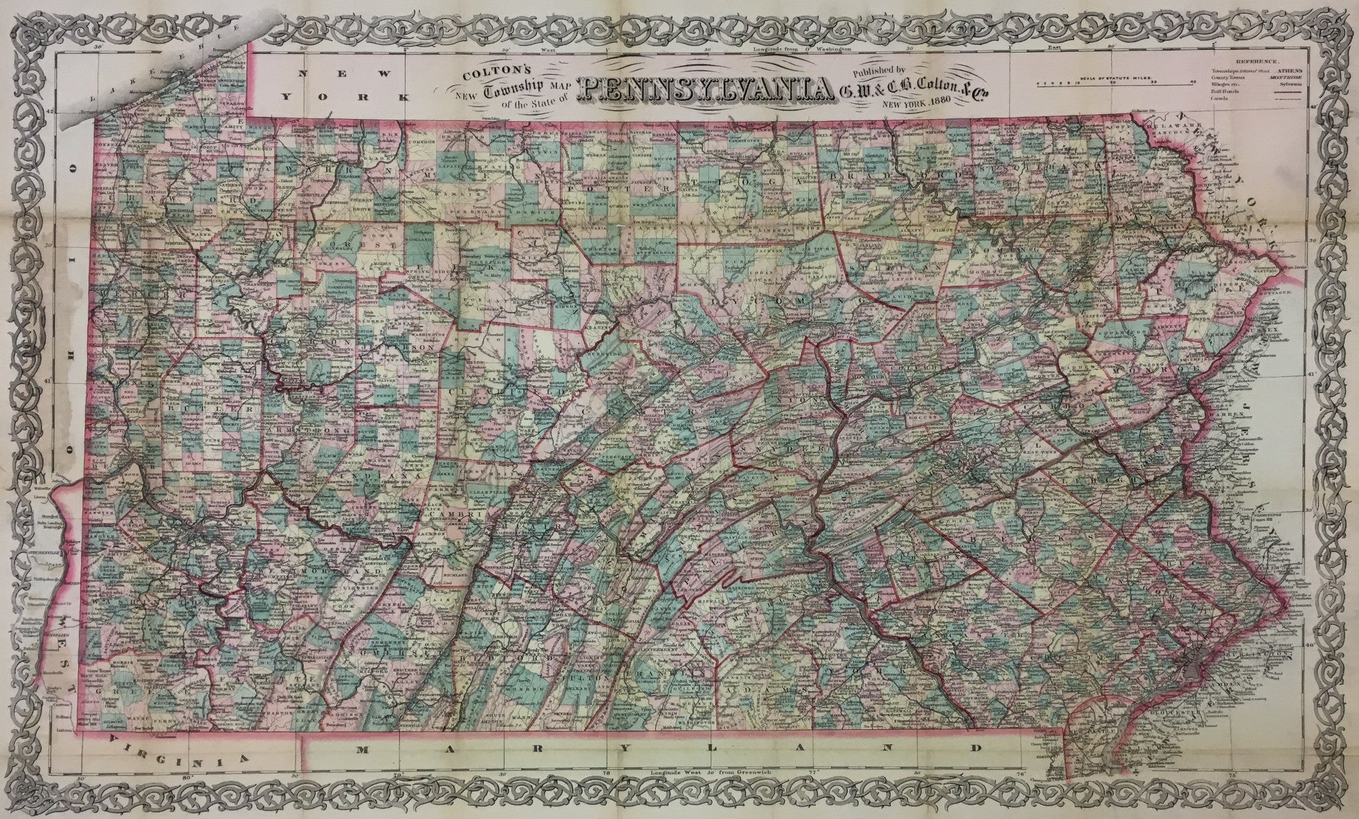
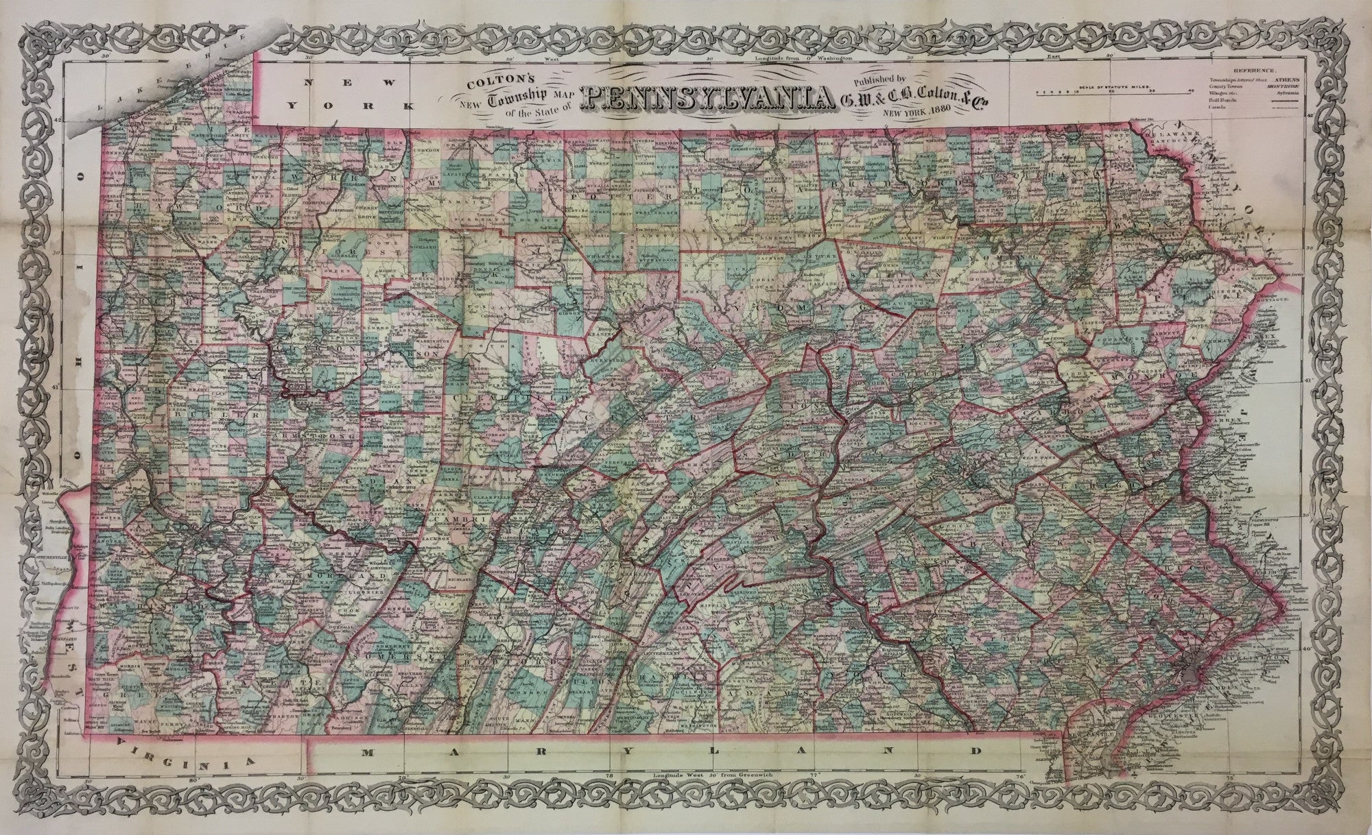
G.W. & C.B. Colton. “Colton's New Township Map of the State of Pennsylvania."
New York: G.W. & C.B. Colton, 1880. 15 3/4 x 26. Lithograph. Original hand color. Folds as issued. Separately issued folding map on banknote paper. Light glue stain left hand side where map was attached to back cover. Very good condition.
Following America's first great World's Fair in Philadelphia in 1876, Pennsylvania continued to flourish due to prosperous agriculture and flourishing manufacturing. The two economic forces were united and distributed through the great and powerful railroads of the day. This map is filled with copious information on the state of Pennsylvania in 1880. It records the many cities, towns, and villages, the mountains and rivers and lakes, and the roads, canals and railroads throughout the state. Such separately issued maps were used by traveling salesmen, teamsters, planners, and anyone else traveling about the state. They were invariably the most up-to-date when they were issued, as the need was great for accuracy. This wonderful map is as fine a cartographic document of the region as was available at the time.
 %20%0A%20%0Ahttps://philaprintshop.com/products/colton-g-w-c-b-coltons-new-township-map-of-the-state-of-pennsylvania %20%0A%20%0AColton,%20G.W.%20%26%20C.B.%20%20%E2%80%9CColton's%20New%20Township%20Map%20of%20the%20State%20of%20Pennsylvania%22 %20%0A%20%0A//philaprintshop.com/cdn/shop/files/coltonpa1880c_1024x1024.jpg?v=1711485692 %20%0A%20%0AAntique Prints, Maps, Drawings, Paintings and Rare Books! %20%0A%20%0AThe Philadelphia Print Shop %20%0A106 E. Lancaster Avenue, Lower Level %20%0AWayne, PA 19087 %20%0A%20%0APhilaPrintShop.com %20%0A@PhiladelphiaPrintShop %20%0A 610 (808) 6165)