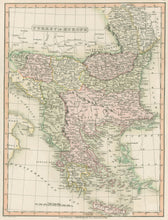
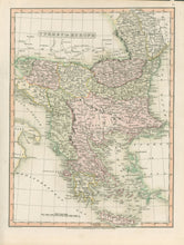
Charles Smith. “Turkey in Europe.” From Smith's New General Atlas ... Third edition.
London: Charles Smith, 1816. 13 ¾ x 10 ¼. Engraving by E. Jones. Original hand color. Full margins. Excellent condition.
Charles Smith established a well respected engraving and cartographic publishing firm, becoming “Map Seller Extraordinary to H.R.H. the Prince of Wales. This is a clear, finely engraved map by Smith showing excellent detail of the county. Towns, roads, churches, parks, “gentleman’s houses,” canals and distances between towns are all indicated. The precise hand coloring adds an element of decoration to this excellent map. This map is from the third edition of Smith’s atlas, which was issued in 1804, 1808, 1818, 1821, 1827, 1834 and 1846. The maps were updated each edition, with the notation added, e.g. “Corrected to 1827.”


