Adding product to your cart
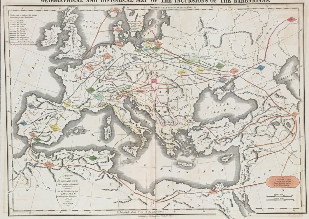
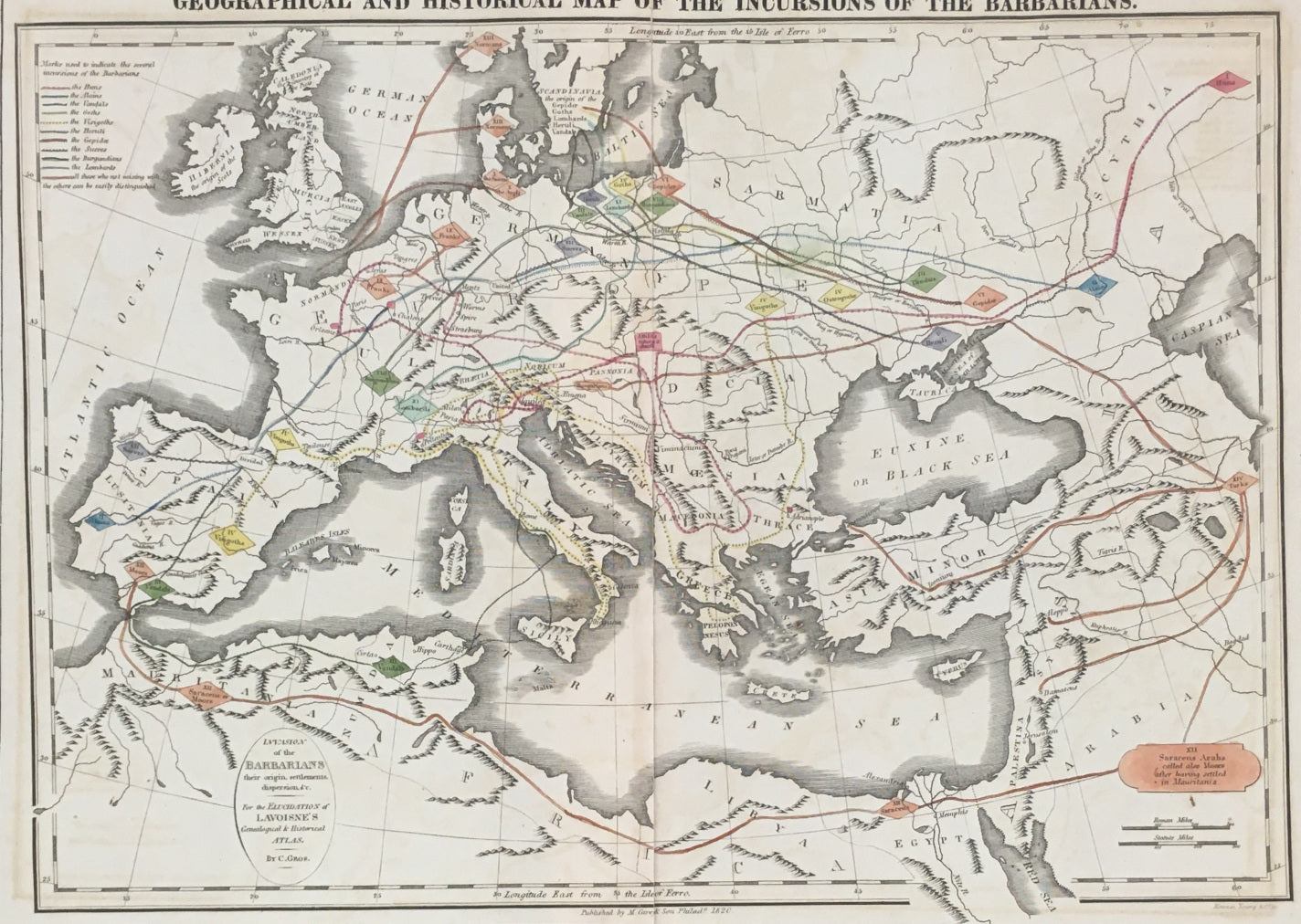
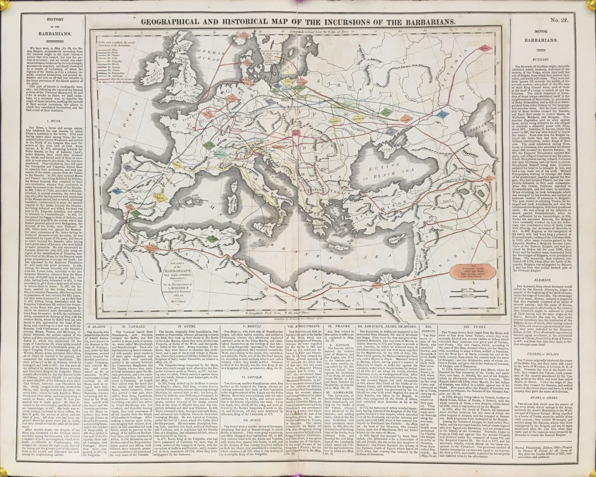
C. Gros. “Geographical and Historical Map of the Incursions of the Barbarians.” From C. V. Lavoisne’s A Complete Genealogical, Historical & Chronological Atlas.
Philadelphia: M. Carey & Son, 1820. 10 3/4 x 15 (map) 16 ½ x 20 ½ (neatlines around text). Engraved. Original hand color. Some separation at center fold. Else, very good condition.
A colorful and precisely drawn map of Europe, North Africa and part of Asia flanked by columns of text pertaining to the areas of activity for different bands of barbarians. A lavish account of each band, beginning with the Huns, and concluding with four bands of “Minor Barbarians.” The combination of an eye-catching map with the lengthy annotation results in an appealing and enlightening artifact.
Use left/right arrows to navigate the slideshow or swipe left/right if using a mobile device


 %20%0A%20%0Ahttps://philaprintshop.com/products/gros-c-geographical-and-historical-map-of-the-incursions-of-the-barbarians %20%0A%20%0AGros,%20C.%20%E2%80%9CGeographical%20and%20Historical%20Map%20of%20the%20Incursions%20of%20the%20Barbarians%22 %20%0A%20%0A//philaprintshop.com/cdn/shop/products/lavoisnebarbariansc_1024x1024.jpg?v=1662227665 %20%0A%20%0AAntique Prints, Maps, Drawings, Paintings and Rare Books! %20%0A%20%0AThe Philadelphia Print Shop %20%0A106 E. Lancaster Avenue, Lower Level %20%0AWayne, PA 19087 %20%0A%20%0APhilaPrintShop.com %20%0A@PhiladelphiaPrintShop %20%0A 610 (808) 6165)