

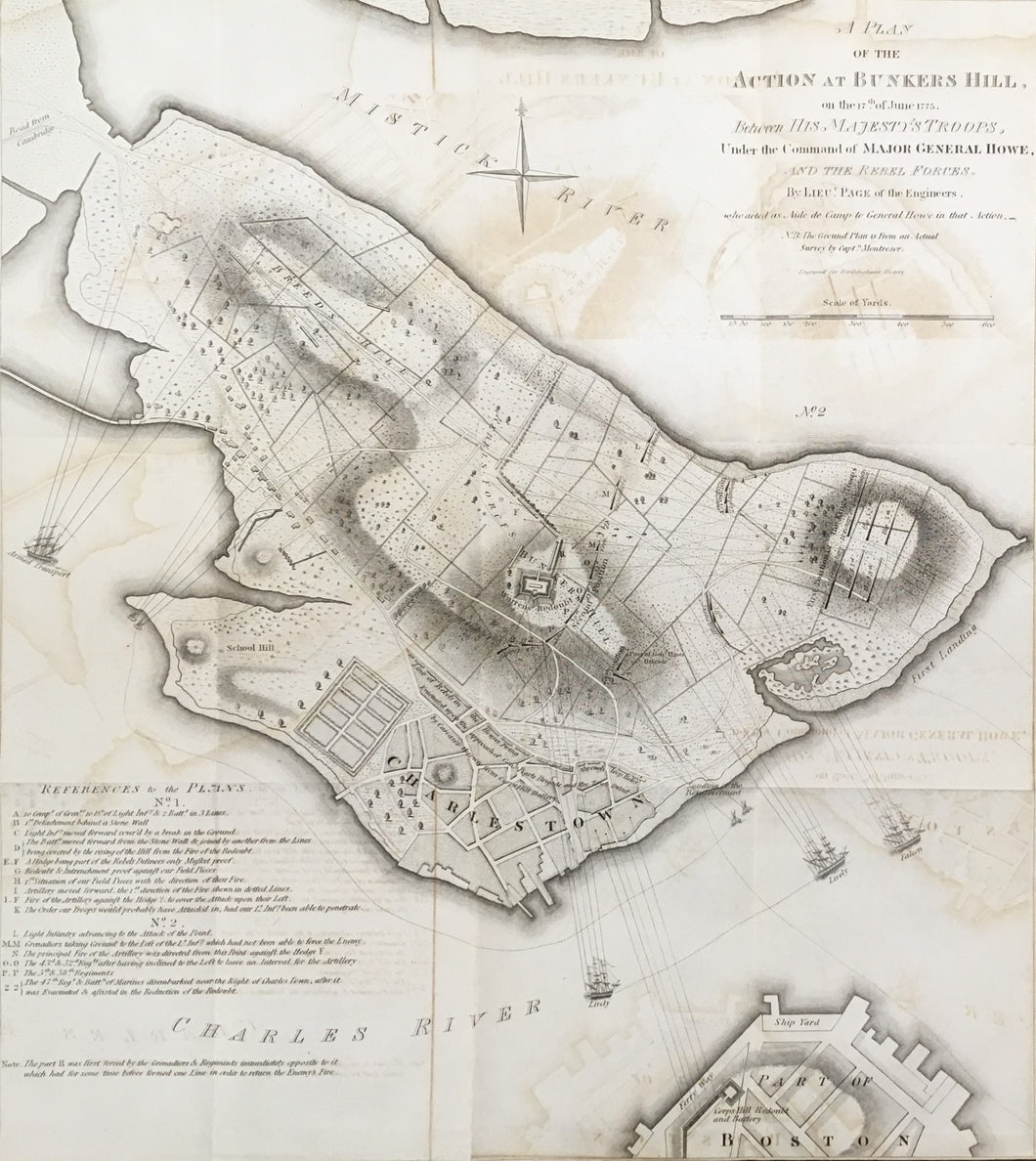
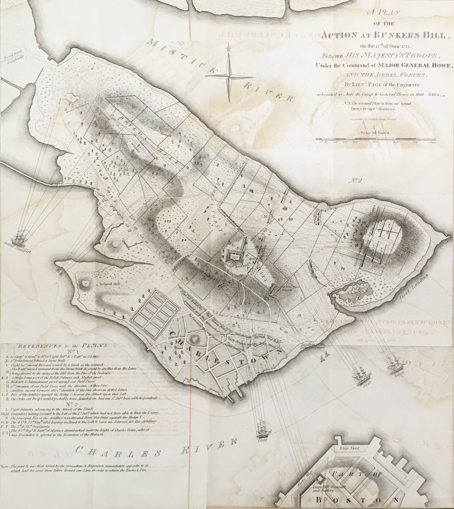

After William Faden. “A Plan of the Action at Bunker's Hill, on the 17th. of June, 1775, Between His Majesty’s Troops under the Command of Major General Howe, and the Rebel Forces, by Lieut. Page of the Engineers, who acted as Aide de Campe to General Howe in that Action.”
From Richard Frothingham’s History of the Siege of Boston and of the Battle of Lexington, Concord and Bunker Hill. Boston: Charles Little & James Brown, ca 1850. 18 ¾ x 16 ¾ (neat lines). Engraved O. Pelton and W. E. Goldsmith. With loose overlay sheet of the landing area. On thin bank note paper. With folds as originally issued. Lower portion of right hand margin trimmed to neat line as originally issued. Some transference of map information as to be expected due to map being folded in publication. Light water stain upper left hand corner. Overall, very good condition. A/A
This dramatic battle plan showing the British attempt to clear the hills above Boston of the American rebel forces was first printed by William Faden in 1784 after the drawings of John Montresor and a Lieutenant Page who was aide-de-camp to General Howe during the battle. The map confuses Bunker Hill and Breeds Hill, and that caused the misnomer for the battle which last to this day; otherwise, it is a very accurate map. The well executed plan called for amphibious landings and encircling the American forts-all shown with much detail about ships and troop movements on a map with excellent topographical accuracy. The map has a dramatic rendering of the first and second days shown by the loose overlay sheet (which as one time attached to the map) that illustrates the changes in the line and situation of troops.

 %20%0A%20%0Ahttps://philaprintshop.com/products/faden-william-a-plan-of-the-action-at-bunkers-hill-on-the-17th-of-june-1775 %20%0A%20%0AFaden,%20William%20%E2%80%9CA%20Plan%20of%20the%20Action%20at%20Bunker's%20Hill,%20on%20the%2017th.%20of%20June,%201775...%22 %20%0A%20%0A//philaprintshop.com/cdn/shop/files/fadenbunkerthmb_1024x1024.jpg?v=1702053414 %20%0A%20%0AAntique Prints, Maps, Drawings, Paintings and Rare Books! %20%0A%20%0AThe Philadelphia Print Shop %20%0A106 E. Lancaster Avenue, Lower Level %20%0AWayne, PA 19087 %20%0A%20%0APhilaPrintShop.com %20%0A@PhiladelphiaPrintShop %20%0A 610 (808) 6165)