
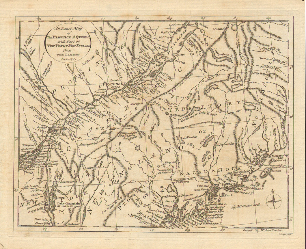
W. Russell. "An Exact Map of the Province of Quebec with Part of New York & New England from the Latest Surveys." From W. Russell's History of North America.
London: W. Russell, 1778. 8 x 10 1/2. Engraving by J. Lodge. Excellent condition.
A very interesting map of the region that was the site of significant action during the American Revolution. The St. Lawrence River is shown from Montreal to the beginning of the Gulf of St. Lawrence, with Quebec situated astride its middle. To the south of the St. Lawrence, west of Nova Scotia, the "Territory of Sagadahock" is shown in what is today mostly Maine. Northern Vermont and New Hampshire are shown (identified here only as New England), as is the upper part of Lake Champlain. This area saw considerable activity during the war, including the expeditions against Quebec by Arnold and Montgomery and the British attacked down the Lake Champlain valley under Burgoyne. This region remained at the center of conflict between the Americans and Canadians for years, as the border of Maine and Canada wasn't finally settled until 1842.
 %20%0A%20%0Ahttps://philaprintshop.com/products/w-russell-an-exact-map-of-the-province-of-quebec-with-part-of-new-york-new-england-from-the-latest-surveys %20%0A%20%0AW.%20Russell.%20%20%22An%20Exact%20Map%20of%20the%20Province%20of%20Quebec%20with%20Part%20of%20New%20York%20%26%20New%20England%20from%20the%20Latest%20Surveys.%22 %20%0A%20%0A//philaprintshop.com/cdn/shop/products/russelquebec_1024x1024.jpg?v=1637684301 %20%0A%20%0AAntique Prints, Maps, Drawings, Paintings and Rare Books! %20%0A%20%0AThe Philadelphia Print Shop %20%0A106 E. Lancaster Avenue, Lower Level %20%0AWayne, PA 19087 %20%0A%20%0APhilaPrintShop.com %20%0A@PhiladelphiaPrintShop %20%0A 610 (808) 6165)