

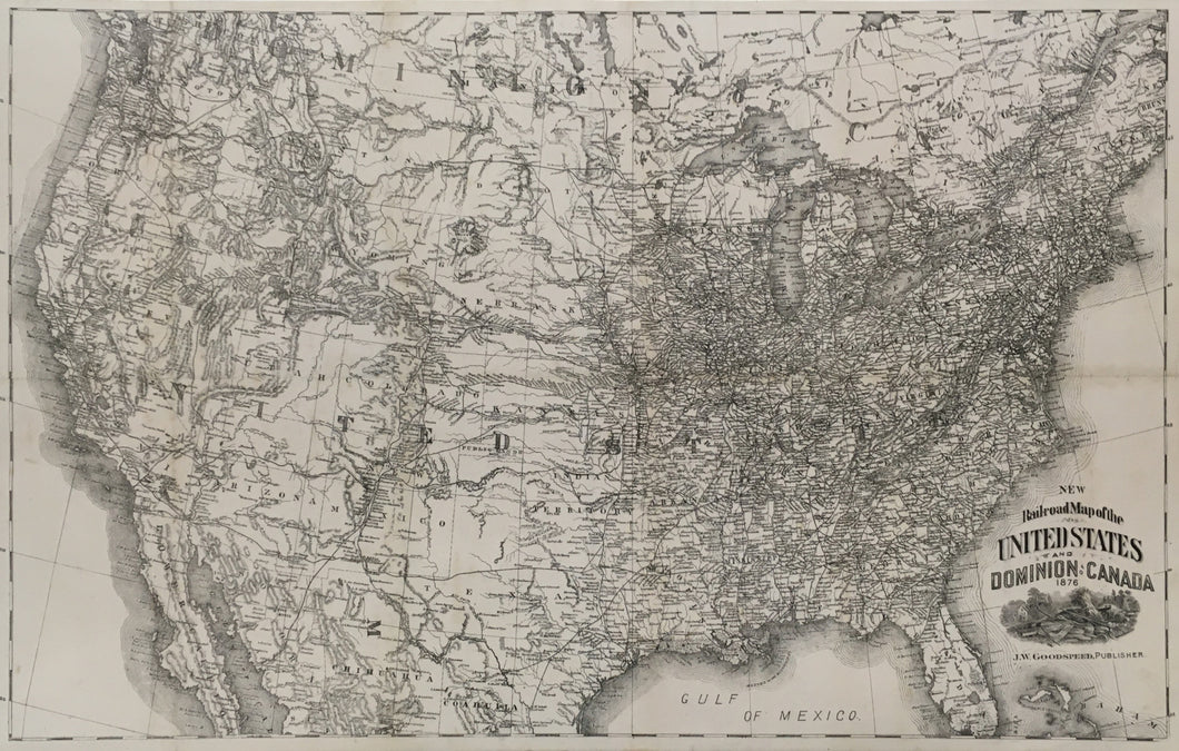
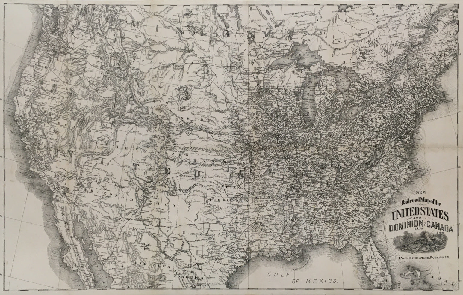
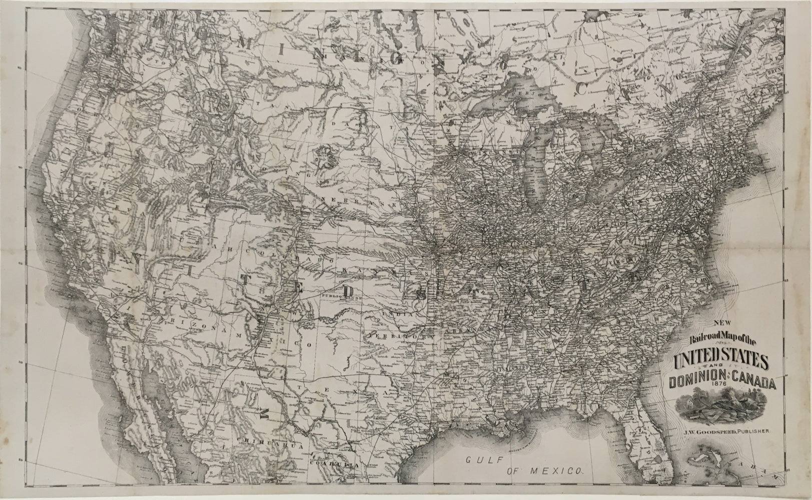
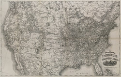
Unattributed. “New Rail-road Map of the United States and Dominion of Canada. 1876.”
Chicago: J.W. Goodspeed, 1876. 16 1/4 x 26 3/8. Lithograph. Old folds evident. Map has been professionally conserved. Very good condition.
An unusual railroad map of the United States issued in Chicago during the nation’s centennial year which was issued in some sort of booklet at the time, but whatever its source, the map presents a fascinating picture of the railroad network in the country 100 years after its beginning. From Kansas City to the east, the map shows a dark tangle of crisscrossing lines that almost hide other information on the map. To the west, topography stands out, though there are a number of important lines snaking across the plains, over the Rockies and along the Pacific coast. An excellent picture of the rail network in the country at the time.
 %20%0A%20%0Ahttps://philaprintshop.com/products/unattributed-new-rail-road-map-of-the-united-states-and-dominion-of-canada-1876 %20%0A%20%0AUnattributed%20%E2%80%9CNew%20Rail-road%20Map%20of%20the%20United%20States%20and%20Dominion%20of%20Canada.%201876%E2%80%9D %20%0A%20%0A//philaprintshop.com/cdn/shop/products/goodspeedrailroadc_1024x1024.jpg?v=1645729198 %20%0A%20%0AAntique Prints, Maps, Drawings, Paintings and Rare Books! %20%0A%20%0AThe Philadelphia Print Shop %20%0A106 E. Lancaster Avenue, Lower Level %20%0AWayne, PA 19087 %20%0A%20%0APhilaPrintShop.com %20%0A@PhiladelphiaPrintShop %20%0A 610 (808) 6165)